dc63e3ca-b814-425b-9d61-7f219fc6338f
Showing rules updates and reviews across all places.
Total edits: 20
Reviews: 5
Joined: May 27, 2026
Reputation: 62
Showing 1–25 of 25 activity items.
Page 1 of 1.
Mapped shape change
Old outline is gray. New outline is blue.
May 29, 2026 9:10 PM
Rules update
• Added a friendly, pilot-focused entry for Johnson Park. Highlighted the combination of municipal city ground rules and the strict, mandatory Class D airport LAANC clearances due to its immediate proximity to the SBP runways.
Place:
Johnson Park
Changed fields
Mapped shape change
Click to load this change into the shared map viewer here.
Before shape notes
—
After shape notes
- No higher than 400ft.
| Field | Before | After |
|---|---|---|
| Flight status | Unknown | Permission |
| Summary | — | Ground launch and landing from park property requires an approved City of SLO permit. Airspace overhead sits directly inside the San Luis Obispo County Regional Airport (SBP) Class D controlled bubble, requiring mandatory LAANC digital authorization. |
| Mapped shapes | — | 082508ce-869b-451e-bef1-d7211e1b0073 |
Before
After
Hey pilots, here is the hyper-specific rundown for navigating Johnson Park:

1. LOCAL GROUND RULES & THE BASKETBALL BOUNDARY: Johnson Park is tightly managed by the City of San Luis Obispo. Per municipal codes, you cannot spin up your motors, launch, or land anywhere within the official park lines—this includes the main central grass lawn, the concrete basketball court on the south side, and the walking trails.

2. THE LAANC AIRSPACE WALL (CRITICAL): You are less than 2 miles directly north of San Luis Obispo County Regional Airport (SBP). This puts Johnson Park deep inside the active Class D surface bubble. You CANNOT legally fly here without a digital LAANC authorization code. Open your app (like AutoPylot), check the specific grid ceiling for this exact patch of Southwood Drive, and get your automated federal clearance before taking off.

3. PINPOINT LAUNCH WORKAROUND: To stay legal regarding the city's ground ban, you must step completely off park property. Your best bet is to stand on the public neighborhood sidewalk along Marsh Street right where it terminates at the park entrance, or the street curb running parallel to the basketball court. Remember: even standing on the public street curb, you are still inside the airport's Class D bubble—so that LAANC digital unlock on your phone remains 100% mandatory!

4. SPECIFIC FLIGHT HAZARDS & TREE LINES:
   - THE CREEK CANOPY: The entire northern and eastern perimeter of the park is bounded by a dense, overgrown riparian creek corridor filled with mature willows and tall cottonwood trees. Do not lose orientation over this canopy—recovering a downed drone from the thick creek bed brush is incredibly difficult.
   - LOW-LEVEL WIND SHEAR: Because the park sits right near the base of the local hillsides, thermal down-drafts frequently roll off the high terrain and drop straight into the creek's tree line, causing sudden turbulence when hovering low near the foliage.
   - PARK INFRASTRUCTURE: Keep a wide berth from the central children's playground structure and the public barbecue areas. This park is a neighborhood favorite; always maintain a strict visual line of sight, never fly directly over unprotected visitors, and keep your FAA registration numbers visible if your bird weighs over 250g.
Show inline change markers
+ Hey pilots, here is the hyper-specific rundown for navigating Johnson Park:
+
+ 1. LOCAL GROUND RULES & THE BASKETBALL BOUNDARY: Johnson Park is tightly managed by the City of San Luis Obispo. Per municipal codes, you cannot spin up your motors, launch, or land anywhere within the official park lines—this includes the main central grass lawn, the concrete basketball court on the south side, and the walking trails.
+
+ 2. THE LAANC AIRSPACE WALL (CRITICAL): You are less than 2 miles directly north of San Luis Obispo County Regional Airport (SBP). This puts Johnson Park deep inside the active Class D surface bubble. You CANNOT legally fly here without a digital LAANC authorization code. Open your app (like AutoPylot), check the specific grid ceiling for this exact patch of Southwood Drive, and get your automated federal clearance before taking off.
+
+ 3. PINPOINT LAUNCH WORKAROUND: To stay legal regarding the city's ground ban, you must step completely off park property. Your best bet is to stand on the public neighborhood sidewalk along Marsh Street right where it terminates at the park entrance, or the street curb running parallel to the basketball court. Remember: even standing on the public street curb, you are still inside the airport's Class D bubble—so that LAANC digital unlock on your phone remains 100% mandatory!
+
+ 4. SPECIFIC FLIGHT HAZARDS & TREE LINES:
+    - THE CREEK CANOPY: The entire northern and eastern perimeter of the park is bounded by a dense, overgrown riparian creek corridor filled with mature willows and tall cottonwood trees. Do not lose orientation over this canopy—recovering a downed drone from the thick creek bed brush is incredibly difficult.
+    - LOW-LEVEL WIND SHEAR: Because the park sits right near the base of the local hillsides, thermal down-drafts frequently roll off the high terrain and drop straight into the creek's tree line, causing sudden turbulence when hovering low near the foliage.
+    - PARK INFRASTRUCTURE: Keep a wide berth from the central children's playground structure and the public barbecue areas. This park is a neighborhood favorite; always maintain a strict visual line of sight, never fly directly over unprotected visitors, and keep your FAA registration numbers visible if your bird weighs over 250g.
May 29, 2026 9:05 PM
Rules update
• Created a pilot-friendly database entry for Sinsheimer Park. Highlighted the combination of municipal city ground constraints and the mandatory federal Class D LAANC authorizations caused by the nearby regional airport.
Place:
Sinsheimer Park
Changed fields
Mapped shape change
Click to load this change into the shared map viewer here.
Before shape notes
—
After shape notes
- 400 ft LAANC
| Field | Before | After |
|---|---|---|
| Flight status | Unknown | Permission |
| Summary | — | Ground launch and landing from park property requires an approved City of SLO permit. Airspace overhead sits directly inside the San Luis Obispo County Regional Airport (SBP) Class D controlled bubble, requiring mandatory LAANC digital authorization. |
| Mapped shapes | — | 19a542ce-5b43-4632-9e15-59acd5808e72 |
Before
After
Hey pilots! Sinsheimer Park is an amazing place to check out, but it requires a very strict double-check before your props ever spin:

1. LOCAL GROUND RULES: This park is managed directly by the City of San Luis Obispo. Per municipal park rules, operators are prohibited from launching, landing, or operating any drones, RC planes, or motorized aircraft right off the turf, sports complexes, or parking lots without an official city-issued permit.
2. AIRSPACE RESTRICTION (CRITICAL): The biggest hurdle here is the airport proximity. Sinsheimer Park sits completely inside the active Class D controlled airspace bubble for the San Luis Obispo County Regional Airport (SBP), which is just over 2 miles south. You CANNOT legally fly in this sky without a digital LAANC approval. Bring up your favorite app (like AutoPylot or B4UFLY), verify the active altitude grid ceiling limits, and submit an automated request before taking off.
3. THE PILOT WORKAROUND: If you want to bypass the city's ground permit restrictions, you can stand entirely off park property—such as on a public neighborhood sidewalk or roadside curb outside the park boundary line—to handle your takeoff and landing. Just be warned: because the entire region is blanketed by the airport bubble, you STILL absolutely must have that digital LAANC airspace authorization active on your phone even if you launch from a public street!
4. SAFTEY & HAZARDS: This park is heavily utilized for youth sports, community baseball games, and public swimming. Always double-check the skies, ensure you maintain a constant visual line of sight, never fly directly over unprotected crowds, and make sure any bird over 250g is properly registered with the FAA.
Show inline change markers
+ Hey pilots! Sinsheimer Park is an amazing place to check out, but it requires a very strict double-check before your props ever spin:
+
+ 1. LOCAL GROUND RULES: This park is managed directly by the City of San Luis Obispo. Per municipal park rules, operators are prohibited from launching, landing, or operating any drones, RC planes, or motorized aircraft right off the turf, sports complexes, or parking lots without an official city-issued permit.
+ 2. AIRSPACE RESTRICTION (CRITICAL): The biggest hurdle here is the airport proximity. Sinsheimer Park sits completely inside the active Class D controlled airspace bubble for the San Luis Obispo County Regional Airport (SBP), which is just over 2 miles south. You CANNOT legally fly in this sky without a digital LAANC approval. Bring up your favorite app (like AutoPylot or B4UFLY), verify the active altitude grid ceiling limits, and submit an automated request before taking off.
+ 3. THE PILOT WORKAROUND: If you want to bypass the city's ground permit restrictions, you can stand entirely off park property—such as on a public neighborhood sidewalk or roadside curb outside the park boundary line—to handle your takeoff and landing. Just be warned: because the entire region is blanketed by the airport bubble, you STILL absolutely must have that digital LAANC airspace authorization active on your phone even if you launch from a public street!
+ 4. SAFTEY & HAZARDS: This park is heavily utilized for youth sports, community baseball games, and public swimming. Always double-check the skies, ensure you maintain a constant visual line of sight, never fly directly over unprotected crowds, and make sure any bird over 250g is properly registered with the FAA.
May 29, 2026 9:00 PM
Rules update
• Added the dedicated SLO Flyers RC flying field at Cuesta College. Marked flight status as "Allowed" due to its status as a sanctioned facility, while detailing the mandatory AMA insurance, club guest rules, and open Class G airspace status.
Place:
SLO FLYERS
Changed fields
Mapped shape change
Click to load this change into the shared map viewer here.
Before shape notes
—
After shape notes
- 400ft LAANC
| Field | Before | After |
|---|---|---|
| Flight status | Unknown | Allowed |
| Summary | — | Dedicated, sanctioned AMA flying site. Open to RC planes, helicopters, and drones. Pilots must maintain active AMA membership, an FAA registration, and follow strict club flight-line safety boundaries. |
| Mapped shapes | — | 1bd3d8fa-8777-41c8-bef7-58c172f770e8 |
Before
After
Welcome to the primary dedicated RC airfield in the SLO area! Unlike public parks, this spot is tailor-made for RC aviation, but it operates under specific club safety bylaws:

1. CLUB & AMA MEMBERSHIP: This field is leased and managed by SLO Flyers Inc. To use the runway and facilities regularly, you must be a club member or a registered guest flying with a member. Active Academy of Model Aeronautics (AMA) membership is strictly required for insurance purposes.
2. PILOT REQUIREMENTS: All pilots must have their current FAA Registration number clearly marked on their aircraft and carry proof of their FAA TRUST certificate.
3. AIRSPACE STATUS: The airfield sits under uncontrolled Class G airspace up to 700 feet. It is well clear of the SBP airport surface bubble, meaning NO daily LAANC app unlocks or coordinate requests are required to take off.
4. FIELD SAFETY RULES:
   - No flying over the active pit area, parking lot, or neighboring Cuesta College facilities/sports fields.
   - Gas and electric models are welcome, but be mindful of the club's specific flight line boundaries to protect onlookers.
   - Guests are allowed but must be accompanied by a member in good standing and adhere to the club's guest flight policies.
Show inline change markers
+ Welcome to the primary dedicated RC airfield in the SLO area! Unlike public parks, this spot is tailor-made for RC aviation, but it operates under specific club safety bylaws:
+
+ 1. CLUB & AMA MEMBERSHIP: This field is leased and managed by SLO Flyers Inc. To use the runway and facilities regularly, you must be a club member or a registered guest flying with a member. Active Academy of Model Aeronautics (AMA) membership is strictly required for insurance purposes.
+ 2. PILOT REQUIREMENTS: All pilots must have their current FAA Registration number clearly marked on their aircraft and carry proof of their FAA TRUST certificate.
+ 3. AIRSPACE STATUS: The airfield sits under uncontrolled Class G airspace up to 700 feet. It is well clear of the SBP airport surface bubble, meaning NO daily LAANC app unlocks or coordinate requests are required to take off.
+ 4. FIELD SAFETY RULES:
+    - No flying over the active pit area, parking lot, or neighboring Cuesta College facilities/sports fields.
+    - Gas and electric models are welcome, but be mindful of the club's specific flight line boundaries to protect onlookers.
+    - Guests are allowed but must be accompanied by a member in good standing and adhere to the club's guest flight policies.
May 29, 2026 8:56 PM
Rules update
• Added a pilot-focused database entry for Cuesta Canyon Park, contrasting its county-level ground restrictions with its clear, LAANC-free Class G airspace.
Place:
Laguna Lake Park
Changed fields
Mapped shape change
Click to load this change into the shared map viewer here.
Before shape notes
—
After shape notes
- No higher than 400ft.
| Field | Before | After |
|---|---|---|
| Flight status | Unknown | Permission |
| Summary | — | Ground takeoff/landing from park property requires a City of SLO permit. Airspace overhead is highly controlled Class D due to the nearby airport, making real-time FAA LAANC approval mandatory. |
| Mapped shapes | — | 3e00c610-fa0b-46fd-83bb-2276deaf760c |
Before
After
Hey pilots! Laguna Lake is an amazing spot to get scenic water and mountain shots, but it requires a strict double-check before you spin up your motors:

LOCAL GROUND RULES: As a designated City of San Luis Obispo park, municipal ordinances prohibit launching or landing drones, RC planes, or motorized models directly from the grass, dirt paths, or parking zones without an approved city permit.

AIRSPACE DANGER ZONE (CRITICAL): This park sits directly inside the active Class D controlled airspace bubble for the San Luis Obispo County Regional Airport (SBP), located just over 2 miles away. You CANNOT legally fly here without real-time FAA LAANC authorization. Pull out your favorite app (like AutoPylot or B4UFLY) to check the ceiling grid limits and secure your automatic digital unlock before taking off.

PILOT WORKAROUND: If you want to skip the city's ground permit hassle, you can step completely off park property lines onto a public sidewalk or public roadside curb outside the park grid to launch and land. Just remember: even if you are standing on a public street, you STILL absolutely need that FAA LAANC airspace approval to fly over the lake!

CROWD SAFETY: Be mindful of disc golfers, kayakers, and joggers using the perimeter paths. Keep your bird within your visual line of sight and ensure anything over 250g is registered.
Show inline change markers
+ Hey pilots! Laguna Lake is an amazing spot to get scenic water and mountain shots, but it requires a strict double-check before you spin up your motors:
+
+ LOCAL GROUND RULES: As a designated City of San Luis Obispo park, municipal ordinances prohibit launching or landing drones, RC planes, or motorized models directly from the grass, dirt paths, or parking zones without an approved city permit.
+
+ AIRSPACE DANGER ZONE (CRITICAL): This park sits directly inside the active Class D controlled airspace bubble for the San Luis Obispo County Regional Airport (SBP), located just over 2 miles away. You CANNOT legally fly here without real-time FAA LAANC authorization. Pull out your favorite app (like AutoPylot or B4UFLY) to check the ceiling grid limits and secure your automatic digital unlock before taking off.
+
+ PILOT WORKAROUND: If you want to skip the city's ground permit hassle, you can step completely off park property lines onto a public sidewalk or public roadside curb outside the park grid to launch and land. Just remember: even if you are standing on a public street, you STILL absolutely need that FAA LAANC airspace approval to fly over the lake!
+
+ CROWD SAFETY: Be mindful of disc golfers, kayakers, and joggers using the perimeter paths. Keep your bird within your visual line of sight and ensure anything over 250g is registered.
May 29, 2026 8:49 PM
Rules update
• Added a pilot-focused database entry for Rancho Grande Park, breaking down the city's ground-launch permitting requirements alongside the completely open Class G airspace overhead.
Place:
Rancho Grande Park
Changed fields
Mapped shape change
Click to load this change into the shared map viewer here.
Before shape notes
—
After shape notes
- No LAANC
| Field | Before | After |
|---|---|---|
| Flight status | Unknown | Allowed |
| Summary | — | Ground takeoff and landing from park property requires approval from Arroyo Grande Parks & Recreation. The airspace overhead is completely uncontrolled Class G, meaning no federal LAANC clearance is required. |
| Mapped shapes | — | 921e2aaa-865b-41bd-bff2-e58a561b64ef |
Before
After
Hey everyone, here is the scoop for flying near Rancho Grande Park:

1. LOCAL GROUND RULES: Since this is a city-managed neighborhood park, Arroyo Grande's municipal regulations apply to the ground. You cannot launch, land, or operate drones, RC planes, or other motorized remote-controlled models right off the grass or parking areas without a special-use permit from the city.
2. AIRSPACE STATUS: On the federal side, the news is great! The airspace directly over the park is completely uncontrolled Class G from the ground up to 700 feet. No airport airspace bubbles overlap here, so you do not need to deal with LAANC unlocks or apps before putting props in the air.
3. THE PILOT WORKAROUND: If you want to capture footage of this scenic neighborhood spot legally, your best bet is to stand outside the park boundaries (like a public sidewalk or street curb) to handle your takeoff and landing. Once airborne, the sky belongs to the FAA, and you are clear to fly over the park!
4. COMMMUNITY ETUQUETTE: This is a quieter neighborhood park with wide-open turf, tennis courts, and a playground. Keep a close watch for local residents walking dogs or using the courts, keep your drone in your visual line of sight, and make sure any bird over 250g has its FAA registration numbers clearly displayed.
Show inline change markers
+ Hey everyone, here is the scoop for flying near Rancho Grande Park:
+
+ 1. LOCAL GROUND RULES: Since this is a city-managed neighborhood park, Arroyo Grande's municipal regulations apply to the ground. You cannot launch, land, or operate drones, RC planes, or other motorized remote-controlled models right off the grass or parking areas without a special-use permit from the city.
+ 2. AIRSPACE STATUS: On the federal side, the news is great! The airspace directly over the park is completely uncontrolled Class G from the ground up to 700 feet. No airport airspace bubbles overlap here, so you do not need to deal with LAANC unlocks or apps before putting props in the air.
+ 3. THE PILOT WORKAROUND: If you want to capture footage of this scenic neighborhood spot legally, your best bet is to stand outside the park boundaries (like a public sidewalk or street curb) to handle your takeoff and landing. Once airborne, the sky belongs to the FAA, and you are clear to fly over the park!
+ 4. COMMMUNITY ETUQUETTE: This is a quieter neighborhood park with wide-open turf, tennis courts, and a playground. Keep a close watch for local residents walking dogs or using the courts, keep your drone in your visual line of sight, and make sure any bird over 250g has its FAA registration numbers clearly displayed.
May 29, 2026 8:47 PM
Rules update
• Added a friendly, pilot-focused rules page for Strother Park. Highlighted the city's ground-launch restrictions for RC aircraft alongside the open, uncontrolled Class G airspace overhead.
Place:
Strother Park
Changed fields
Mapped shape change
Click to load this change into the shared map viewer here.
Before shape notes
—
After shape notes
- 700ft LAANC
| Field | Before | After |
|---|---|---|
| Flight status | Unknown | Allowed |
| Summary | — | Launching or landing drones, RC planes, or other motorized aircraft from park grounds requires prior authorization from Arroyo Grande Parks & Recreation. Airspace is uncontrolled Class G up to 700 feet, making it clear of federal airport bubbles. |
| Mapped shapes | — | 3e2286ce-b4c5-4b0c-902e-67804026d413 |
Before
After
Hey pilots! Here is the breakdown for flying around Strother Park:

1. LOCAL GROUND RULES: Because Strother Park is managed by the City of Arroyo Grande, local municipal rules apply to the ground. The city restricts the launch, landing, or operation of motorized remote-controlled aircraft, models, or drones from the grass, picnic areas, or parking lots unless you have a specific special-use permit or authorization from the Parks and Recreation department.
2. AIRSPACE STATUS: The good news is that the FAA airspace directly over the park is completely uncontrolled Class G from the ground up to 700 feet. You do not need to mess with LAANC approvals or airport unlocks here.
3. BY-LAWS & CROWDS: This is a highly popular community hub featuring barbecues, two playgrounds, and a softball field. If you choose to fly over the park (by launching from outside park boundaries), keep a sharp eye out for crowds, never fly directly over unprotected people, and respect the privacy of families utilizing the picnic areas.
4. PILOT CHECKLIST: Always carry proof of your FAA TRUST certificate, keep your bird within your visual line of sight, and make sure anything over 250g is registered.
Show inline change markers
+ Hey pilots! Here is the breakdown for flying around Strother Park:
+
+ 1. LOCAL GROUND RULES: Because Strother Park is managed by the City of Arroyo Grande, local municipal rules apply to the ground. The city restricts the launch, landing, or operation of motorized remote-controlled aircraft, models, or drones from the grass, picnic areas, or parking lots unless you have a specific special-use permit or authorization from the Parks and Recreation department.
+ 2. AIRSPACE STATUS: The good news is that the FAA airspace directly over the park is completely uncontrolled Class G from the ground up to 700 feet. You do not need to mess with LAANC approvals or airport unlocks here.
+ 3. BY-LAWS & CROWDS: This is a highly popular community hub featuring barbecues, two playgrounds, and a softball field. If you choose to fly over the park (by launching from outside park boundaries), keep a sharp eye out for crowds, never fly directly over unprotected people, and respect the privacy of families utilizing the picnic areas.
+ 4. PILOT CHECKLIST: Always carry proof of your FAA TRUST certificate, keep your bird within your visual line of sight, and make sure anything over 250g is registered.
May 29, 2026 8:43 PM
Rules update
• Created a rules page mapping out ground launch restrictions for RC aircraft and drones under San Luis Obispo County Parks jurisdiction. Clarified permitting workflows and contrasted the open Class G airspace with strict local ground control rules.
Place:
Nipomo Community Park
Changed fields
Mapped shape change
Click to load this change into the shared map viewer here.
Before shape notes
—
After shape notes
- No higher than 700ft
| Field | Before | After |
|---|---|---|
| Flight status | Unknown | Allowed |
| Summary | — | Launching or operating motorized remote-controlled vehicles, planes, or drones from County Park property is restricted to designated areas or requires a Special Use / Film permit from San Luis Obispo County Parks. |
| Mapped shapes | — | 136cc429-711a-4465-8037-e5d5ba9e3b49 |
Before
After
Nipomo Community Park is operated under the jurisdiction of San Luis Obispo County Parks.

For Unmanned Aircraft Systems (UAS / Drones) and RC Vehicles:
1. GROUND/LAUNCH RULE: Per San Luis Obispo County park guidelines, the take-off, landing, or operating of motorized models, RC planes, helicopters, or drones is restricted on open park turf, near sports complexes, and around native oak areas unless explicitly designated by the Parks Director or authorized via a County Special Use Permit.
2. COMMERCIAL/FILMING: Any drone flight conducted for commercial production or media mapping requires an approved County Film Permit, a $250 non-refundable application fee, and specialized UAS insurance adhering to California Film Commission guidelines.
3. FAA COMPLIANCE: Hobbyists must possess a valid FAA TRUST certificate and register any aircraft weighing over 250 grams.
4. AIRSPACE NOTE: The park rests in Class G (uncontrolled) airspace up to 700 feet, meaning LAANC authorization is not federally forced from the surface here, but the ground launch prohibition by the County remains fully enforceable.
Show inline change markers
+ Nipomo Community Park is operated under the jurisdiction of San Luis Obispo County Parks.
+
+ For Unmanned Aircraft Systems (UAS / Drones) and RC Vehicles:
+ 1. GROUND/LAUNCH RULE: Per San Luis Obispo County park guidelines, the take-off, landing, or operating of motorized models, RC planes, helicopters, or drones is restricted on open park turf, near sports complexes, and around native oak areas unless explicitly designated by the Parks Director or authorized via a County Special Use Permit.
+ 2. COMMERCIAL/FILMING: Any drone flight conducted for commercial production or media mapping requires an approved County Film Permit, a $250 non-refundable application fee, and specialized UAS insurance adhering to California Film Commission guidelines.
+ 3. FAA COMPLIANCE: Hobbyists must possess a valid FAA TRUST certificate and register any aircraft weighing over 250 grams.
+ 4. AIRSPACE NOTE: The park rests in Class G (uncontrolled) airspace up to 700 feet, meaning LAANC authorization is not federally forced from the surface here, but the ground launch prohibition by the County remains fully enforceable.
May 29, 2026 8:34 PM
Rules update
• Added ground-launch restrictions for RC vehicles and drones based on Santa Maria park policies, added federal TRUST test requirements, and flagged mandatory LAANC clearance due to the park's 3-mile proximity to Santa Maria Public Airport (SMX).
Place:
Grogan Park
Changed fields
Mapped shape change
Click to load this change into the shared map viewer here.
Before shape notes
—
After shape notes
- 400ft LAANC
| Field | Before | After |
|---|---|---|
| Flight status | Unknown | Permission |
| Summary | — | Launching or landing RC vehicles, planes, helicopters, or drones requires explicit municipal authorization. Recreational operators must also hold a valid TRUST certificate and comply with local airport proximity rules. |
| Mapped shapes | — | f2f8de76-689b-4668-8d8f-b85209d2fbfc |
Before
After
Pursuant to City of Santa Maria recreation and park regulations, specialized structures, advanced recreational equipment, and motorized remote-controlled (RC) craft are restricted from open use without a department-issued permit.

For Unmanned Aircraft Systems (UAS / Drones / RC Planes):
1. GROUND/LAUNCH RULE: Operators cannot launch, land, or operate RC aircraft within Grogan Park without prior authorization or an approved special use permit from the Santa Maria Recreation and Parks Department.
2. FAA TRUST TEST: All recreational drone pilots must pass and carry proof of The Recreational UAS Safety Test (TRUST) as mandated by federal law.
3. AIRSPACE ALERT: Grogan Park sits approximately 3 miles northwest of the Santa Maria Public Airport (SMX). Because it is located within controlled Class E/Class D surface airspace buffers, operators must secure automated LAANC authorization via an approved FAA app (like AutoPylot or B4UFLY) prior to any flight, separate from city ground permits.
Show inline change markers
+ Pursuant to City of Santa Maria recreation and park regulations, specialized structures, advanced recreational equipment, and motorized remote-controlled (RC) craft are restricted from open use without a department-issued permit.
+
+ For Unmanned Aircraft Systems (UAS / Drones / RC Planes):
+ 1. GROUND/LAUNCH RULE: Operators cannot launch, land, or operate RC aircraft within Grogan Park without prior authorization or an approved special use permit from the Santa Maria Recreation and Parks Department.
+ 2. FAA TRUST TEST: All recreational drone pilots must pass and carry proof of The Recreational UAS Safety Test (TRUST) as mandated by federal law.
+ 3. AIRSPACE ALERT: Grogan Park sits approximately 3 miles northwest of the Santa Maria Public Airport (SMX). Because it is located within controlled Class E/Class D surface airspace buffers, operators must secure automated LAANC authorization via an approved FAA app (like AutoPylot or B4UFLY) prior to any flight, separate from city ground permits.
May 27, 2026 9:13 PM
Rules update
• Added a fun park to fly at and all the rules and recommendations needed to have some fun!
Place:
Preisker Park
Changed fields
Mapped shape change
Click to load this change into the shared map viewer here.
Before shape notes
—
After shape notes
- No higher than 400ft
| Field | Before | After |
|---|---|---|
| Flight status | Unknown | Allowed |
| Summary | — | Preisker Park in Santa Maria is a large open park that can sometimes be used for casual RC flying, but it is frequently occupied by soccer games and other sports. It can also get windy, so pilots should only fly during quiet conditions, use FAA-compliant setups, and avoid any people or active fields. |
| Mapped shapes | — | cd9f5e59-3c60-40f7-b563-4461db3388da |
Before
After
Preisker Park in Santa Maria is a large open community park that can occasionally be used for casual RC flying due to its wide grassy areas and open layout. However, it is heavily used for soccer games and organized sports, so flying is only suitable during off-peak times when fields are empty and no events are in progress.

The park is also known for getting very windy at times, which can make flying more challenging, especially for lighter aircraft. Pilots should choose their timing carefully and avoid flying when sports activities or strong wind conditions could create safety risks.

All FAA recreational rules apply, including carrying TRUST and using Remote ID if required. As always, pilots must avoid flying over people, athletes, or active play areas and keep operations well clear of spectators.
Show inline change markers
+ Preisker Park in Santa Maria is a large open community park that can occasionally be used for casual RC flying due to its wide grassy areas and open layout. However, it is heavily used for soccer games and organized sports, so flying is only suitable during off-peak times when fields are empty and no events are in progress.
+
+ The park is also known for getting very windy at times, which can make flying more challenging, especially for lighter aircraft. Pilots should choose their timing carefully and avoid flying when sports activities or strong wind conditions could create safety risks.
+
+ All FAA recreational rules apply, including carrying TRUST and using Remote ID if required. As always, pilots must avoid flying over people, athletes, or active play areas and keep operations well clear of spectators.
May 27, 2026 9:08 PM
Rules update
• Added a ton of information on a fun park to fly at and the requirements/reccomendations needed to fly there
Place:
Simas Park
Changed fields
Mapped shape change
Click to load this change into the shared map viewer here.
Before shape notes
—
After shape notes
- LAANC grid of 400ft
| Field | Before | After |
|---|---|---|
| Flight status | Unknown | Allowed |
| Summary | — | Simas Park in Santa Maria is a small public park where RC flying may only be done casually during quiet times with no nearby park activity. Pilots must follow FAA rules, stay clear of people and sports areas, and use small, lightweight aircraft for safety. |
| Mapped shapes | — | 6b03d782-e408-47b3-8e2a-2bfa8f2af823 |
Before
After
Simas Park in Santa Maria is a small community park that can sometimes be used for very light, casual RC flying during quiet hours when no sports practices or family activities are taking place. Because it is a shared public space, pilots should prioritize safety, keep flights low-risk, and avoid operating near playgrounds, sports fields, or groups of people.

All FAA recreational rules still apply at Simas Park, including carrying a TRUST certificate and using Remote ID if required for your aircraft. Pilots should remain highly aware of their surroundings, since park activity can change quickly and space is limited.

Smaller, lightweight aircraft are strongly recommended here to reduce risk and improve control in tighter areas. Responsible flying and respect for other park users is essential to keep this location viable for casual RC practice.
Show inline change markers
+ Simas Park in Santa Maria is a small community park that can sometimes be used for very light, casual RC flying during quiet hours when no sports practices or family activities are taking place. Because it is a shared public space, pilots should prioritize safety, keep flights low-risk, and avoid operating near playgrounds, sports fields, or groups of people.
+
+ All FAA recreational rules still apply at Simas Park, including carrying a TRUST certificate and using Remote ID if required for your aircraft. Pilots should remain highly aware of their surroundings, since park activity can change quickly and space is limited.
+
+ Smaller, lightweight aircraft are strongly recommended here to reduce risk and improve control in tighter areas. Responsible flying and respect for other park users is essential to keep this location viable for casual RC practice.
May 27, 2026 9:05 PM
Rules update
• Added information on a fairground than can occasionally be used for flying with the right requirements complete
Place:
Santa Maria Fairpark
Changed fields
Mapped shape change
Click to load this change into the shared map viewer here.
Before shape notes
—
After shape notes
- No higher than 400 ft
| Field | Before | After |
|---|---|---|
| Flight status | Unknown | Allowed |
| Summary | — | Santa Maria Fairpark may only be used for RC flying when the grounds are completely empty and no events or public activities are taking place. Pilots must follow FAA rules, carry TRUST, use Remote ID if required, and avoid flying over any people or property. |
| Mapped shapes | — | bc71eaad-7443-49c6-9dbc-71661a59f910 |
Before
After
Santa Maria Fairpark is a large event venue that is sometimes used informally for RC flying only when the grounds are completely empty and not in use for any events. Flying should only happen during off-hours with no public activity, no scheduled events, and no crowds present, since the area regularly hosts large gatherings, fairs, and exhibitions.

Because this is not an official RC airfield, FAA recreational rules still apply at all times. Pilots should carry their TRUST certificate, follow Remote ID requirements if applicable, and avoid flying over any people, parked vehicles, or active fairground structures.

Extreme caution is required since the Fairpark is frequently used for events and can become crowded without notice. Any flying should be treated as temporary and situational, with pilots always yielding priority to public use of the space.
Show inline change markers
+ Santa Maria Fairpark is a large event venue that is sometimes used informally for RC flying only when the grounds are completely empty and not in use for any events. Flying should only happen during off-hours with no public activity, no scheduled events, and no crowds present, since the area regularly hosts large gatherings, fairs, and exhibitions.
+
+ Because this is not an official RC airfield, FAA recreational rules still apply at all times. Pilots should carry their TRUST certificate, follow Remote ID requirements if applicable, and avoid flying over any people, parked vehicles, or active fairground structures.
+
+ Extreme caution is required since the Fairpark is frequently used for events and can become crowded without notice. Any flying should be treated as temporary and situational, with pilots always yielding priority to public use of the space.
May 27, 2026 8:57 PM
Rules update
• Added info about my own property and how to get permission to fly there
Place:
7060 Long Canyon Rd
Changed fields
Mapped shape change
Click to load this change into the shared map viewer here.
Before shape notes
—
After shape notes
- PRIVATE PROPERTY. WITH permission no higher than 400 feet
| Field | Before | After |
|---|---|---|
| Flight status | Unknown | Permission |
| Summary | — | PRIVATE PROPERTY. Do NOT fly here unless you contacted owner and got special permission! (wrubalcava7@gmail.com) |
| Mapped shapes | — | 4b01b2d7-29b2-44ff-95c4-d3d157df6b78 |
Before
After
7060 Long Canyon Road is a private ranch property with a private runway used for RC and aviation-related activities. This is strictly not a public flying site, and no flying is allowed unless you have direct permission from the property owner.

Access is by invitation only, and pilots must coordinate ahead of time before operating any aircraft on the property. Unauthorized flying or trespassing is not permitted under any circumstances.

Even on private property, FAA safety rules still apply, including Remote ID requirements where applicable and proper recreational or pilot certification. All operations must be conducted responsibly with full awareness of surrounding airspace and safety conditions.
Show inline change markers
+ 7060 Long Canyon Road is a private ranch property with a private runway used for RC and aviation-related activities. This is strictly not a public flying site, and no flying is allowed unless you have direct permission from the property owner.
+
+ Access is by invitation only, and pilots must coordinate ahead of time before operating any aircraft on the property. Unauthorized flying or trespassing is not permitted under any circumstances.
+
+ Even on private property, FAA safety rules still apply, including Remote ID requirements where applicable and proper recreational or pilot certification. All operations must be conducted responsibly with full awareness of surrounding airspace and safety conditions.
May 27, 2026 8:47 PM
Rules update
• Added a good park to fly at as long as rules are followed which I also provided
Place:
Biddle Park
Changed fields
Mapped shape change
Click to load this change into the shared map viewer here.
Before shape notes
—
After shape notes
- 400ft LAANC grid
| Field | Before | After |
|---|---|---|
| Flight status | Unknown | Allowed |
| Summary | — | Biddle Park in Arroyo Grande is a casual public park where small RC aircraft and drones may be flown during quiet, low-traffic times. Pilots must follow FAA rules, including TRUST and Remote ID requirements, and avoid flying near people or active park areas. |
| Mapped shapes | — | e786230f-24ee-4607-b989-ea1f060d56e2 |
Before
After
Biddle Park in Arroyo Grande is a casual local park that can work well for relaxed RC flying with smaller aircraft and lightweight drones during quieter hours. Because the park is shared with sports, families, and other visitors, pilots should keep flights low-risk, avoid crowded areas, and use good judgment at all times.

As with any public park, all FAA recreational flying rules still apply. Pilots should carry their TRUST certificate, use Remote ID if required for their aircraft, and remain aware of nearby people, trees, and park activity while flying.
Show inline change markers
+ Biddle Park in Arroyo Grande is a casual local park that can work well for relaxed RC flying with smaller aircraft and lightweight drones during quieter hours. Because the park is shared with sports, families, and other visitors, pilots should keep flights low-risk, avoid crowded areas, and use good judgment at all times.
+
+ As with any public park, all FAA recreational flying rules still apply. Pilots should carry their TRUST certificate, use Remote ID if required for their aircraft, and remain aware of nearby people, trees, and park activity while flying.
May 27, 2026 8:43 PM
Rules update
• Added useful information about a fun park to fly at and rules that should be followed
Place:
Atkinson Park
Changed fields
Mapped shape change
Click to load this change into the shared map viewer here.
Before shape notes
—
After shape notes
- No higher than 400ft
| Field | Before | After |
|---|---|---|
| Flight status | Unknown | Allowed |
| Summary | — | Atkinson Park is a casual public park spot sometimes used for relaxed RC flying with smaller aircraft. Pilots should follow all FAA rules, avoid crowded areas, and bring required items like their TRUST certificate and Remote ID if needed. |
| Mapped shapes | — | 79943426-9e60-42e9-be5c-9b87a6df3523 |
Before
After
Atkinson Park is a fun casual spot in Santa Maria where some RC pilots fly smaller aircraft and practice basic maneuvers in the open grassy areas. Similar to Sunrise Park, it works best for relaxed flying sessions when the park is less crowded and activity around the sports courts and playgrounds is low.

Since this is a public city park and not an official RC airfield, all FAA recreational flying rules still apply. Pilots should bring their TRUST certificate, use Remote ID if required for their aircraft, and stay aware of pedestrians, sports games, and other park visitors at all times.

Smaller and lighter aircraft are recommended here, especially during busy hours, and pilots should avoid flying directly over people or active park areas. Responsible flying and respecting other visitors helps keep the park a safe and enjoyable place for casual RC activity.
Show inline change markers
+ Atkinson Park is a fun casual spot in Santa Maria where some RC pilots fly smaller aircraft and practice basic maneuvers in the open grassy areas. Similar to Sunrise Park, it works best for relaxed flying sessions when the park is less crowded and activity around the sports courts and playgrounds is low.
+
+ Since this is a public city park and not an official RC airfield, all FAA recreational flying rules still apply. Pilots should bring their TRUST certificate, use Remote ID if required for their aircraft, and stay aware of pedestrians, sports games, and other park visitors at all times.
+
+ Smaller and lighter aircraft are recommended here, especially during busy hours, and pilots should avoid flying directly over people or active park areas. Responsible flying and respecting other visitors helps keep the park a safe and enjoyable place for casual RC activity.
May 27, 2026 8:37 PM
Rules update
• Added very useful information of where not to fly because of restricted airspace.
Place:
Santa Maria Airport
Changed fields
Mapped shape change
Click to load this change into the shared map viewer here.
Before shape notes
—
After shape notes
- No fly zone
| Field | Before | After |
|---|---|---|
| Flight status | Permission | NoFly |
| Summary | This is a towered US Airport, check LAANC availability to fly here. | This is a towered US Airport, check LAANC availability to fly here. Do NOT fly here unless you have permission from the Santa Maria Airport and the FAA. |
| Mapped shapes | 90da8e63-eef1-40e4-95d0-3de2879cf5cc | 0882961c-ed46-4de8-aaa6-e9ba8c02c4e6 |
Before
## Towered Airport. Check for LAANC availability to get a permit to fly here.
After
## Towered Airport. Check for LAANC availability to get a permit to fly here.
and is not a recreational RC flying area. Do not fly drones or RC aircraft here unless you have very special permission and authorization from both the Santa Maria Airport and the FAA.

Because this is controlled airspace with active full-scale aircraft traffic, pilots must check LAANC availability and comply with all FAA airspace restrictions before conducting any operation nearby. Unauthorized flying in this area can create serious safety hazards and may result in FAA enforcement action.
Show inline change markers
  ## Towered Airport. Check for LAANC availability to get a permit to fly here.
+ and is not a recreational RC flying area. Do not fly drones or RC aircraft here unless you have very special permission and authorization from both the Santa Maria Airport and the FAA.
+
+ Because this is controlled airspace with active full-scale aircraft traffic, pilots must check LAANC availability and comply with all FAA airspace restrictions before conducting any operation nearby. Unauthorized flying in this area can create serious safety hazards and may result in FAA enforcement action.
May 27, 2026 8:22 PM
Rules update
• Added fun park to fly at and included useful guidelines to follow
Place:
Waller Park
Changed fields
Mapped shape change
Click to load this change into the shared map viewer here.
Before shape notes
—
After shape notes
- Fly under 400 ft
| Field | Before | After |
|---|---|---|
| Flight status | Unknown | Allowed |
| Summary | — | Anything under 250 grams is recommended unless you have special permission, especially when crowded. |
| Mapped shapes | — | 0cdaa763-4cc8-4bea-9841-18eee7cc374e |
Before
After
Waller Park is a scenic public park in Santa Maria that some RC pilots use for casual flying, especially with smaller electric aircraft and lightweight drones. Because the park is often busy with families, sports, and community activities, aircraft under 250 grams are strongly recommended unless you have special permission or are flying during very quiet times.

Pilots should always fly safely, stay clear of people and park activity, and follow all FAA recreational flying rules while operating in the area. Bringing your FAA TRUST certificate is recommended, and any aircraft requiring Remote ID must comply with current FAA regulations.

Since Waller Park is not a dedicated RC airfield, flyers are expected to use good judgment and avoid crowded conditions whenever possible. Respecting other park visitors and keeping flights low-risk helps maintain the area as a safe and enjoyable casual flying location for everyone.
Show inline change markers
+ Waller Park is a scenic public park in Santa Maria that some RC pilots use for casual flying, especially with smaller electric aircraft and lightweight drones. Because the park is often busy with families, sports, and community activities, aircraft under 250 grams are strongly recommended unless you have special permission or are flying during very quiet times.
+
+ Pilots should always fly safely, stay clear of people and park activity, and follow all FAA recreational flying rules while operating in the area. Bringing your FAA TRUST certificate is recommended, and any aircraft requiring Remote ID must comply with current FAA regulations.
+
+ Since Waller Park is not a dedicated RC airfield, flyers are expected to use good judgment and avoid crowded conditions whenever possible. Respecting other park visitors and keeping flights low-risk helps maintain the area as a safe and enjoyable casual flying location for everyone.
May 27, 2026 8:16 PM
Review
Place:
Fletcher Park
4 out of 5 stars
4/5
Supe fun spot, lots of space. Just make sure nobody’s playing soccer or just hanging out.
May 27, 2026 2:49 PM
Rules update
• Added Information about the park as well as some guidelines and tips
Place:
John Osborne Field
Changed fields
Mapped shape change
Click to load this change into the shared map viewer here.
Before shape notes
—
After shape notes
- No higher than 400ft
| Field | Before | After |
|---|---|---|
| Flight status | Unknown | Allowed |
| Summary | — | The Crossroad Basin Field is an informal public flying spot in Santa Maria often used for casual RC practice and smaller aircraft. Pilots should follow all FAA rules, including carrying their TRUST certificate and using Remote ID when required. |
| Mapped shapes | — | 2ac3974f-7148-4c8b-b2e9-f3476f1517bd |
Before
After
##Overview
The Crossroad Basin Field is a large open sports field area in Santa Maria that some RC pilots use as an informal flying spot for smaller aircraft and casual practice sessions. Because it is a public area near Allan Hancock College and other community spaces, pilots should always fly responsibly, avoid crowded times, and follow all FAA recreational flying rules while using the area.

##Requirements
Pilots flying here should bring their FAA TRUST certificate, Remote ID equipment if required for their aircraft, and any other legally required documentation. Since the field is not an official dedicated RC airfield, flyers are expected to stay aware of pedestrians, sports activity, and surrounding facilities at all times while keeping operations safe and respectful for everyone nearby.
Show inline change markers
+ ##Overview
+ The Crossroad Basin Field is a large open sports field area in Santa Maria that some RC pilots use as an informal flying spot for smaller aircraft and casual practice sessions. Because it is a public area near Allan Hancock College and other community spaces, pilots should always fly responsibly, avoid crowded times, and follow all FAA recreational flying rules while using the area.
+
+ ##Requirements
+ Pilots flying here should bring their FAA TRUST certificate, Remote ID equipment if required for their aircraft, and any other legally required documentation. Since the field is not an official dedicated RC airfield, flyers are expected to stay aware of pedestrians, sports activity, and surrounding facilities at all times while keeping operations safe and respectful for everyone nearby.
May 27, 2026 4:49 AM
Review
Place:
John Osborne Field
5 out of 5 stars
5/5
Lots of space to fly any RC model. Not many obstacles and usually hardly anybody there as long as you don’t go during soccer season. Grass is very well maintained.
May 27, 2026 4:46 AM
Review
4 out of 5 stars
4/5
Fun place to fly, lots of space. Make sure to come early or or make sure there is no wind because it can get very windy. Watch out for other people especially kids. Probably best to come when there aren’t many people enjoying the park.
May 27, 2026 4:41 AM
Rules update
• Added information for a fun park to fly at, included all the certifications and requirements needed
Place:
Maramonte Park
Changed fields
Mapped shape change
Click to load this change into the shared map viewer here.
Before shape notes
—
After shape notes
- Fly under 400ft
| Field | Before | After |
|---|---|---|
| Flight status | Unknown | Allowed |
| Summary | — | Fun park to fly in remmember to bring remote id, trust test paper and anything else that the FAA requires police sometimes check but not often. |
| Mapped shapes | — | 9e6a3fee-0a8e-4ea3-8617-166d480a3ccc |
Before
After
Welcome to Maramonte Park — a relaxed and popular local spot where RC pilots often gather for casual flying sessions in an open, easygoing environment. It’s known as a “fun park to fly in,” making it a common meet-up location for practicing, testing new builds, and enjoying low-pressure flying with friends.

Because this is a public area, FAA rules still fully apply. All pilots must comply with current regulations, including having an FAA TRUST completion certificate and following Remote ID requirements for eligible aircraft. Even in casual park settings, these rules are mandatory for legal flight operations in the United States.

It’s important to arrive prepared with everything required for compliance, including your TRUST proof (digital or printed), proper Remote ID setup if your aircraft requires it, and any other standard safety gear or documentation. Keeping your setup organized makes flying smoother and avoids issues if questions come up about compliance.

While enforcement presence can vary depending on the day, pilots should always assume rules may be checked and operate accordingly at all times. Sunrise Park is best enjoyed as a responsible, self-regulated flying area where safety, awareness, and respect for other park users come first.
Show inline change markers
+ Welcome to Maramonte Park — a relaxed and popular local spot where RC pilots often gather for casual flying sessions in an open, easygoing environment. It’s known as a “fun park to fly in,” making it a common meet-up location for practicing, testing new builds, and enjoying low-pressure flying with friends.
+
+ Because this is a public area, FAA rules still fully apply. All pilots must comply with current regulations, including having an FAA TRUST completion certificate and following Remote ID requirements for eligible aircraft. Even in casual park settings, these rules are mandatory for legal flight operations in the United States.
+
+ It’s important to arrive prepared with everything required for compliance, including your TRUST proof (digital or printed), proper Remote ID setup if your aircraft requires it, and any other standard safety gear or documentation. Keeping your setup organized makes flying smoother and avoids issues if questions come up about compliance.
+
+ While enforcement presence can vary depending on the day, pilots should always assume rules may be checked and operate accordingly at all times. Sunrise Park is best enjoyed as a responsible, self-regulated flying area where safety, awareness, and respect for other park users come first.
May 27, 2026 4:33 AM
Review
Place:
Maramonte Park
5 out of 5 stars
5/5
Super fun place to fly you might see someone out there in the mornings (typically Tuesdays) with rc helis and planes but drones are also welcome.
May 27, 2026 4:24 AM
Rules update
• Added rules and full description
Changed fields
Mapped shape change
Click to load this change into the shared map viewer here.
| Field | Before | After |
|---|---|---|
| Flight status | Unknown | Permission |
| Summary | — | The Santa Maria Elks Rodeo Grounds RC site is only open for flying during special, permitted events like organized fly-ins. AMA rules are required for pilots, and spectators are welcome during events such as the Giant Scale Fly-In July 22–26. |
| Mapped shapes | — | b0394860-3017-40d7-b9e4-fdd2ace292e7 |
Before
After
Welcome to the RC flying events held at the Santa Maria Elks Rodeo Grounds in Santa Maria, California. Unlike a normal public flying field, this site is only opened for RC aircraft operations during approved special events and organized fly-ins. General public flying is not allowed, and pilots may only fly with special permission during scheduled event dates coordinated with organizers and the Elks Event Center. One of the major upcoming events is the Giant Scale Fly-In scheduled for July 22–26, which attracts pilots and spectators from across California for several days of large-scale RC aircraft flying.

Because the site operates as a temporary event venue rather than a daily club field, strict safety and operational rules are enforced at all times. Pilots are expected to follow AMA safety guidelines, use designated flight lines and pit areas, announce takeoffs and landings, and obey all event staff instructions. Current AMA membership is typically required for participating pilots due to insurance and liability requirements, and only approved aircraft may fly during event operations. Unsafe flying or failure to follow event procedures may result in immediate removal from the flight line.

Spectators are welcome during organized events and fly-ins, giving visitors the opportunity to see giant scale aircraft, warbirds, aerobatic planes, EDF jets, and other RC aircraft up close. Events often create a family-friendly atmosphere where guests can meet pilots, view aircraft displays, and enjoy watching large-scale model aviation demonstrations throughout the day. The venue has become a recognized location for special RC gatherings on California’s Central Coast.

The flying area is hosted through the Santa Maria Elks Events Center and associated Elks property in Santa Maria, which regularly hosts large community events throughout the year in addition to RC aviation activities. Event access, schedules, and pilot participation are determined by organizers for each individual fly-in, so anyone interested in flying should contact event coordinators ahead of time rather than arriving expecting open public flight access.
Show inline change markers
+ Welcome to the RC flying events held at the Santa Maria Elks Rodeo Grounds in Santa Maria, California. Unlike a normal public flying field, this site is only opened for RC aircraft operations during approved special events and organized fly-ins. General public flying is not allowed, and pilots may only fly with special permission during scheduled event dates coordinated with organizers and the Elks Event Center. One of the major upcoming events is the Giant Scale Fly-In scheduled for July 22–26, which attracts pilots and spectators from across California for several days of large-scale RC aircraft flying.
+
+ Because the site operates as a temporary event venue rather than a daily club field, strict safety and operational rules are enforced at all times. Pilots are expected to follow AMA safety guidelines, use designated flight lines and pit areas, announce takeoffs and landings, and obey all event staff instructions. Current AMA membership is typically required for participating pilots due to insurance and liability requirements, and only approved aircraft may fly during event operations. Unsafe flying or failure to follow event procedures may result in immediate removal from the flight line.
+
+ Spectators are welcome during organized events and fly-ins, giving visitors the opportunity to see giant scale aircraft, warbirds, aerobatic planes, EDF jets, and other RC aircraft up close. Events often create a family-friendly atmosphere where guests can meet pilots, view aircraft displays, and enjoy watching large-scale model aviation demonstrations throughout the day. The venue has become a recognized location for special RC gatherings on California’s Central Coast.
+
+ The flying area is hosted through the Santa Maria Elks Events Center and associated Elks property in Santa Maria, which regularly hosts large community events throughout the year in addition to RC aviation activities. Event access, schedules, and pilot participation are determined by organizers for each individual fly-in, so anyone interested in flying should contact event coordinators ahead of time rather than arriving expecting open public flight access.
May 27, 2026 4:10 AM
Rules update
• Added a AMA flying site so people can fly any drone, plane, or helicopter at a safe space.
Place:
Hetrick Avenue
Changed fields
Mapped shape change
Click to load this change into the shared map viewer here.
Before shape notes
—
After shape notes
- AMA flying site
| Field | Before | After |
|---|---|---|
| Flight status | Unknown | Permission |
| Summary | — | Tri Valley Rc modelers club. Have to be an AMA member to fly, visitors are welcome to spectate, training available via buddy boxes. Please become a club member if planning on flying there often. |
| Mapped shapes | — | 8172b185-ad17-4a98-b37f-e3ef7b6e5b0d |
Before
After
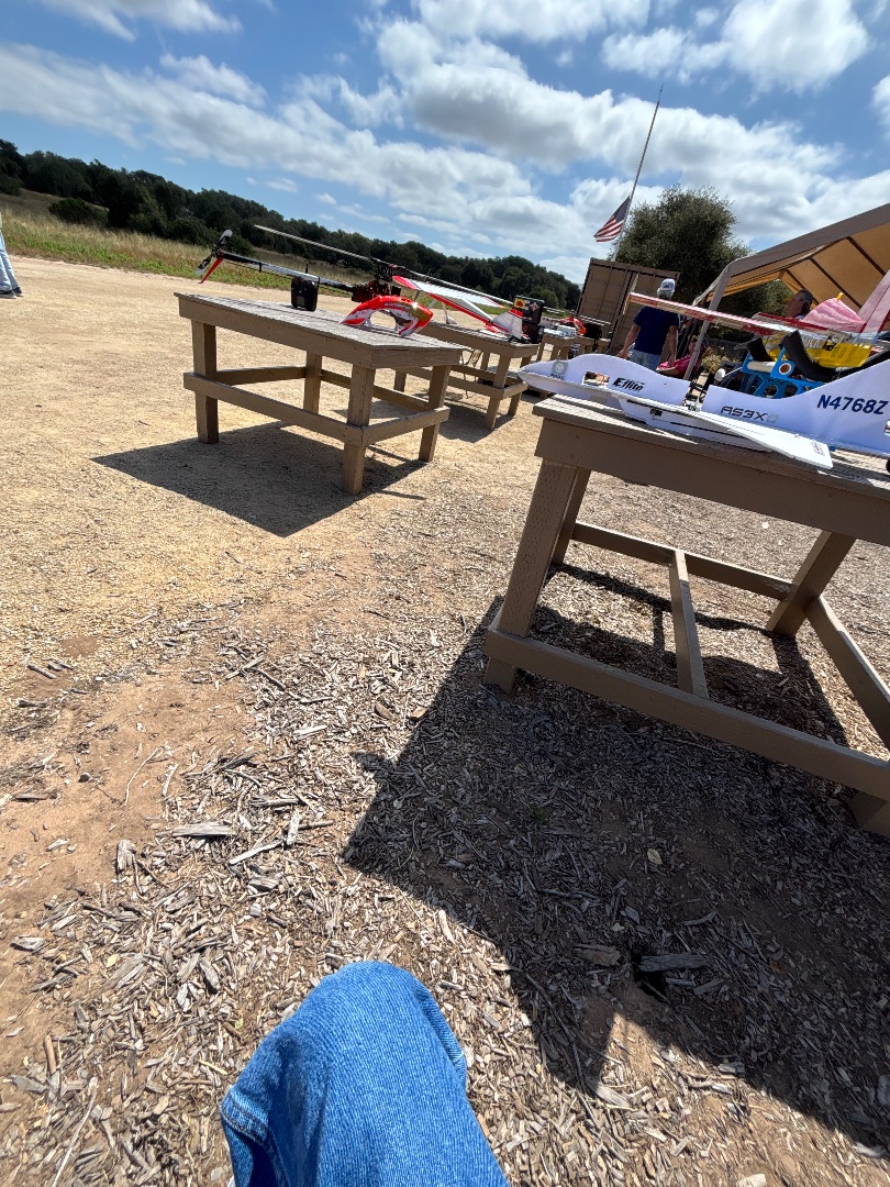
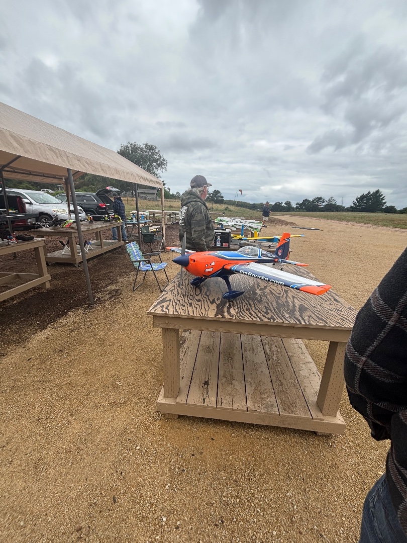
Welcome to Tri-Valley R.C. Modelers — a long-standing AMA-sanctioned RC flying club serving the Central Coast aviation community for over 60 years. Located at 1116 Hetrick Avenue in Arroyo Grande, our club is dedicated to the fun, safety, and advancement of radio-controlled aviation for pilots of all experience levels.

Our members build and fly a wide variety of aircraft including fixed-wing airplanes, helicopters, gliders, giant scale aircraft, EDF jets, and multi-rotors. Whether you are an experienced pilot or completely new to the hobby, Tri-Valley RC Modelers offers a welcoming environment where members can learn, improve their skills, and enjoy flying with fellow aviation enthusiasts. The club regularly hosts fun flies, BBQs, swap meets, contests, and special events throughout the year.

Visitors are always welcome to come spectate, meet members, and experience the excitement of RC aviation firsthand. If you are interested in learning to fly, training is available using a buddy box system, allowing instructors to safely assist new pilots during flight lessons. This makes learning easier, safer, and more enjoyable for beginners.

For safety and insurance purposes, all pilots flying at the field are required to hold a current membership with the Academy of Model Aeronautics (AMA). Guests and occasional visitors are welcome, but if you plan on flying at the field regularly, we encourage you to become a club member and join our growing RC community.

The flying field provides a great place to practice, socialize, and enjoy the hobby in a safe and organized environment. Whether you fly electric, gas, nitro, turbine, helicopters, or drones, Tri-Valley RC Modelers welcomes anyone passionate about model aviation.

For more information about membership, field rules, upcoming events, and club activities, visit  Tri-Valley RC Modelers Official Website.
Show inline change markers
+ Welcome to Tri-Valley R.C. Modelers — a long-standing AMA-sanctioned RC flying club serving the Central Coast aviation community for over 60 years. Located at 1116 Hetrick Avenue in Arroyo Grande, our club is dedicated to the fun, safety, and advancement of radio-controlled aviation for pilots of all experience levels.
+
+ Our members build and fly a wide variety of aircraft including fixed-wing airplanes, helicopters, gliders, giant scale aircraft, EDF jets, and multi-rotors. Whether you are an experienced pilot or completely new to the hobby, Tri-Valley RC Modelers offers a welcoming environment where members can learn, improve their skills, and enjoy flying with fellow aviation enthusiasts. The club regularly hosts fun flies, BBQs, swap meets, contests, and special events throughout the year.
+
+ Visitors are always welcome to come spectate, meet members, and experience the excitement of RC aviation firsthand. If you are interested in learning to fly, training is available using a buddy box system, allowing instructors to safely assist new pilots during flight lessons. This makes learning easier, safer, and more enjoyable for beginners.
+
+ For safety and insurance purposes, all pilots flying at the field are required to hold a current membership with the Academy of Model Aeronautics (AMA). Guests and occasional visitors are welcome, but if you plan on flying at the field regularly, we encourage you to become a club member and join our growing RC community.
+
+ The flying field provides a great place to practice, socialize, and enjoy the hobby in a safe and organized environment. Whether you fly electric, gas, nitro, turbine, helicopters, or drones, Tri-Valley RC Modelers welcomes anyone passionate about model aviation.
+
+ For more information about membership, field rules, upcoming events, and club activities, visit  Tri-Valley RC Modelers Official Website.
May 27, 2026 3:59 AM
Review
Place:
Hetrick Avenue
5 out of 5 stars
5/5
Great Rc Club fly drones, planes, and helicopters, tons of fun!