5f513e8f-2439-4ccd-87fb-cf7aa961810d
Showing rules updates and reviews across all places.
Total edits: 148
Reviews: 3
Joined: May 27, 2026
Reputation: 150
Showing 126–150 of 151 activity items.
Page 6 of 7.
Mapped shape change
Old outline is gray. New outline is blue.
May 27, 2026 3:47 PM
Rules update
• added park source and map, restricted Wilderness area, and details on the restriction
Place:
Schuyler Island
Changed fields
Mapped shape change
Click to load this change into the shared map viewer here.
| Field | Before | After |
|---|---|---|
| Restriction type | Ground | Air |
| Flight status | Unknown | NoFly |
| Summary | — | Both commercial and hobbyist use of drones on Forest Preserve lands is prohibited by 6 NYCRR 196.8 in areas classified as: Wilderness Primitive Primitive Bicycle Corridors Canoe Areas |
| Mapped shapes | — | b41dfaad-1399-437e-8a97-223d11f0149f |
Before
After
## Both commercial and hobbyist use of drones on Forest Preserve lands is prohibited by 6 NYCRR 196.8 in areas classified as:

- Wilderness
- Primitive
- Primitive Bicycle Corridors
- Canoe Areas

This area is classified as: "Wilderness" by the Adirondack Park Agency (APA)
Show inline change markers
+ ## Both commercial and hobbyist use of drones on Forest Preserve lands is prohibited by 6 NYCRR 196.8 in areas classified as:
+
+ - Wilderness
+ - Primitive
+ - Primitive Bicycle Corridors
+ - Canoe Areas
+
+ This area is classified as: "Wilderness" by the Adirondack Park Agency (APA)
May 27, 2026 3:45 PM
Rules update
• added park source and map, restricted Primitive area, and details on the restriction
Place:
Deer River Primitive Area
Changed fields
Mapped shape change
Click to load this change into the shared map viewer here.
| Field | Before | After |
|---|---|---|
| Restriction type | Ground | Air |
| Flight status | Unknown | NoFly |
| Summary | — | Both commercial and hobbyist use of drones on Forest Preserve lands is prohibited by 6 NYCRR 196.8 in areas classified as: Wilderness Primitive Primitive Bicycle Corridors Canoe Areas |
| Mapped shapes | — | 9281dfd9-e896-4a99-8900-95273381a7fd |
Before
After
## Both commercial and hobbyist use of drones on Forest Preserve lands is prohibited by 6 NYCRR 196.8 in areas classified as:

- Wilderness
- Primitive
- Primitive Bicycle Corridors
- Canoe Areas

This area is classified as: "Primitive" by the Adirondack Park Agency (APA)
Show inline change markers
+ ## Both commercial and hobbyist use of drones on Forest Preserve lands is prohibited by 6 NYCRR 196.8 in areas classified as:
+
+ - Wilderness
+ - Primitive
+ - Primitive Bicycle Corridors
+ - Canoe Areas
+
+ This area is classified as: "Primitive" by the Adirondack Park Agency (APA)
May 27, 2026 3:43 PM
Rules update
• added park source and map, restricted Primitive area, and details on the restriction
Changed fields
Mapped shape change
Click to load this change into the shared map viewer here.
| Field | Before | After |
|---|---|---|
| Restriction type | Ground | Air |
| Flight status | Unknown | NoFly |
| Summary | — | Both commercial and hobbyist use of drones on Forest Preserve lands is prohibited by 6 NYCRR 196.8 in areas classified as: Wilderness Primitive Primitive Bicycle Corridors Canoe Areas |
| Mapped shapes | — | 08177ae5-a20e-4b4b-82cf-e2ed70883524 |
Before
After
## Both commercial and hobbyist use of drones on Forest Preserve lands is prohibited by 6 NYCRR 196.8 in areas classified as:

- Wilderness
- Primitive
- Primitive Bicycle Corridors
- Canoe Areas

This area is classified as: "Primitive" by the Adirondack Park Agency (APA)
Show inline change markers
+ ## Both commercial and hobbyist use of drones on Forest Preserve lands is prohibited by 6 NYCRR 196.8 in areas classified as:
+
+ - Wilderness
+ - Primitive
+ - Primitive Bicycle Corridors
+ - Canoe Areas
+
+ This area is classified as: "Primitive" by the Adirondack Park Agency (APA)
May 27, 2026 3:40 PM
Rules update
• added park source and map, restricted Primitive area, and details on the restriction
Place:
Saint Regis Canoe Area
Changed fields
Mapped shape change
Click to load this change into the shared map viewer here.
| Field | Before | After |
|---|---|---|
| Restriction type | Ground | Air |
| Flight status | Unknown | NoFly |
| Summary | — | Both commercial and hobbyist use of drones on Forest Preserve lands is prohibited by 6 NYCRR 196.8 in areas classified as: Wilderness Primitive Primitive Bicycle Corridors Canoe Areas |
| Mapped shapes | — | b9812f7f-7698-4a4c-9097-3ad158a8b018 |
Before
After
## Both commercial and hobbyist use of drones on Forest Preserve lands is prohibited by 6 NYCRR 196.8 in areas classified as:

- Wilderness
- Primitive
- Primitive Bicycle Corridors
- Canoe Areas

This area is classified as: "Primitive" by the Adirondack Park Agency (APA)
Show inline change markers
+ ## Both commercial and hobbyist use of drones on Forest Preserve lands is prohibited by 6 NYCRR 196.8 in areas classified as:
+
+ - Wilderness
+ - Primitive
+ - Primitive Bicycle Corridors
+ - Canoe Areas
+
+ This area is classified as: "Primitive" by the Adirondack Park Agency (APA)
May 27, 2026 3:38 PM
Rules update
• added park source and map, restricted Primitive area, and details on the restriction
Place:
Raquette Boreal Wild Forest
Changed fields
Mapped shape change
Click to load this change into the shared map viewer here.
| Field | Before | After |
|---|---|---|
| Restriction type | Ground | Air |
| Flight status | Unknown | NoFly |
| Summary | — | Both commercial and hobbyist use of drones on Forest Preserve lands is prohibited by 6 NYCRR 196.8 in areas classified as: Wilderness Primitive Primitive Bicycle Corridors Canoe Areas |
| Mapped shapes | — | 51e28154-0fe3-4a6a-9fe8-af118bfcec60 |
Before
After
## Both commercial and hobbyist use of drones on Forest Preserve lands is prohibited by 6 NYCRR 196.8 in areas classified as:

- Wilderness
- Primitive
- Primitive Bicycle Corridors
- Canoe Areas

This area is classified as: "Primitive" by the Adirondack Park Agency (APA)
Show inline change markers
+ ## Both commercial and hobbyist use of drones on Forest Preserve lands is prohibited by 6 NYCRR 196.8 in areas classified as:
+
+ - Wilderness
+ - Primitive
+ - Primitive Bicycle Corridors
+ - Canoe Areas
+
+ This area is classified as: "Primitive" by the Adirondack Park Agency (APA)
May 27, 2026 3:24 PM
Rules update
• added park source and map, restricted wilderness area, and details on the restriction
Place:
Algonquin Peak
Changed fields
Mapped shape change
Click to load this change into the shared map viewer here.
| Field | Before | After |
|---|---|---|
| Restriction type | Ground | Air |
| Flight status | Unknown | NoFly |
| Summary | — | Both commercial and hobbyist use of drones on Forest Preserve lands is prohibited by 6 NYCRR 196.8 in areas classified as: Wilderness Primitive Primitive Bicycle Corridors Canoe Areas |
| Mapped shapes | — | d6f3d47e-1a0b-4f9f-89d4-4c58ab33243b |
Before
After
## Both commercial and hobbyist use of drones on Forest Preserve lands is prohibited by 6 NYCRR 196.8 in areas classified as:

- Wilderness
- Primitive
- Primitive Bicycle Corridors
- Canoe Areas

This area is classified as: "wilderness" by the Adirondack Park Agency (APA)
Show inline change markers
+ ## Both commercial and hobbyist use of drones on Forest Preserve lands is prohibited by 6 NYCRR 196.8 in areas classified as:
+
+ - Wilderness
+ - Primitive
+ - Primitive Bicycle Corridors
+ - Canoe Areas
+
+ This area is classified as: "wilderness" by the Adirondack Park Agency (APA)
May 27, 2026 3:07 PM
Rules update
• added park source and map, restricted wilderness area, and details on the restriction
Place:
Giant Mountain
Changed fields
Mapped shape change
Click to load this change into the shared map viewer here.
| Field | Before | After |
|---|---|---|
| Restriction type | Ground | Air |
| Flight status | Unknown | NoFly |
| Summary | — | Both commercial and hobbyist use of drones on Forest Preserve lands is prohibited by 6 NYCRR 196.8 in areas classified as: Wilderness Primitive Primitive Bicycle Corridors Canoe Areas |
| Mapped shapes | — | d940310c-c798-4f79-8cb3-66baea485c03 |
Before
After
## Both commercial and hobbyist use of drones on Forest Preserve lands is prohibited by 6 NYCRR 196.8 in areas classified as:

- Wilderness
- Primitive
- Primitive Bicycle Corridors
- Canoe Areas

This area is classified as: "wilderness" by the Adirondack Park Agency (APA)
Show inline change markers
+ ## Both commercial and hobbyist use of drones on Forest Preserve lands is prohibited by 6 NYCRR 196.8 in areas classified as:
+
+ - Wilderness
+ - Primitive
+ - Primitive Bicycle Corridors
+ - Canoe Areas
+
+ This area is classified as: "wilderness" by the Adirondack Park Agency (APA)
May 27, 2026 3:02 PM
Rules update
• added park source and map, restricted wilderness area, and details on the restriction
Place:
Hoffman Notch
Changed fields
Mapped shape change
Click to load this change into the shared map viewer here.
| Field | Before | After |
|---|---|---|
| Restriction type | Ground | Air |
| Flight status | Unknown | NoFly |
| Summary | — | Both commercial and hobbyist use of drones on Forest Preserve lands is prohibited by 6 NYCRR 196.8 in areas classified as: Wilderness Primitive Primitive Bicycle Corridors Canoe Areas |
| Mapped shapes | — | 2584ff97-3242-4573-9a68-9a658d00574c |
Before
After
## Both commercial and hobbyist use of drones on Forest Preserve lands is prohibited by 6 NYCRR 196.8 in areas classified as:

- Wilderness
- Primitive
- Primitive Bicycle Corridors
- Canoe Areas

This area is classified as: "wilderness" by the Adirondack Park Agency (APA)
Show inline change markers
+ ## Both commercial and hobbyist use of drones on Forest Preserve lands is prohibited by 6 NYCRR 196.8 in areas classified as:
+
+ - Wilderness
+ - Primitive
+ - Primitive Bicycle Corridors
+ - Canoe Areas
+
+ This area is classified as: "wilderness" by the Adirondack Park Agency (APA)
May 27, 2026 2:51 PM
Rules update
• added park source and map, restricted wilderness area, and details on the restriction
Place:
Pharaoh Lake Wilderness Area
Changed fields
Mapped shape change
Click to load this change into the shared map viewer here.
| Field | Before | After |
|---|---|---|
| Restriction type | Ground | Air |
| Flight status | Unknown | NoFly |
| Summary | — | Both commercial and hobbyist use of drones on Forest Preserve lands is prohibited by 6 NYCRR 196.8 in areas classified as: Wilderness Primitive Primitive Bicycle Corridors Canoe Areas |
| Mapped shapes | — | 7c38106e-d92b-4f08-993a-04da0e267791 |
Before
After
## Both commercial and hobbyist use of drones on Forest Preserve lands is prohibited by 6 NYCRR 196.8 in areas classified as:

- Wilderness
- Primitive
- Primitive Bicycle Corridors
- Canoe Areas

This area is classified as: "wilderness" by the Adirondack Park Agency (APA)
Show inline change markers
+ ## Both commercial and hobbyist use of drones on Forest Preserve lands is prohibited by 6 NYCRR 196.8 in areas classified as:
+
+ - Wilderness
+ - Primitive
+ - Primitive Bicycle Corridors
+ - Canoe Areas
+
+ This area is classified as: "wilderness" by the Adirondack Park Agency (APA)
May 27, 2026 2:46 PM
Rules update
• added park source and map, restricted wilderness area, and details on the restriction
Place:
Pigeon Lake
Changed fields
Mapped shape change
Click to load this change into the shared map viewer here.
| Field | Before | After |
|---|---|---|
| Restriction type | Ground | Air |
| Flight status | Unknown | NoFly |
| Summary | — | Both commercial and hobbyist use of drones on Forest Preserve lands is prohibited by 6 NYCRR 196.8 in areas classified as: Wilderness Primitive Primitive Bicycle Corridors Canoe Areas |
| Mapped shapes | — | 3fc24e20-a54b-4f71-997a-bcb695f9115c |
Before
After
## Both commercial and hobbyist use of drones on Forest Preserve lands is prohibited by 6 NYCRR 196.8 in areas classified as:

- Wilderness
- Primitive
- Primitive Bicycle Corridors
- Canoe Areas

This area is classified as: "wilderness" by the Adirondack Park Agency (APA)
Show inline change markers
+ ## Both commercial and hobbyist use of drones on Forest Preserve lands is prohibited by 6 NYCRR 196.8 in areas classified as:
+
+ - Wilderness
+ - Primitive
+ - Primitive Bicycle Corridors
+ - Canoe Areas
+
+ This area is classified as: "wilderness" by the Adirondack Park Agency (APA)
May 27, 2026 2:11 PM
Rules update
• added park source and map, restricted wilderness area, and details on the restriction
Place:
Five Ponds Wilderness
Changed fields
Mapped shape change
Click to load this change into the shared map viewer here.
| Field | Before | After |
|---|---|---|
| Restriction type | Ground | Air |
| Flight status | Unknown | NoFly |
| Summary | — | Both commercial and hobbyist use of drones on Forest Preserve lands is prohibited by 6 NYCRR 196.8 in areas classified as: Wilderness Primitive Primitive Bicycle Corridors Canoe Areas |
| Mapped shapes | — | 13f8daec-7c52-43b5-a435-03960760f7ed |
Before
After
## Both commercial and hobbyist use of drones on Forest Preserve lands is prohibited by 6 NYCRR 196.8 in areas classified as:

- Wilderness
- Primitive
- Primitive Bicycle Corridors
- Canoe Areas

This area is classified as: "wilderness" by the Adirondack Park Agency (APA)
Show inline change markers
+ ## Both commercial and hobbyist use of drones on Forest Preserve lands is prohibited by 6 NYCRR 196.8 in areas classified as:
+
+ - Wilderness
+ - Primitive
+ - Primitive Bicycle Corridors
+ - Canoe Areas
+
+ This area is classified as: "wilderness" by the Adirondack Park Agency (APA)
May 27, 2026 2:03 PM
Rules update
• added park source and map, restricted wilderness area, and details on the restriction
Place:
Ha-De-Ron-Dah Wilderness
Changed fields
Mapped shape change
Click to load this change into the shared map viewer here.
| Field | Before | After |
|---|---|---|
| Restriction type | Ground | Air |
| Flight status | Unknown | NoFly |
| Summary | — | Both commercial and hobbyist use of drones on Forest Preserve lands is prohibited by 6 NYCRR 196.8 in areas classified as: Wilderness Primitive Primitive Bicycle Corridors Canoe Areas |
| Mapped shapes | — | 5e12546d-bb58-4758-baac-280fc48b6adc |
Before
After
## Both commercial and hobbyist use of drones on Forest Preserve lands is prohibited by 6 NYCRR 196.8 in areas classified as:

- Wilderness
- Primitive
- Primitive Bicycle Corridors
- Canoe Areas

This area is classified as: "wilderness" by the Adirondack Park Agency (APA)
Show inline change markers
+ ## Both commercial and hobbyist use of drones on Forest Preserve lands is prohibited by 6 NYCRR 196.8 in areas classified as:
+
+ - Wilderness
+ - Primitive
+ - Primitive Bicycle Corridors
+ - Canoe Areas
+
+ This area is classified as: "wilderness" by the Adirondack Park Agency (APA)
May 27, 2026 1:40 PM
Rules update
• added park source and map, restricted wilderness area, and details on the restriction
Place:
Silver Lake Wilderness
Changed fields
Mapped shape change
Click to load this change into the shared map viewer here.
| Field | Before | After |
|---|---|---|
| Restriction type | Ground | Air |
| Flight status | Unknown | NoFly |
| Summary | — | Both commercial and hobbyist use of drones on Forest Preserve lands is prohibited by 6 NYCRR 196.8 in areas classified as: Wilderness Primitive Primitive Bicycle Corridors Canoe Areas |
| Mapped shapes | — | 75dde54b-4e6f-4170-b114-9d8018b23663 |
Before
After
## Both commercial and hobbyist use of drones on Forest Preserve lands is prohibited by 6 NYCRR 196.8 in areas classified as:

- Wilderness
- Primitive
- Primitive Bicycle Corridors
- Canoe Areas

This area is classified as: "wilderness" by the Adirondack Park Agency (APA)
Show inline change markers
+ ## Both commercial and hobbyist use of drones on Forest Preserve lands is prohibited by 6 NYCRR 196.8 in areas classified as:
+
+ - Wilderness
+ - Primitive
+ - Primitive Bicycle Corridors
+ - Canoe Areas
+
+ This area is classified as: "wilderness" by the Adirondack Park Agency (APA)
May 27, 2026 1:36 PM
Rules update
• added park source and map, restricted wilderness area, and details on the restriction
Place:
Blue Mountain Lake
Changed fields
Mapped shape change
Click to load this change into the shared map viewer here.
| Field | Before | After |
|---|---|---|
| Restriction type | Ground | Air |
| Flight status | Unknown | NoFly |
| Summary | — | Both commercial and hobbyist use of drones on Forest Preserve lands is prohibited by 6 NYCRR 196.8 in areas classified as: Wilderness Primitive Primitive Bicycle Corridors Canoe Areas |
| Mapped shapes | — | 717f8696-717a-4e20-a908-592840704ea4 |
Before
After
## Both commercial and hobbyist use of drones on Forest Preserve lands is prohibited by 6 NYCRR 196.8 in areas classified as:

- Wilderness
- Primitive
- Primitive Bicycle Corridors
- Canoe Areas

This area is classified as: "wilderness" by the Adirondack Park Agency (APA)
Show inline change markers
+ ## Both commercial and hobbyist use of drones on Forest Preserve lands is prohibited by 6 NYCRR 196.8 in areas classified as:
+
+ - Wilderness
+ - Primitive
+ - Primitive Bicycle Corridors
+ - Canoe Areas
+
+ This area is classified as: "wilderness" by the Adirondack Park Agency (APA)
May 27, 2026 1:32 PM
Rules update
• added park source and map, restricted wilderness area, and details on the restriction
Place:
Johnsburg
Changed fields
Mapped shape change
Click to load this change into the shared map viewer here.
| Field | Before | After |
|---|---|---|
| Flight status | Unknown | NoFly |
| Summary | — | Both commercial and hobbyist use of drones on Forest Preserve lands is prohibited by 6 NYCRR 196.8 in areas classified as: Wilderness Primitive Primitive Bicycle Corridors Canoe Areas |
| Mapped shapes | — | 39f0337c-ff73-4145-8c2b-b6c9908ba798 |
Before
After
## Both commercial and hobbyist use of drones on Forest Preserve lands is prohibited by 6 NYCRR 196.8 in areas classified as:

- Wilderness
- Primitive
- Primitive Bicycle Corridors
- Canoe Areas

This area is classified as: "wilderness" by the Adirondack Park Agency (APA)
Show inline change markers
+ ## Both commercial and hobbyist use of drones on Forest Preserve lands is prohibited by 6 NYCRR 196.8 in areas classified as:
+
+ - Wilderness
+ - Primitive
+ - Primitive Bicycle Corridors
+ - Canoe Areas
+
+ This area is classified as: "wilderness" by the Adirondack Park Agency (APA)
May 27, 2026 1:27 PM
Rules update
• added park source and map, restricted wilderness area, and details on the restriction
Changed fields
Mapped shape change
Click to load this change into the shared map viewer here.
| Field | Before | After |
|---|---|---|
| Restriction type | Ground | Air |
| Flight status | Unknown | NoFly |
| Summary | — | Both commercial and hobbyist use of drones on Forest Preserve lands is prohibited by 6 NYCRR 196.8 in areas classified as: Wilderness Primitive Primitive Bicycle Corridors Canoe Areas |
| Mapped shapes | — | e7ea2329-1fee-48e3-8728-73eab4eacf97 |
Before
After
## Both commercial and hobbyist use of drones on Forest Preserve lands is prohibited by 6 NYCRR 196.8 in areas classified as:

- Wilderness
- Primitive
- Primitive Bicycle Corridors
- Canoe Areas

This area is classified as: "wilderness" by the Adirondack Park Agency (APA)
Show inline change markers
+ ## Both commercial and hobbyist use of drones on Forest Preserve lands is prohibited by 6 NYCRR 196.8 in areas classified as:
+
+ - Wilderness
+ - Primitive
+ - Primitive Bicycle Corridors
+ - Canoe Areas
+
+ This area is classified as: "wilderness" by the Adirondack Park Agency (APA)
May 27, 2026 2:37 AM
Review
5 out of 5 stars
5/5
Big old golf course with open areas to fly and trees popping up throughout. Theres still golf cart paths which can lead to some cool shots. watch out for dog walkers though :)
May 27, 2026 2:24 AM
Rules update
• New page: set flight status to Permission Required, added FAA airspace restriction summary and details.
Place:
Dansville Municipal Airport
Changed fields
Mapped shape change
Click to load this change into the shared map viewer here.
| Field | Before | After |
|---|---|---|
| Restriction type | Ground | Air |
| Flight status | Unknown | Permission |
| Summary | — | FAA controlled airspace restriction from Airport. Review current FAA data for LAANC availability. |
| Mapped shapes | — | c0e77e06-5673-4d99-a619-46924f28ebcc |
Before
After
## FAA airspace restriction
> This is nearby to a towered airport. Laanc availability may be possible.
Show inline change markers
+ ## FAA airspace restriction
+ > This is nearby to a towered airport. Laanc availability may be possible.
May 27, 2026 1:37 AM
Rules update
• New page: set flight status to Permission Required, added FAA airspace restriction summary and details.
Place:
Oneonta Municipal Airport
Changed fields
Mapped shape change
Click to load this change into the shared map viewer here.
| Field | Before | After |
|---|---|---|
| Restriction type | Ground | Air |
| Flight status | Unknown | Permission |
| Summary | — | FAA controlled airspace restriction from Airport. Review current FAA data for LAANC availability. |
| Mapped shapes | — | 5dfd5a9e-64f4-4fb8-8ecf-21594c27d697 |
Before
After
## FAA airspace restriction
> This is nearby to a towered airport. Laanc availability may be possible.
Show inline change markers
+ ## FAA airspace restriction
+ > This is nearby to a towered airport. Laanc availability may be possible.
May 27, 2026 1:35 AM
Rules update
• New page: set flight status to Permission Required, added FAA airspace restriction summary and details.
Place:
Fulton County Airport-NY0
Changed fields
Mapped shape change
Click to load this change into the shared map viewer here.
| Field | Before | After |
|---|---|---|
| Restriction type | Ground | Air |
| Flight status | Unknown | Permission |
| Summary | — | FAA controlled airspace restriction from Airport. Review current FAA data for LAANC availability. |
| Mapped shapes | — | 3fe5f878-f242-4a81-be81-d4defd940de0 |
Before
After
## FAA airspace restriction
> This is nearby to a towered airport. Laanc availability may be possible.
Show inline change markers
+ ## FAA airspace restriction
+ > This is nearby to a towered airport. Laanc availability may be possible.
May 27, 2026 1:29 AM
Rules update
• New page: set flight status to Permission Required, added FAA airspace restriction summary and details.
Place:
Penn Yan Regional Airport
Changed fields
Mapped shape change
Click to load this change into the shared map viewer here.
| Field | Before | After |
|---|---|---|
| Restriction type | Ground | Air |
| Flight status | Unknown | Permission |
| Summary | — | FAA controlled airspace restriction from Airport. Review current FAA data for LAANC availability. |
| Mapped shapes | — | ea3625b6-1068-473b-add1-add3f02f1458 |
Before
After
## FAA airspace restriction
> This is nearby to a towered airport. Laanc availability may be possible.
Show inline change markers
+ ## FAA airspace restriction
+ > This is nearby to a towered airport. Laanc availability may be possible.
May 27, 2026 1:27 AM
Rules update
• New page: set flight status to Permission Required, added FAA airspace restriction summary and details.
Place:
Wellsville Municipal Airport
Changed fields
Mapped shape change
Click to load this change into the shared map viewer here.
| Field | Before | After |
|---|---|---|
| Restriction type | Ground | Air |
| Flight status | Unknown | Permission |
| Summary | — | FAA controlled airspace restriction from Airport. Review current FAA data for LAANC availability. |
| Mapped shapes | — | 80e8f8cb-b967-44a9-8ac5-155f55d91c5b |
Before
After
## FAA airspace restriction
> This is nearby to a towered airport. Laanc availability may be possible.
Show inline change markers
+ ## FAA airspace restriction
+ > This is nearby to a towered airport. Laanc availability may be possible.
May 27, 2026 1:23 AM
Rules update
• New page: set flight status to Permission Required, added FAA airspace restriction summary and details.
Place:
Corning–Painted Post Airport
Changed fields
Mapped shape change
Click to load this change into the shared map viewer here.
| Field | Before | After |
|---|---|---|
| Restriction type | Ground | Air |
| Flight status | Unknown | Permission |
| Summary | — | FAA controlled airspace restriction from Airport. Review current FAA data for LAANC availability. |
| Mapped shapes | — | 58b981ae-a0c3-4a0e-8112-f612981ed716 |
Before
After
## FAA airspace restriction
> This is nearby to a towered airport. Laanc availability may be possible.
Show inline change markers
+ ## FAA airspace restriction
+ > This is nearby to a towered airport. Laanc availability may be possible.
May 27, 2026 1:09 AM
Rules update
• Set flight status to Permission Required. Added FAA airspace restriction summary and details matching standard airport format. Added FAA source link.
Place:
Hornell Municipal Airport
Changed fields
Mapped shape change
Click to load this change into the shared map viewer here.
| Field | Before | After |
|---|---|---|
| Restriction type | Ground | Air |
| Flight status | Unknown | Permission |
| Summary | — | FAA controlled airspace restriction from Airport. Review current FAA data for LAANC availability. |
| Mapped shapes | — | e2a2f4ea-5dc0-4181-a3e3-ec7c6c5ab3cc |
Before
After
## FAA airspace restriction
> This is nearby to a towered airport. Laanc availability may be possible.
Show inline change markers
+ ## FAA airspace restriction
+ > This is nearby to a towered airport. Laanc availability may be possible.
May 27, 2026 12:58 AM
Review
Place:
Stony Brook State Park
5 out of 5 stars
5/5
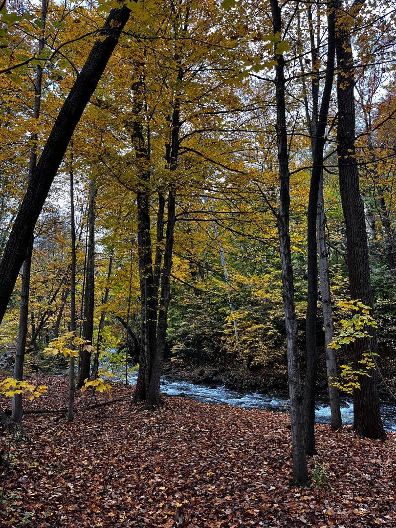
Huge open fields with the rolling field of upstate ny in the backround. Theres a large gorge and running water. Theres also various bridges and old brick structure making flying FPV super fun. The fall make it so much better