14529576-3545-4e3c-9147-c3fbe9f2fd6a
Showing rules updates and reviews across all places.
Total edits: 28
Reviews: 11
Joined: May 27, 2026
Reputation: 112
Showing 26–39 of 39 activity items.
Page 2 of 2.
Mapped shape change
Old outline is gray. New outline is blue.
May 28, 2026 2:34 AM
Rules update
• Added the FRIA zone for the park.
Changed fields
Mapped shape change
Click to load this change into the shared map viewer here.
| Field | Before | After |
|---|---|---|
| Restriction type | Ground | Air |
| Flight status | Unknown | Allowed |
| Summary | — | FAA-Recognized Identification Area |
| Mapped shapes | — | 4cfb8658-b47e-42e3-be0b-58b007050205 |
Before
After
## Definition

“A FRIA is a defined geographic area where drones can be flown without Remote ID equipment. Both the drone and the pilot must be located within the FRIA's boundaries throughout the operation. In addition, the pilot of the drone must be able to see it at all times throughout the duration of the flight.”
Show inline change markers
+ ## Definition
+
+ “A FRIA is a defined geographic area where drones can be flown without Remote ID equipment. Both the drone and the pilot must be located within the FRIA's boundaries throughout the operation. In addition, the pilot of the drone must be able to see it at all times throughout the duration of the flight.”
+
May 28, 2026 2:32 AM
Review
5 out of 5 stars
5/5
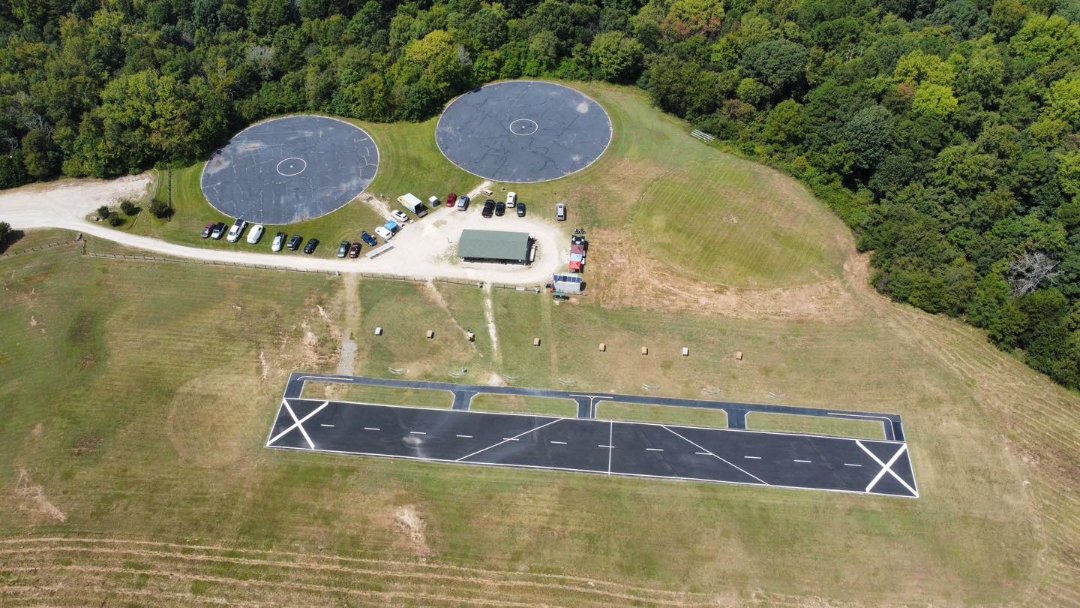
Aeromodeler flying field - grass
May 28, 2026 2:29 AM
Rules update
• Added the FRIA zone for the park.
Changed fields
Mapped shape change
Click to load this change into the shared map viewer here.
| Field | Before | After |
|---|---|---|
| Restriction type | Ground | Air |
| Flight status | Unknown | Allowed |
| Summary | — | FAA-Recognized Identification Area |
| Mapped shapes | — | 7afaa2db-9472-4014-859b-aff12641ab28 |
Before
After
## Definition

“A FRIA is a defined geographic area where drones can be flown without Remote ID equipment. Both the drone and the pilot must be located within the FRIA's boundaries throughout the operation. In addition, the pilot of the drone must be able to see it at all times throughout the duration of the flight.”
Show inline change markers
+ ## Definition
+
+ “A FRIA is a defined geographic area where drones can be flown without Remote ID equipment. Both the drone and the pilot must be located within the FRIA's boundaries throughout the operation. In addition, the pilot of the drone must be able to see it at all times throughout the duration of the flight.”
+
May 28, 2026 2:24 AM
Review
5 out of 5 stars
5/5
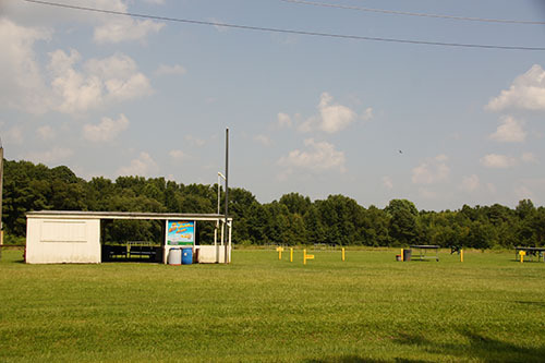
Aeromodeler flying field - grass
May 28, 2026 2:18 AM
Rules update
• Added the FRIA zone for the park.
Changed fields
Mapped shape change
Click to load this change into the shared map viewer here.
| Field | Before | After |
|---|---|---|
| Restriction type | Ground | Air |
| Flight status | Unknown | Allowed |
| Summary | — | FAA-Recognized Identification Area |
| Mapped shapes | — | 7a2227ef-7570-4ef7-9110-6bf4bbf73f59 |
Before
After
## Definition

“A FRIA is a defined geographic area where drones can be flown without Remote ID equipment. Both the drone and the pilot must be located within the FRIA's boundaries throughout the operation. In addition, the pilot of the drone must be able to see it at all times throughout the duration of the flight.”
Show inline change markers
+ ## Definition
+
+ “A FRIA is a defined geographic area where drones can be flown without Remote ID equipment. Both the drone and the pilot must be located within the FRIA's boundaries throughout the operation. In addition, the pilot of the drone must be able to see it at all times throughout the duration of the flight.”
May 28, 2026 2:13 AM
Review
5 out of 5 stars
5/5
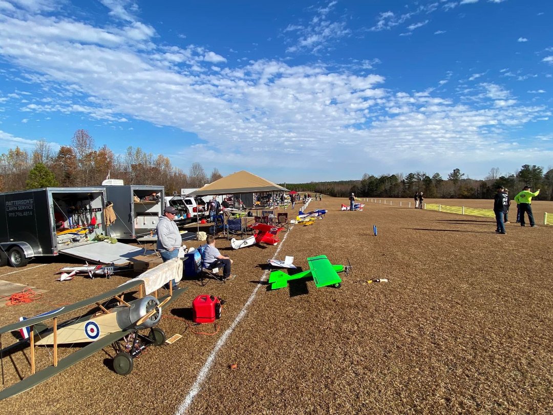
Aeromodeler flying field - grass
May 27, 2026 7:04 PM
Rules update
• Added the FRIA zone for North Carolina State University Lake Wheeler West
Changed fields
Mapped shape change
Click to load this change into the shared map viewer here.
| Field | Before | After |
|---|---|---|
| Associated place id | EjZZYXRlcyBNaWxsIFBvbmQgQ291bnR5IFBhcmsgUmQsIFJhbGVpZ2gsIE5DIDI3NjAzLCBVU0EiLiosChQKEgn3o6XEzoqsiRERbdic2XknkhIUChIJ9-BRny9arIkRrfARilK2kGc | GhIJ5IwXwbXdQUARD1atlgWtU8A |
| Associated place/name | Yates Mill Pond County Park Road | P7JW+RJ Southwest Raleigh, Raleigh, NC, USA |
| Associated address | Yates Mill Pond County Park Rd, Raleigh, NC 27603, USA | P7JW+RJ Southwest Raleigh, Raleigh, NC, USA |
| Restriction type | Ground | Air |
| Flight status | Unknown | Allowed |
| Summary | — | FAA-Recognized Identification Area |
| Mapped shapes | — | 6a2f95ec-34af-4665-a7df-edbd9bf7d9c1 |
Before
After
“A FRIA is a defined geographic area where drones can be flown without Remote ID equipment. Both the drone and the pilot must be located within the FRIA's boundaries throughout the operation. In addition, the pilot of the drone must be able to see it at all times throughout the duration of the flight.”
Show inline change markers
+ “A FRIA is a defined geographic area where drones can be flown without Remote ID equipment. Both the drone and the pilot must be located within the FRIA's boundaries throughout the operation. In addition, the pilot of the drone must be able to see it at all times throughout the duration of the flight.”
May 27, 2026 6:42 PM
Rules update
• Created the no fly zone and provided details.
Place:
Macon
Changed fields
Mapped shape change
Click to load this change into the shared map viewer here.
| Field | Before | After |
|---|---|---|
| Restriction type | Ground | Air |
| Flight status | Unknown | NoFly |
| Summary | — | Temporary flight restrictions for Special Security Reasons |
| Mapped shapes | — | 8fb88067-491c-43e5-ab5b-1f95def4de4f |
Before
After
0500 to 0930 UTC Daily starting May 29 and ending June 5.

No pilots may operate an aircraft in the areas covered by this NOTAM (except as described).

1. ALL ACFT ENTERING OR EXITING THE TFR MUST BE ON AN ACT IFR OR VFR FLT PLAN WITH A DISCRETE CODE ASSIGNED BY AN AIR TFC CTL (ATC) FAC. ACFT MUST BE SQUAWKING THE DISCRETE CODE PRIOR TO DEP AND AT ALL TIMES WHILE IN THE TFR.

2. ALL ACFT ENTERING OR EXITING THE TFR MUST REMAIN IN TWO - WAY RADIO COM WITH ATC.
Show inline change markers
+ 0500 to 0930 UTC Daily starting May 29 and ending June 5.
+
+ No pilots may operate an aircraft in the areas covered by this NOTAM (except as described).
+
+ 1. ALL ACFT ENTERING OR EXITING THE TFR MUST BE ON AN ACT IFR OR VFR FLT PLAN WITH A DISCRETE CODE ASSIGNED BY AN AIR TFC CTL (ATC) FAC. ACFT MUST BE SQUAWKING THE DISCRETE CODE PRIOR TO DEP AND AT ALL TIMES WHILE IN THE TFR.
+
+ 2. ALL ACFT ENTERING OR EXITING THE TFR MUST REMAIN IN TWO - WAY RADIO COM WITH ATC.
May 27, 2026 6:00 PM
Rules update
• The issue was the address marker is a dudes house next to it and not the field itself, which is under the same address. Sorry for the confusion!
Changed fields
Mapped shape change
Click to load this change into the shared map viewer here.
| Field | Before | After |
|---|---|---|
| Associated place id | ChIJw4w1Z7pzVIgRDq7fj4lT_ik | ChIJJU6l-rlzVIgRIBOYxoew7_0 |
| Associated place/name | 1111 Dutch Rd | 1200 Dutch Rd, Mt Pleasant, NC 28124, USA |
| Associated address | 1111 Dutch Rd, Mt Pleasant, NC 28124, USA | 1200 Dutch Rd, Mt Pleasant, NC 28124, USA |
| Restriction type | Ground | Air |
| Flight status | Unknown | Allowed |
| Summary | — | FAA-Recognized Identification Area |
| Mapped shapes | — | 250f5140-94fd-4aa2-a1fb-e8ea60056315 |
Before
After
"A FRIA is a defined geographic area where drones can be flown without Remote ID equipment. Both the drone and the pilot must be located within the FRIA's boundaries throughout the operation. In addition, the pilot of the drone must be able to see it at all times throughout the duration of the flight."
Show inline change markers
+ "A FRIA is a defined geographic area where drones can be flown without Remote ID equipment. Both the drone and the pilot must be located within the FRIA's boundaries throughout the operation. In addition, the pilot of the drone must be able to see it at all times throughout the duration of the flight."
May 27, 2026 5:38 PM
Review
Place:
1111 Dutch Rd
5 out of 5 stars
5/5
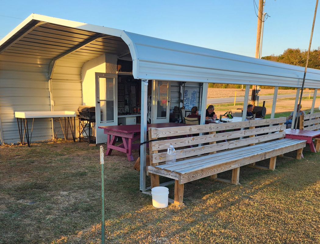
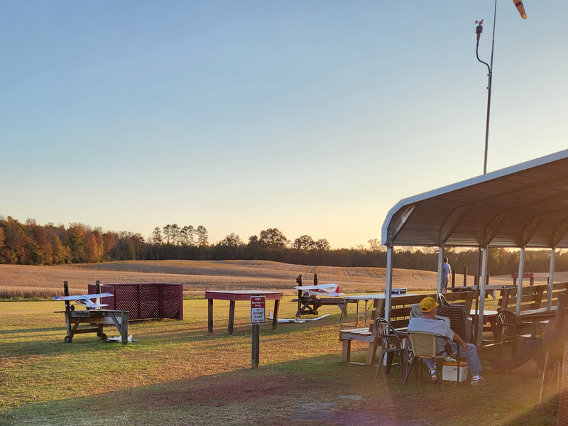
Grass flying field with good community and free training!
May 27, 2026 5:33 PM
Rules update
• Added the FRIA zone for the park.
Place:
429 Patterson Farm Rd
Changed fields
Mapped shape change
Click to load this change into the shared map viewer here.
| Field | Before | After |
|---|---|---|
| Restriction type | Ground | Air |
| Flight status | Unknown | Allowed |
| Summary | — | FAA-Recognized Identification Area |
| Mapped shapes | — | 6f86ac21-b5c8-4471-8379-6c8e974ca598 |
Before
After
"A FRIA is a defined geographic area where drones can be flown without Remote ID equipment. Both the drone and the pilot must be located within the FRIA's boundaries throughout the operation. In addition, the pilot of the drone must be able to see it at all times throughout the duration of the flight."
Show inline change markers
+ "A FRIA is a defined geographic area where drones can be flown without Remote ID equipment. Both the drone and the pilot must be located within the FRIA's boundaries throughout the operation. In addition, the pilot of the drone must be able to see it at all times throughout the duration of the flight."
May 27, 2026 5:29 PM
Review
Place:
429 Patterson Farm Rd
5 out of 5 stars
5/5
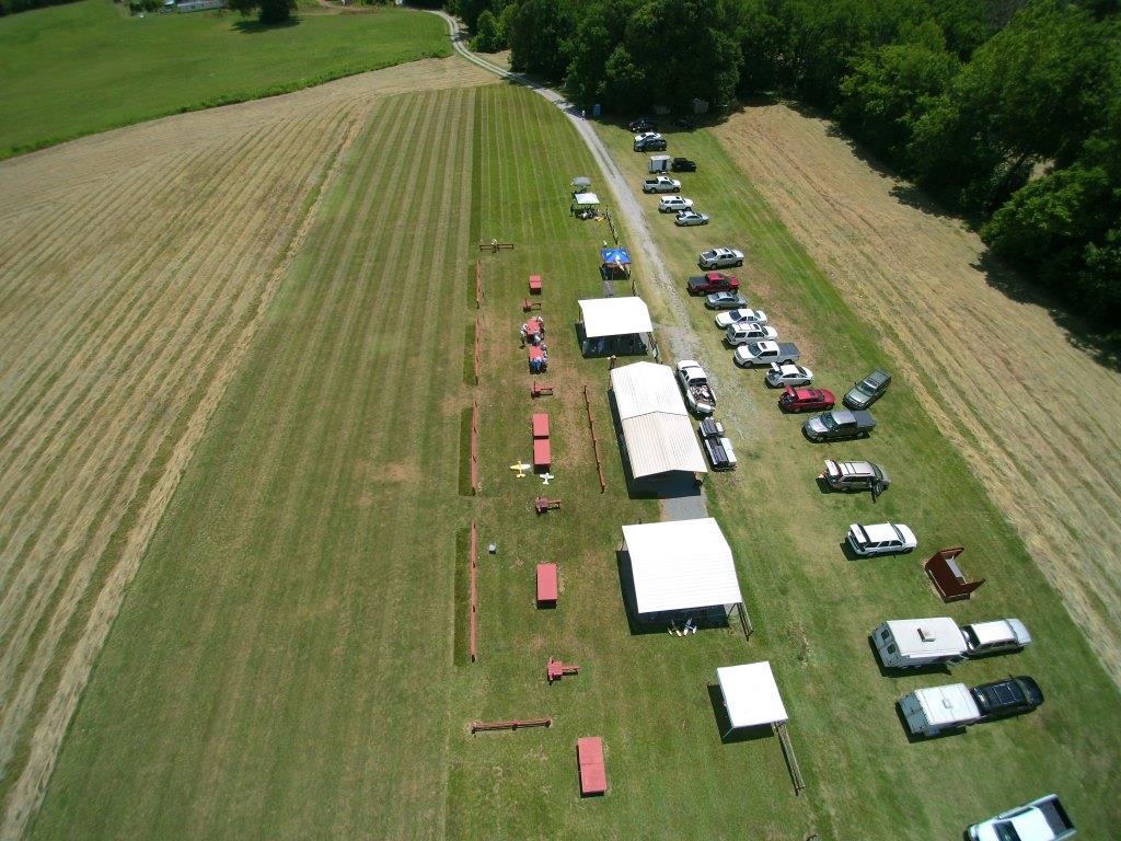
Fairly popular flying club with an FRIA zone.
May 27, 2026 5:17 PM
Rules update
• Added the FRIA zone for the park.
Changed fields
Mapped shape change
Click to load this change into the shared map viewer here.
| Field | Before | After |
|---|---|---|
| Restriction type | Ground | Air |
| Flight status | Unknown | Allowed |
| Summary | — | FAA-Recognized Identification Area |
| Mapped shapes | — | 1ca04050-ca3f-4240-a9ef-ef89567a4c16 |
Before
After
"A FRIA is a defined geographic area where drones can be flown without Remote ID equipment. Both the drone and the pilot must be located within the FRIA's boundaries throughout the operation. In addition, the pilot of the drone must be able to see it at all times throughout the duration of the flight."
Show inline change markers
+ "A FRIA is a defined geographic area where drones can be flown without Remote ID equipment. Both the drone and the pilot must be located within the FRIA's boundaries throughout the operation. In addition, the pilot of the drone must be able to see it at all times throughout the duration of the flight."
May 27, 2026 5:04 PM
Review
5 out of 5 stars
5/5
Awesome area to fly and find help. Both for drones and planes.
Open to public on Wednesdays from 9am - sunset and Sundays 9am - 2pm. Otherwise you will need a park pass.