3569459f-2e05-4190-ac43-1e693d99c944
Showing rules updates and reviews across all places.
Total edits: 341
Reviews: 39
Joined: Jun 1, 2026
Reputation: 1,001
Showing 351–375 of 380 activity items.
Page 15 of 16.
Mapped shape change
Old outline is gray. New outline is blue.
Jun 2, 2026 3:21 PM
Review
Place:
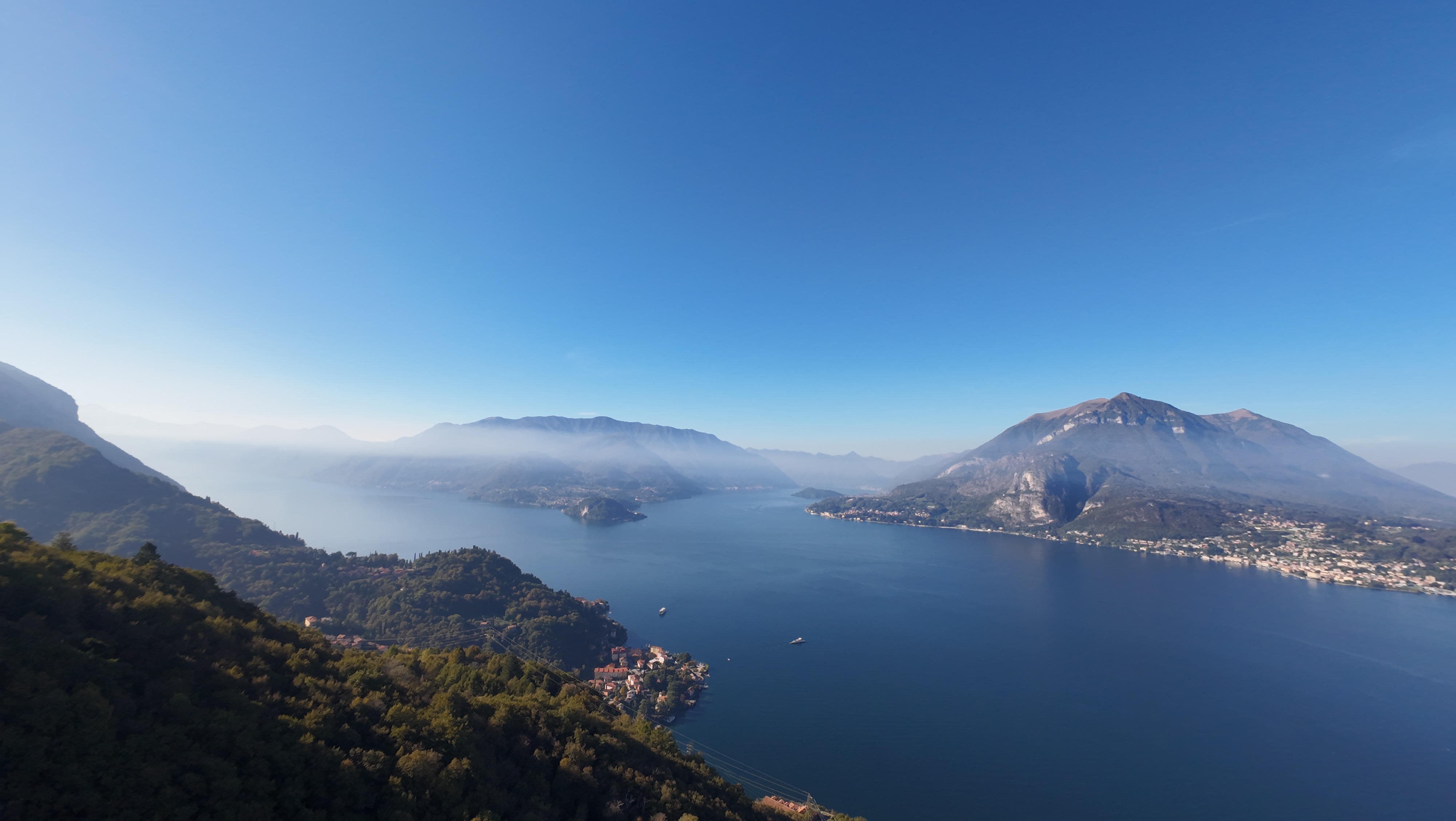
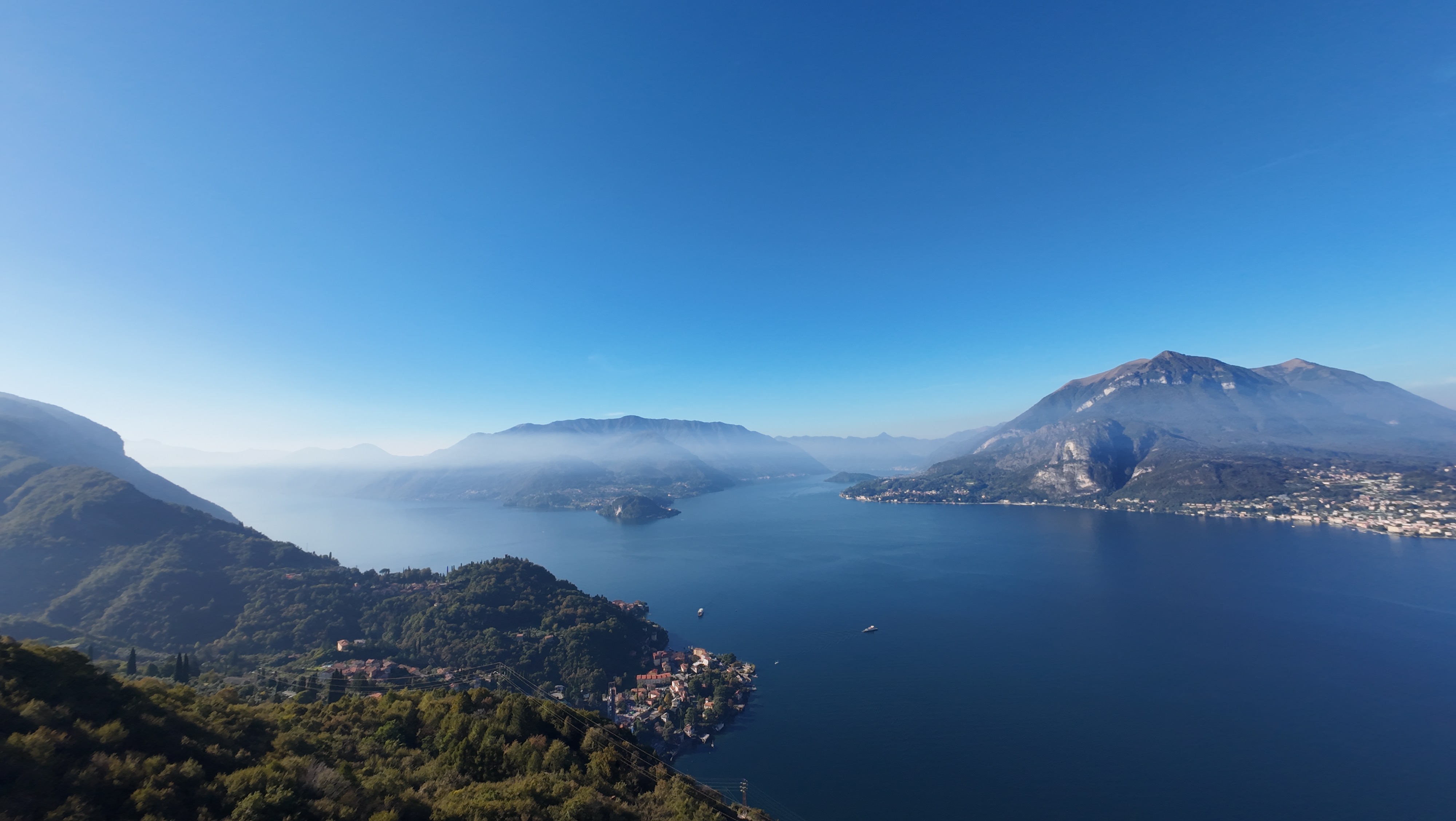
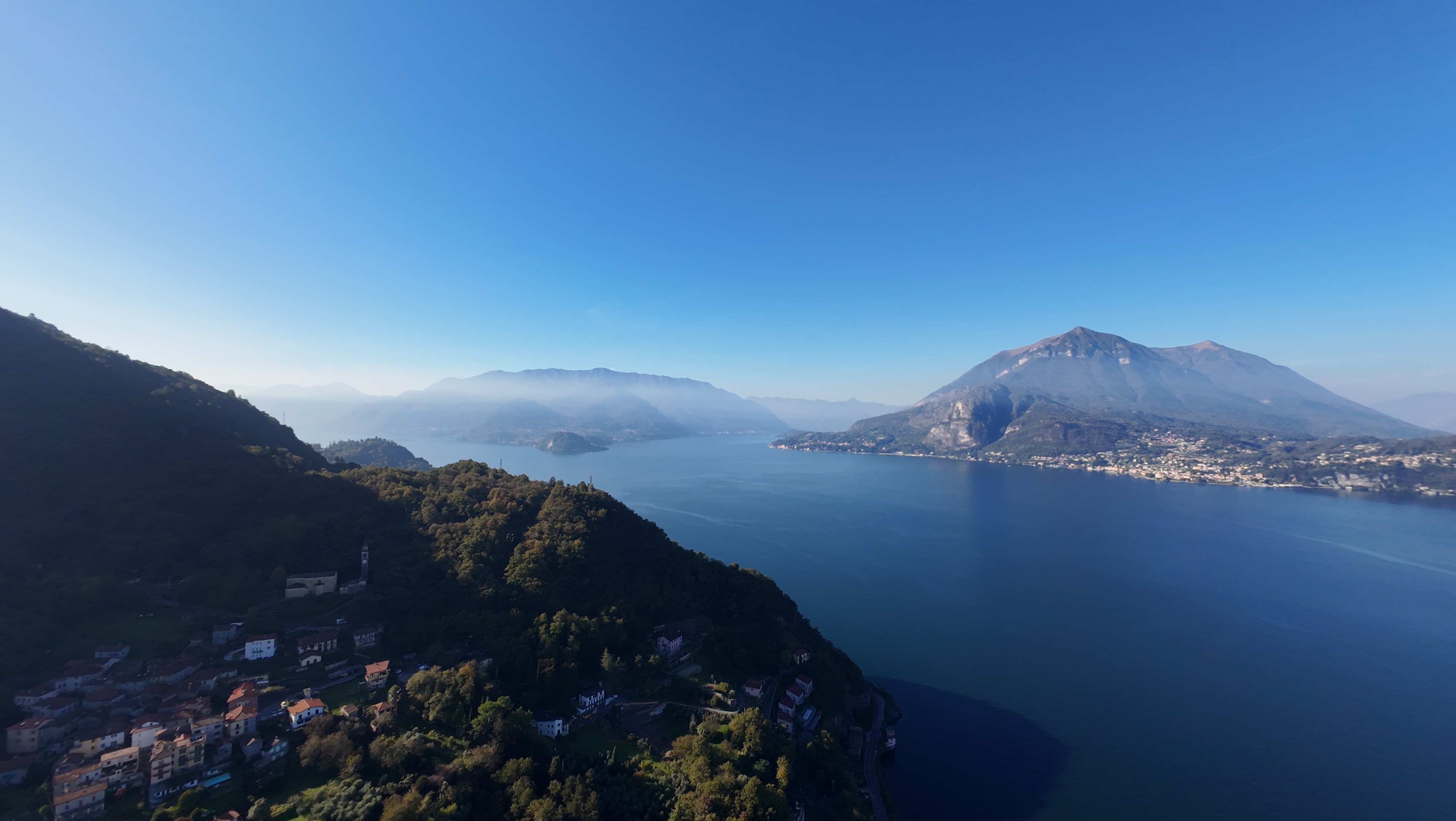
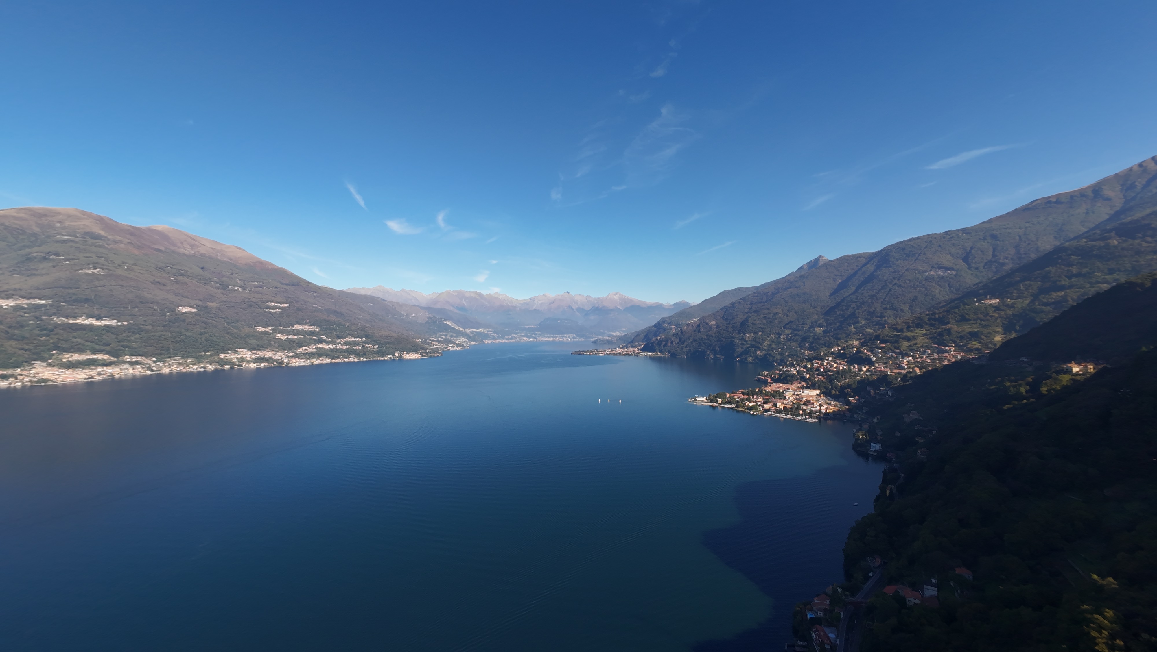
Holidays in Gittana
5 out of 5 stars
5/5
Very nice views with no obstructions overall a greta spot to fly and take nice panorama Photos
Jun 2, 2026 3:20 PM
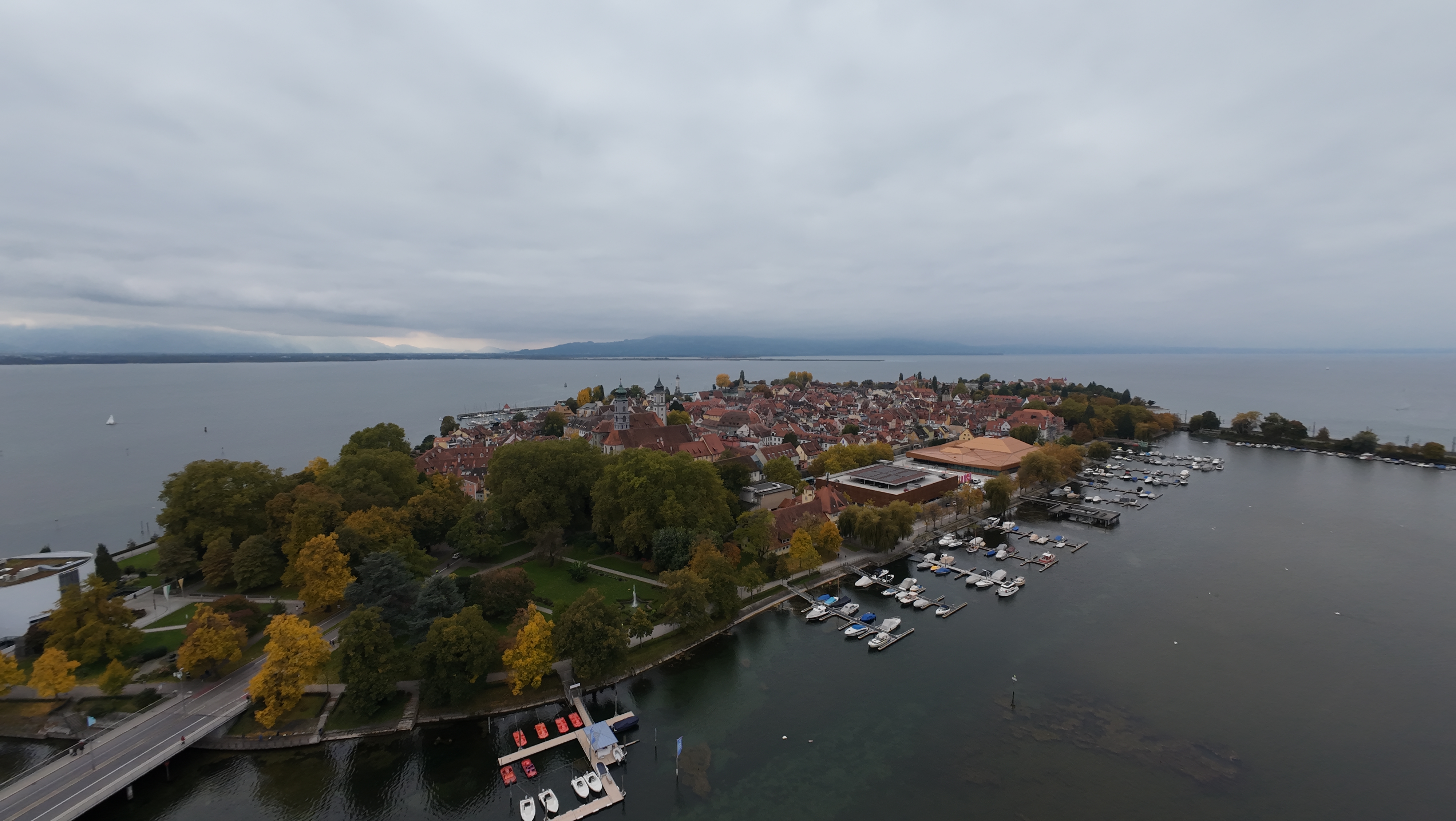
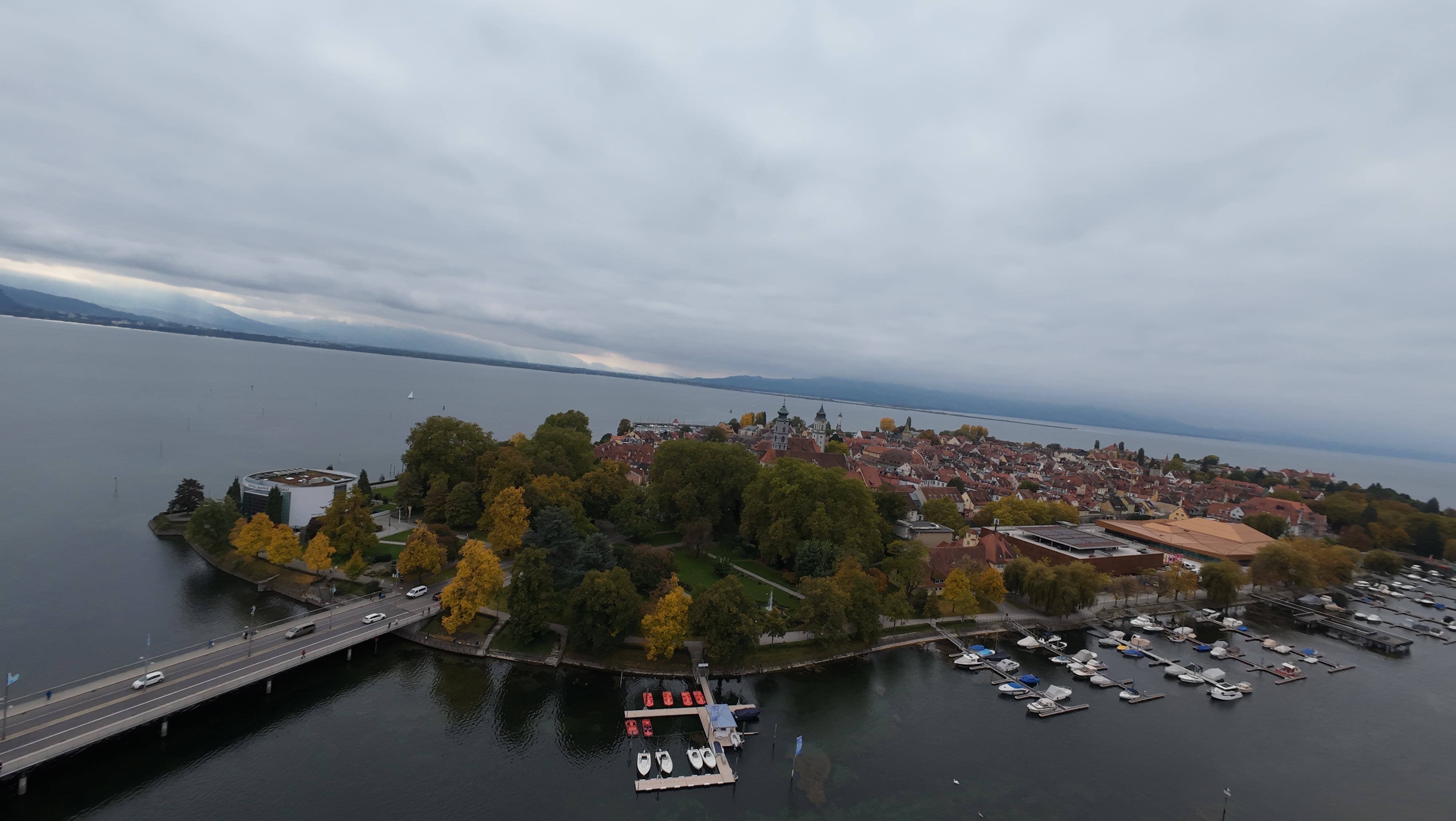
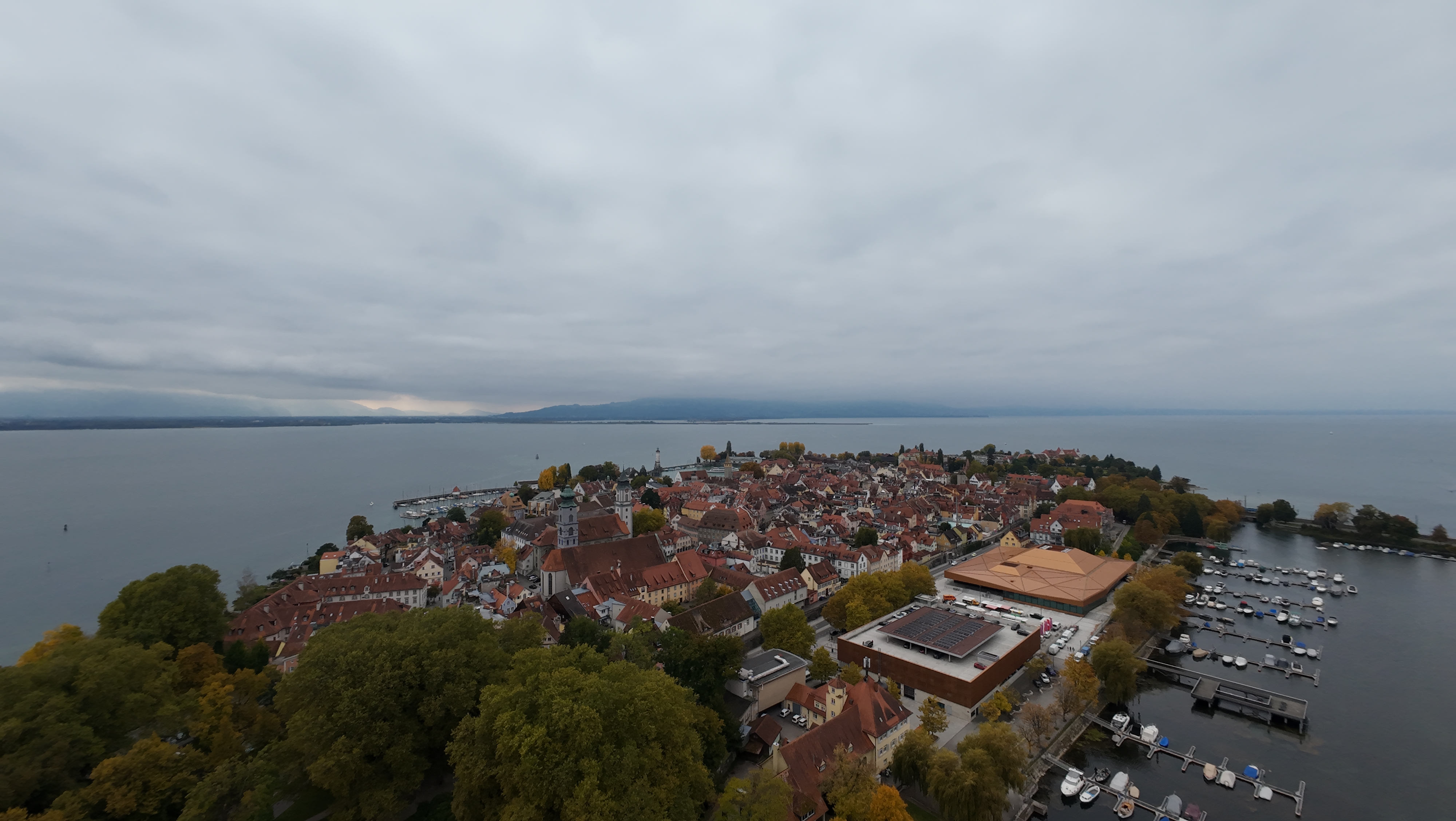
Review
Place:
Spielbank Lindau
4 out of 5 stars
4/5
This is a not beautiful but still peaceful spot to fly, where you can experiment new drone tricks and fly very far away.
Jun 2, 2026 3:17 PM
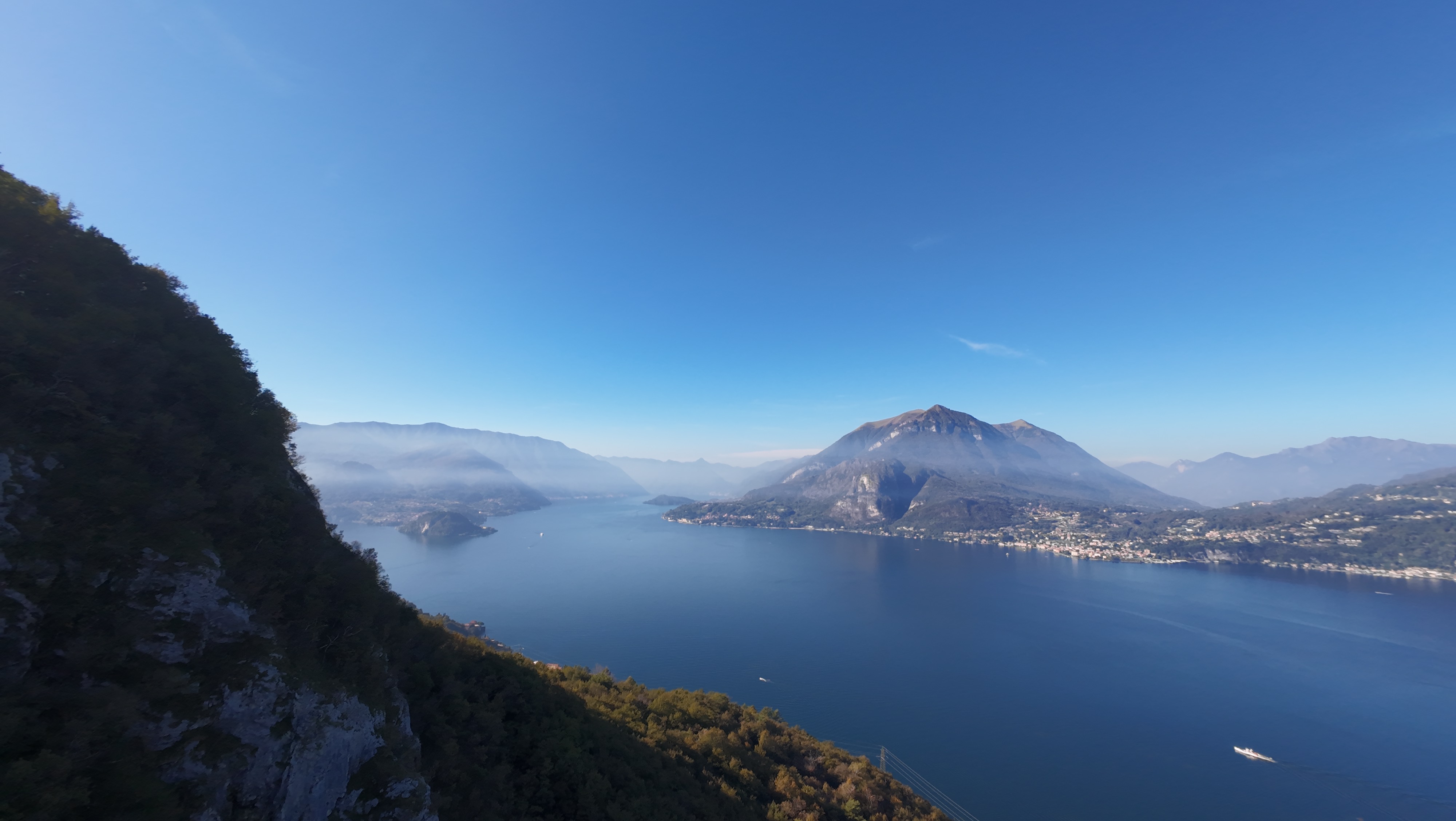
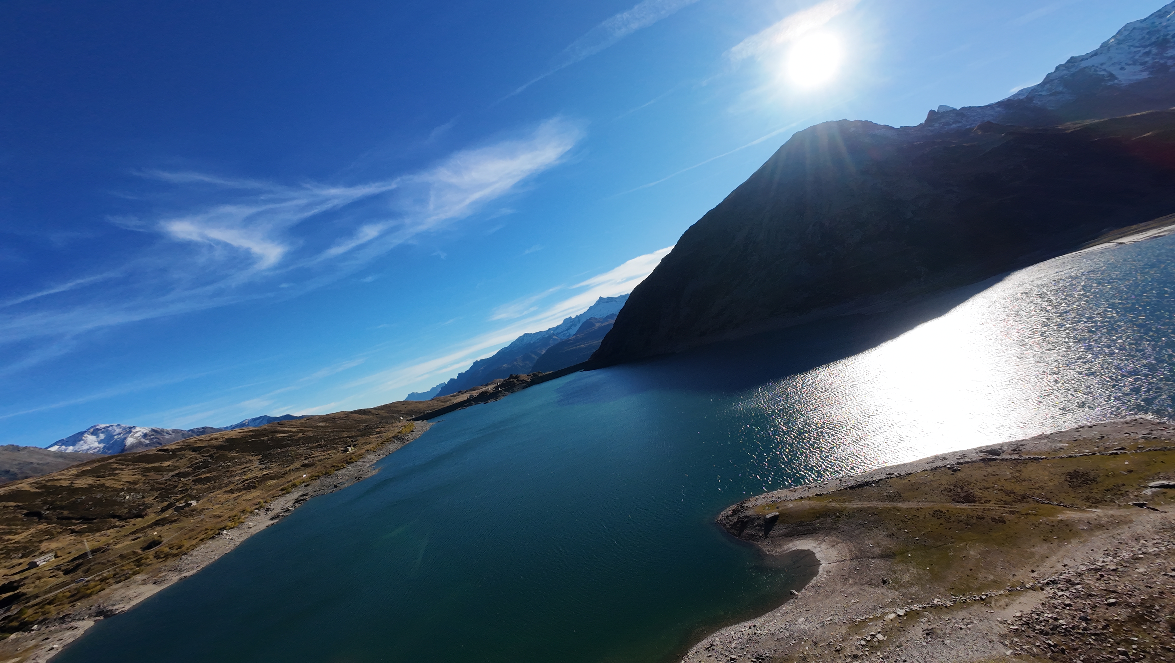
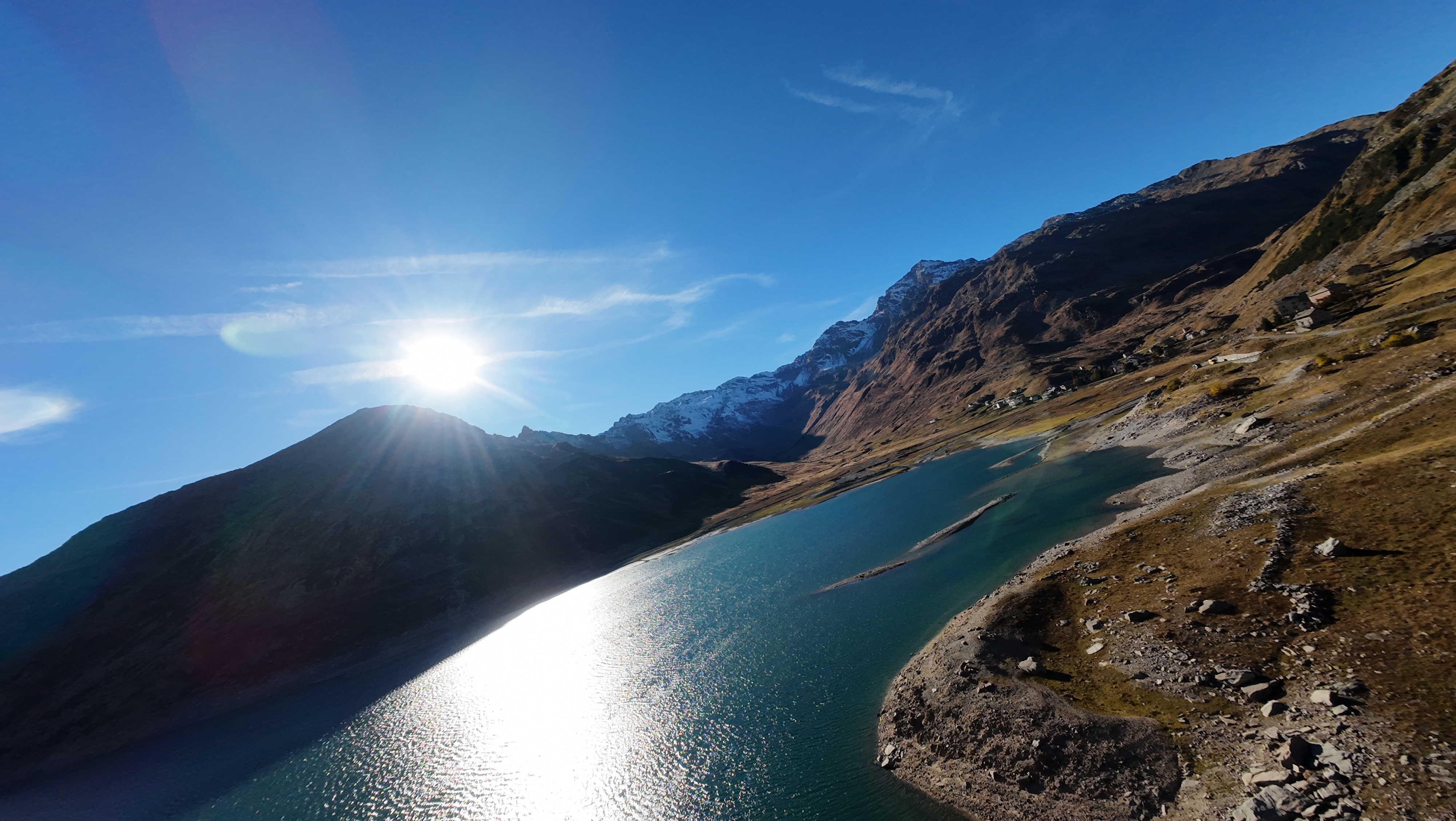
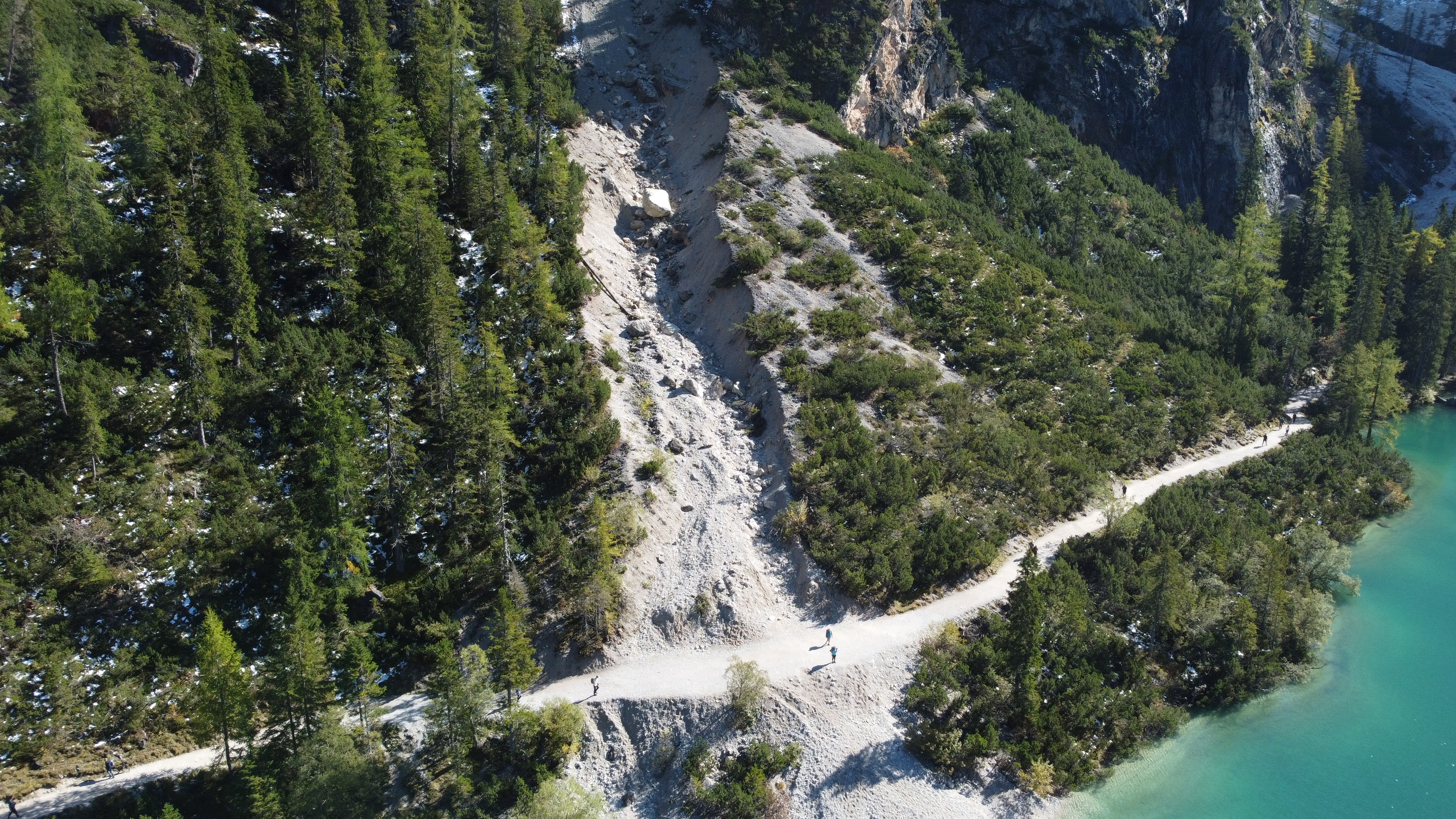
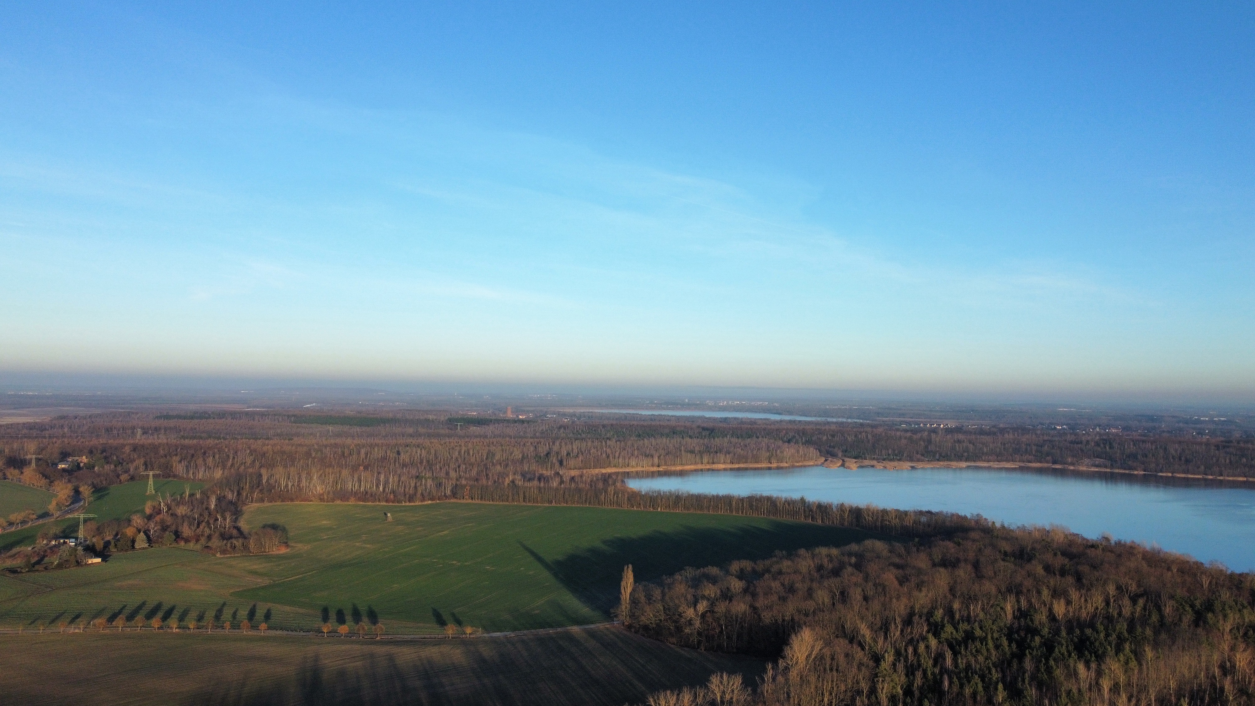
Review
Place:
Lago di Montespluga
5 out of 5 stars
5/5
This is a beautiful Italian lake with lovely views around it and lots of open space to fly very far without annoying any people.
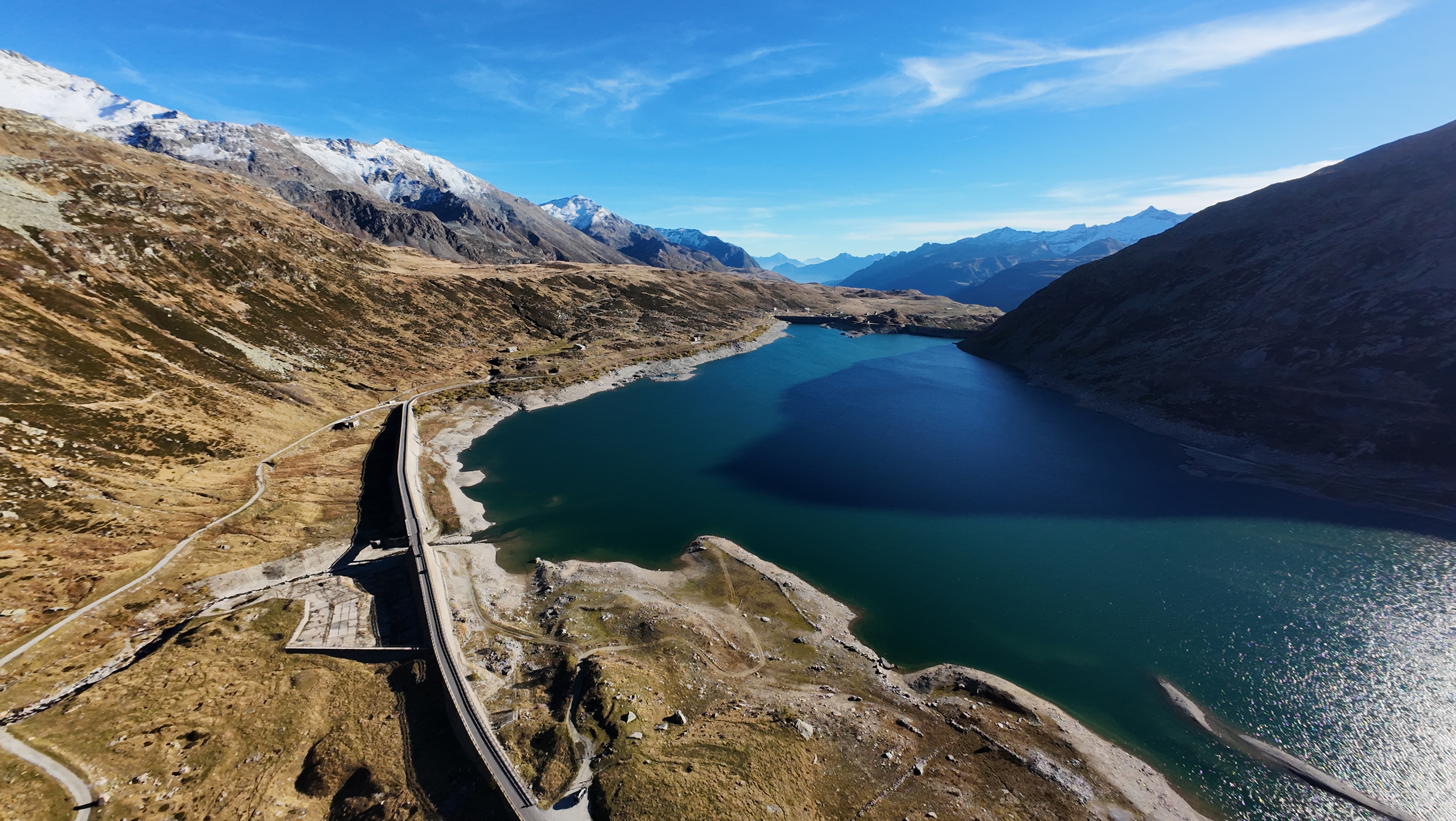
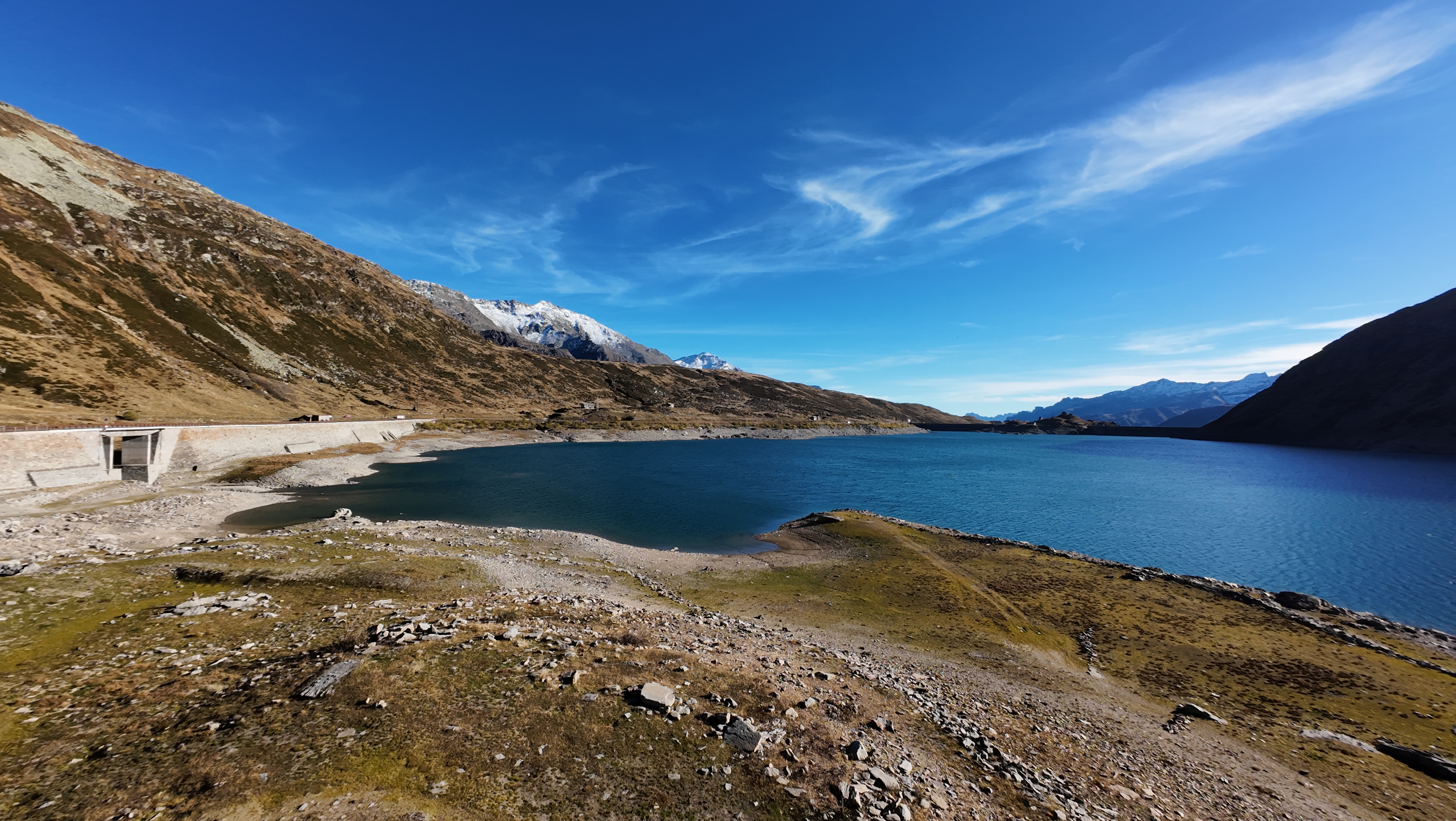
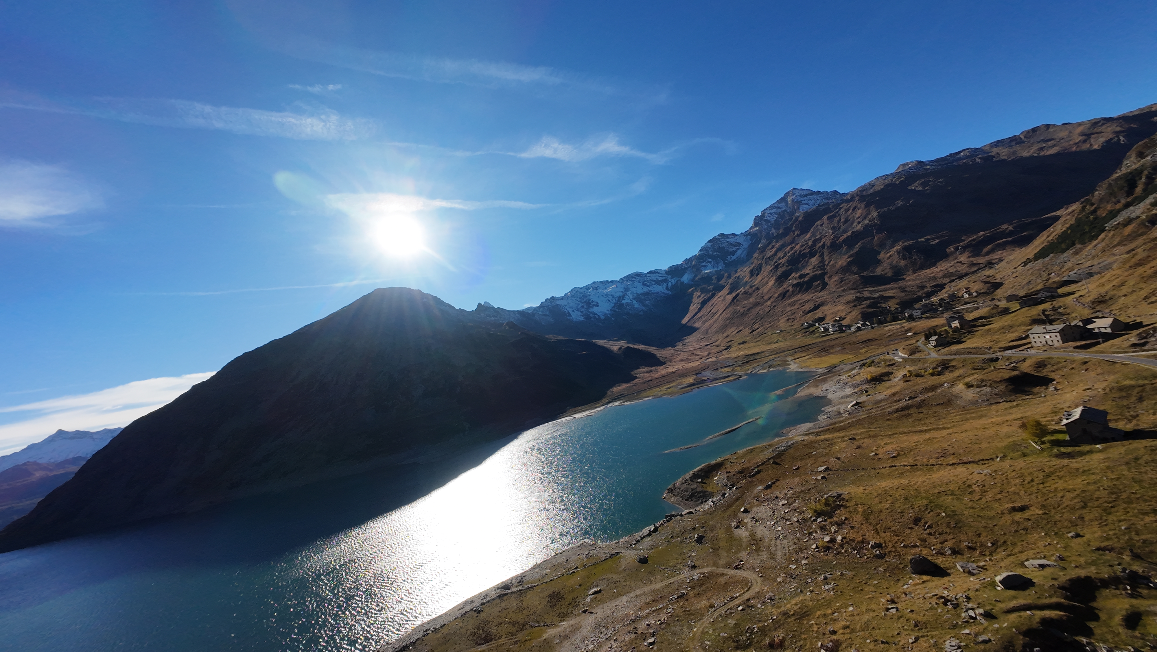
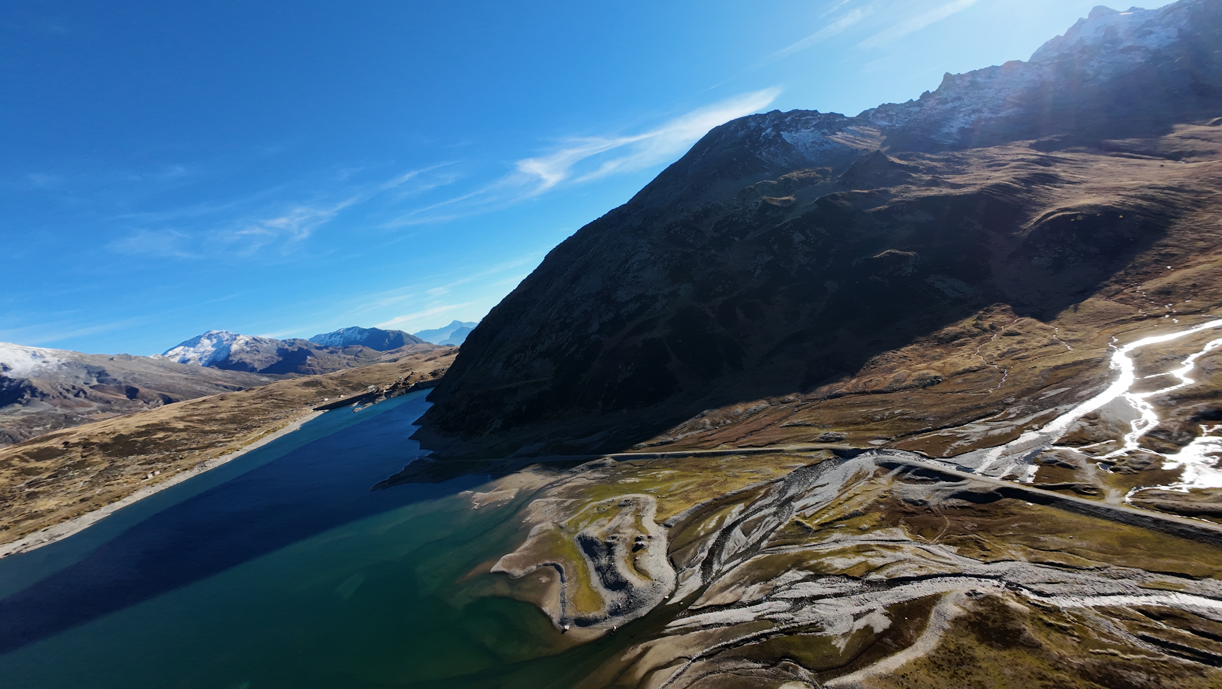
Showing 6 of 7 photos.
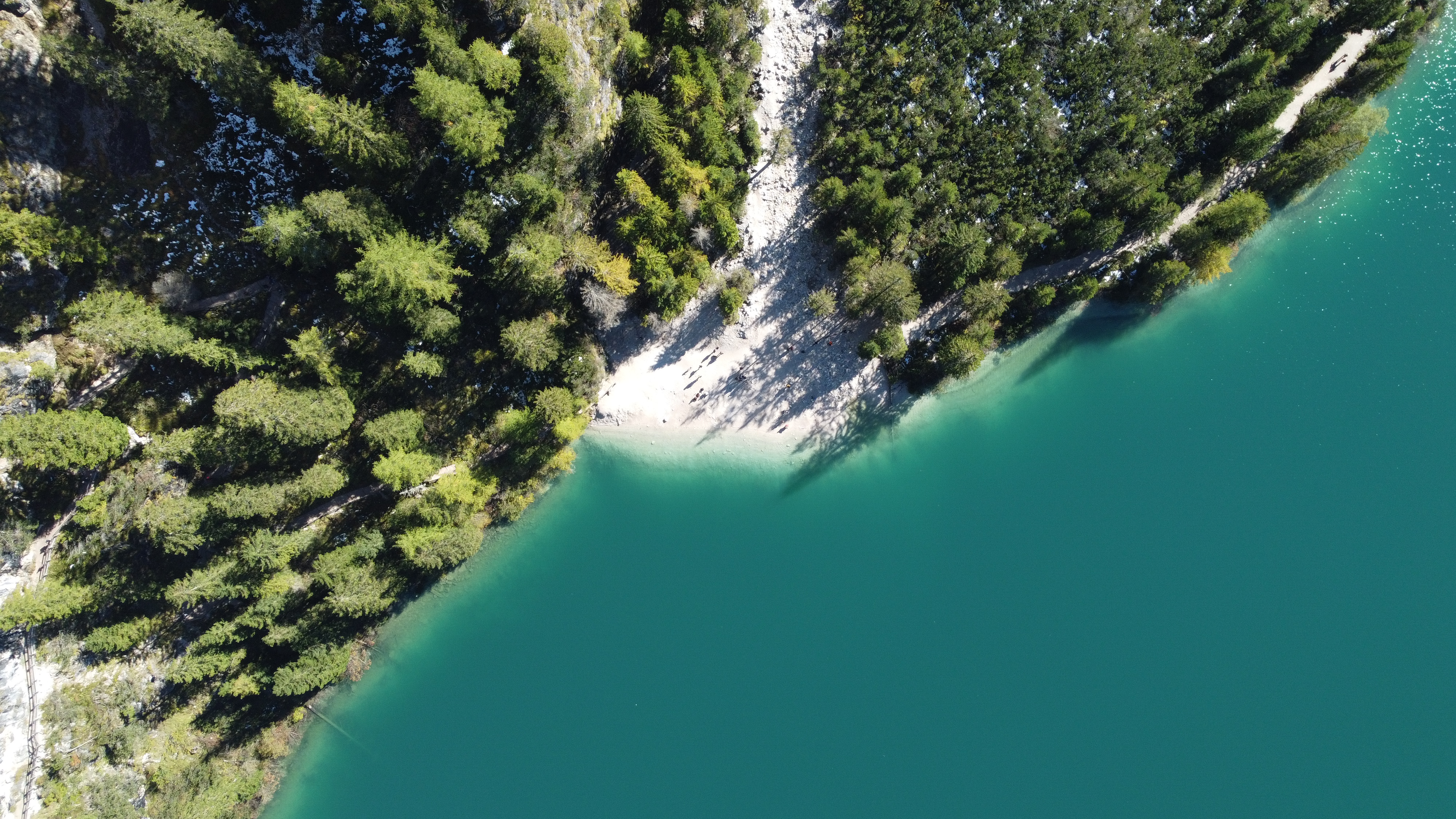
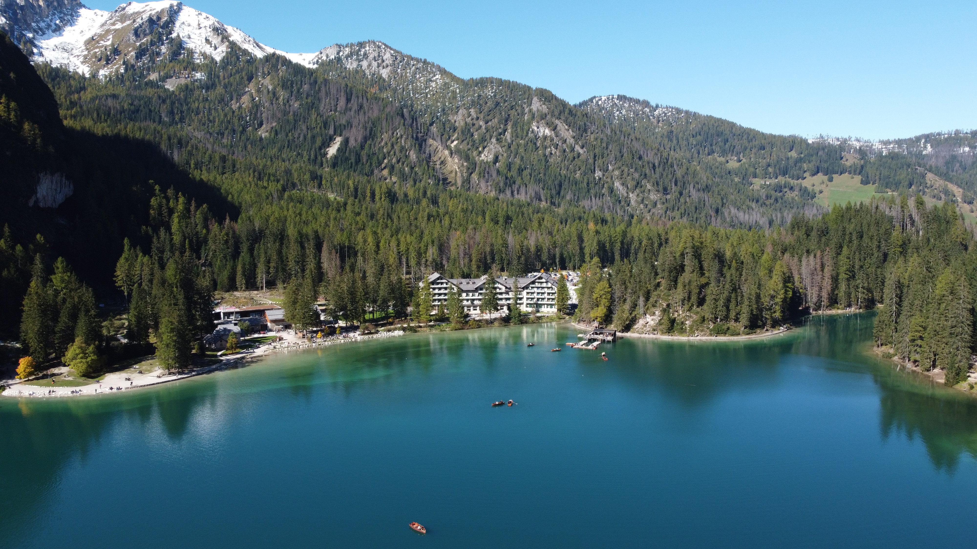
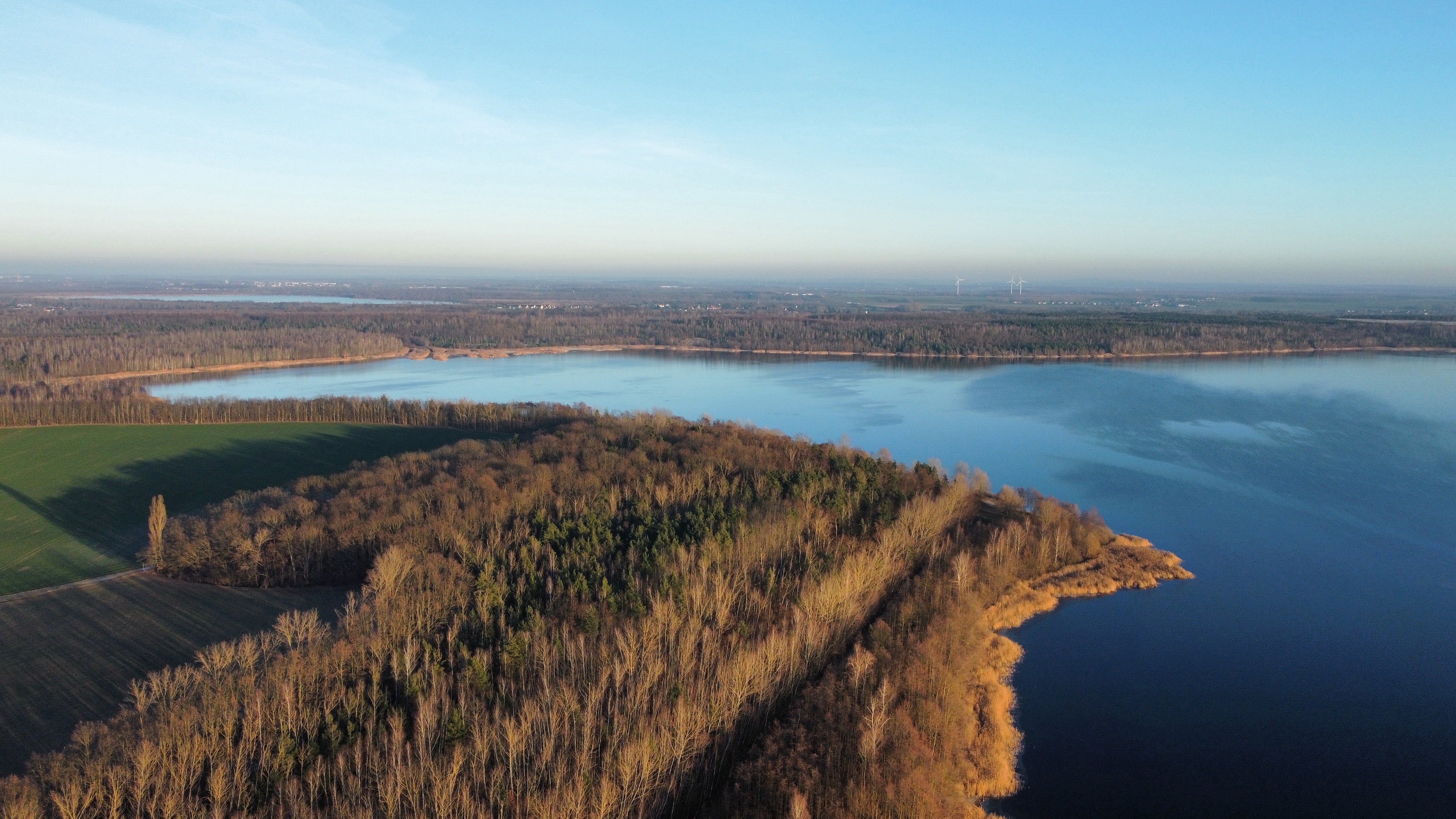
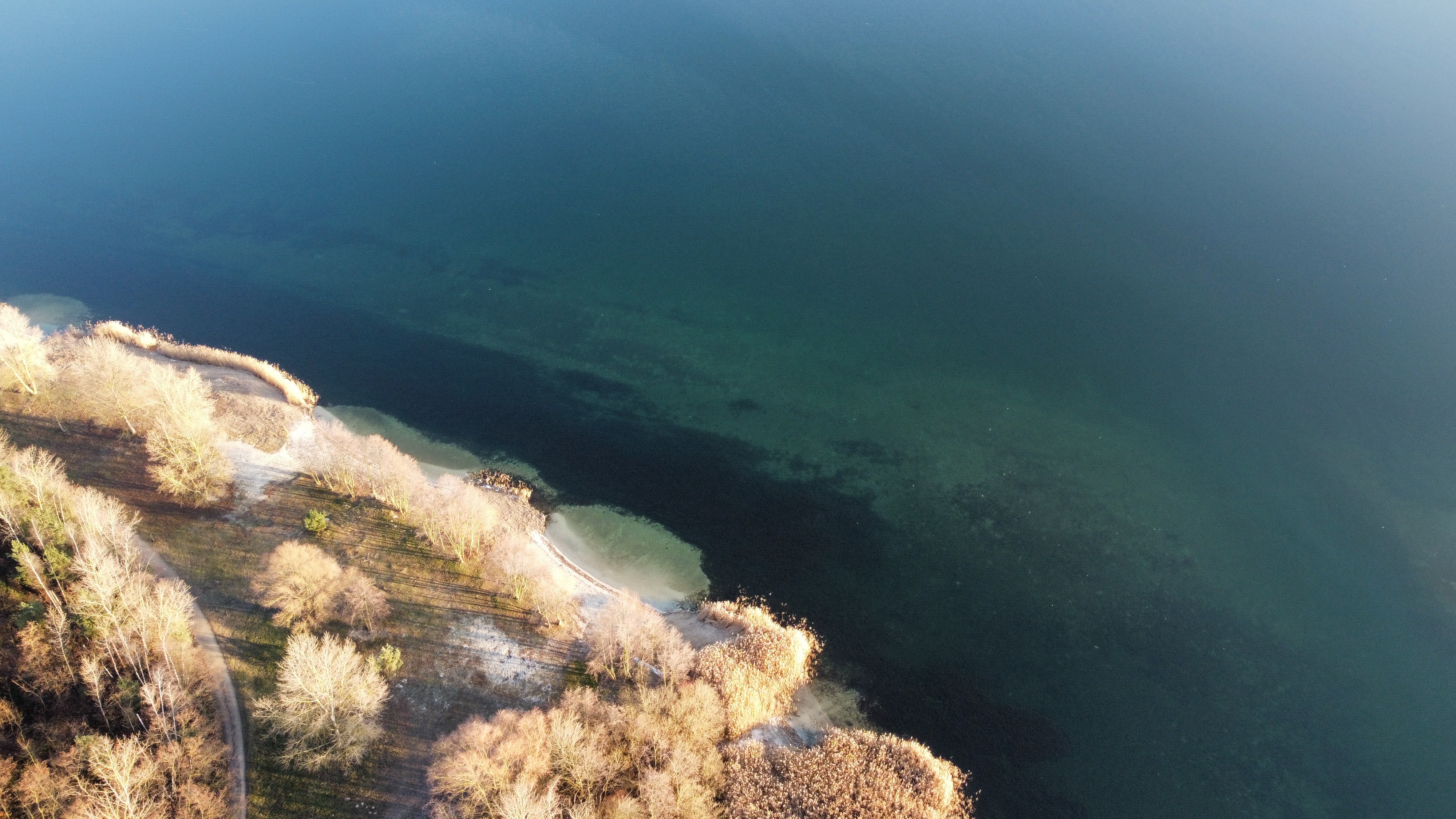
Jun 2, 2026 3:13 PM
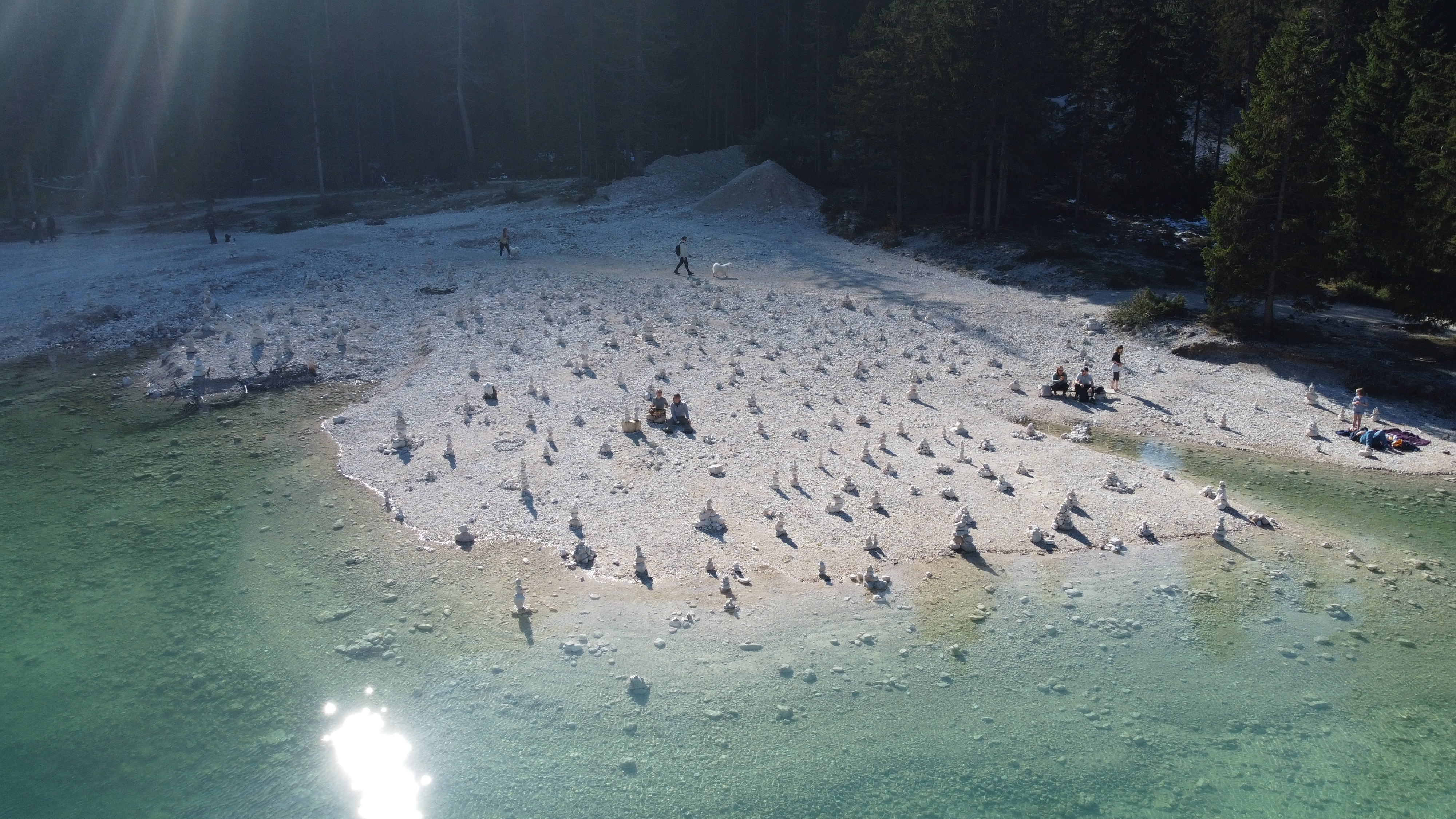
Review
Place:
Pragser Wildsee
5 out of 5 stars
5/5
This is a beautiful Italian lake with lovely scenery and amazingly turquoise water with surrounding snow trees and mountains this spot offers it all. The best thing is, drones are more than welcome here wich makes it a must visit on your next Italy trip.
Jun 2, 2026 3:09 PM
Review
5 out of 5 stars
5/5
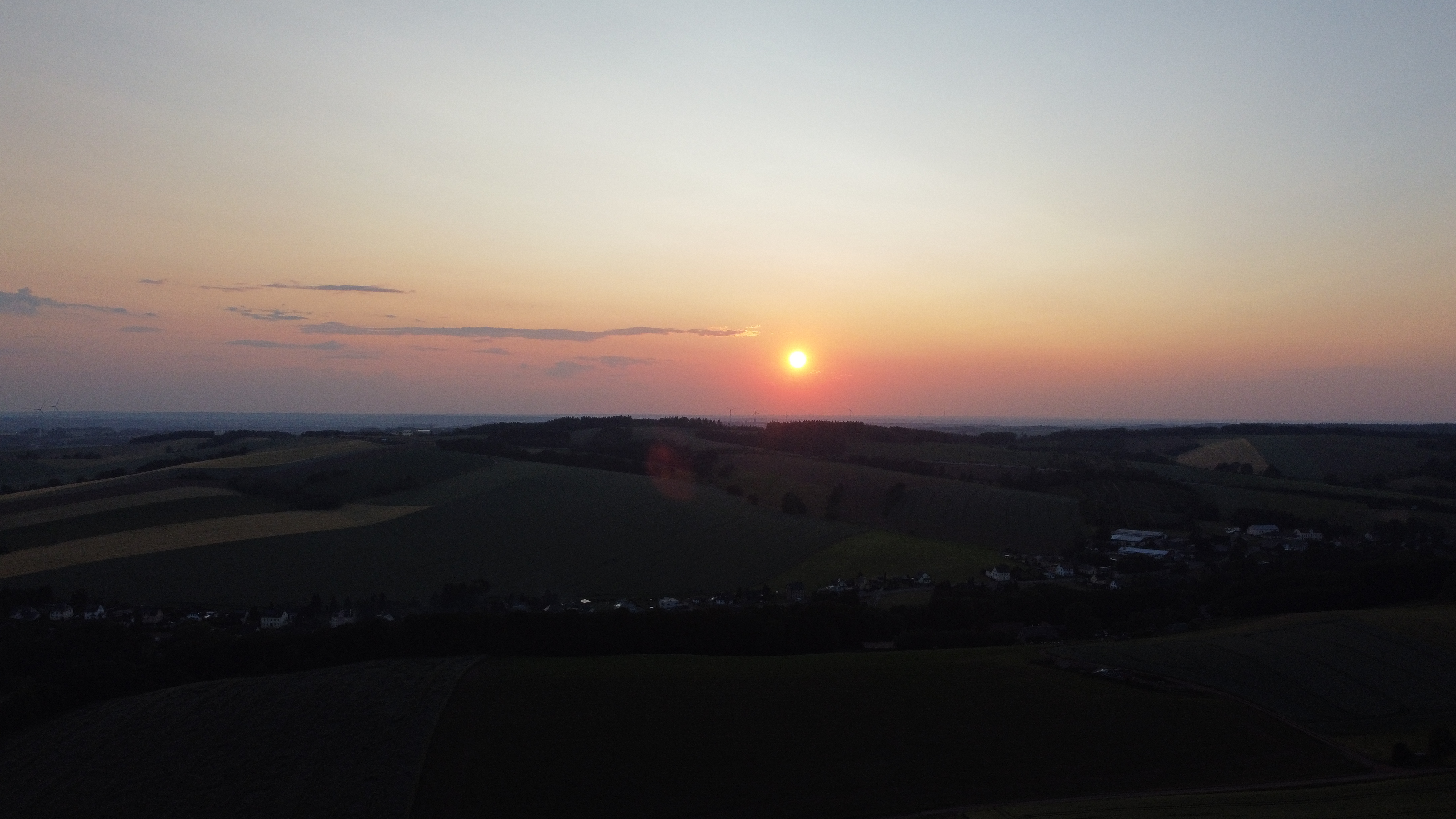
Very beautiful and open views as well as no disturbance towards other people make this spot a must visit when you are in the area.
Jun 2, 2026 3:06 PM
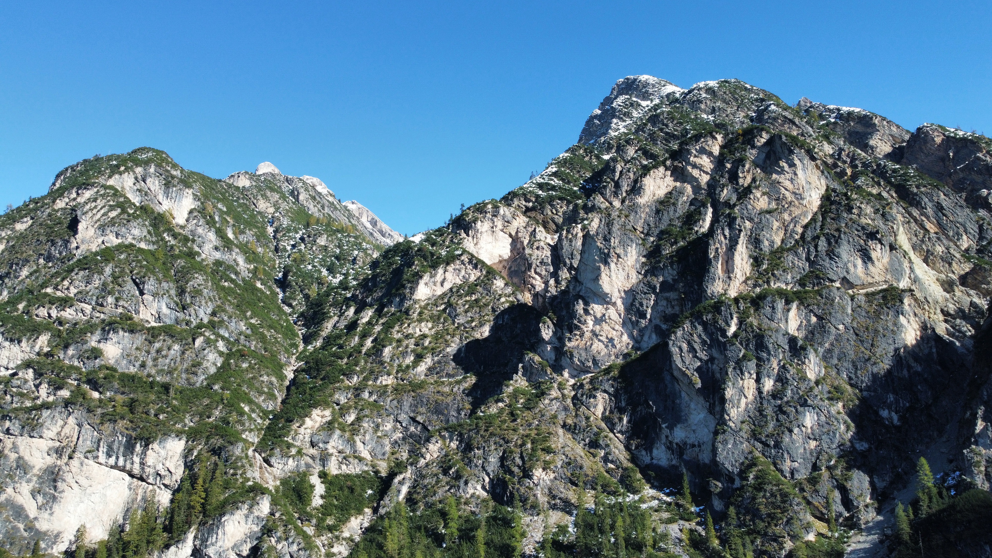
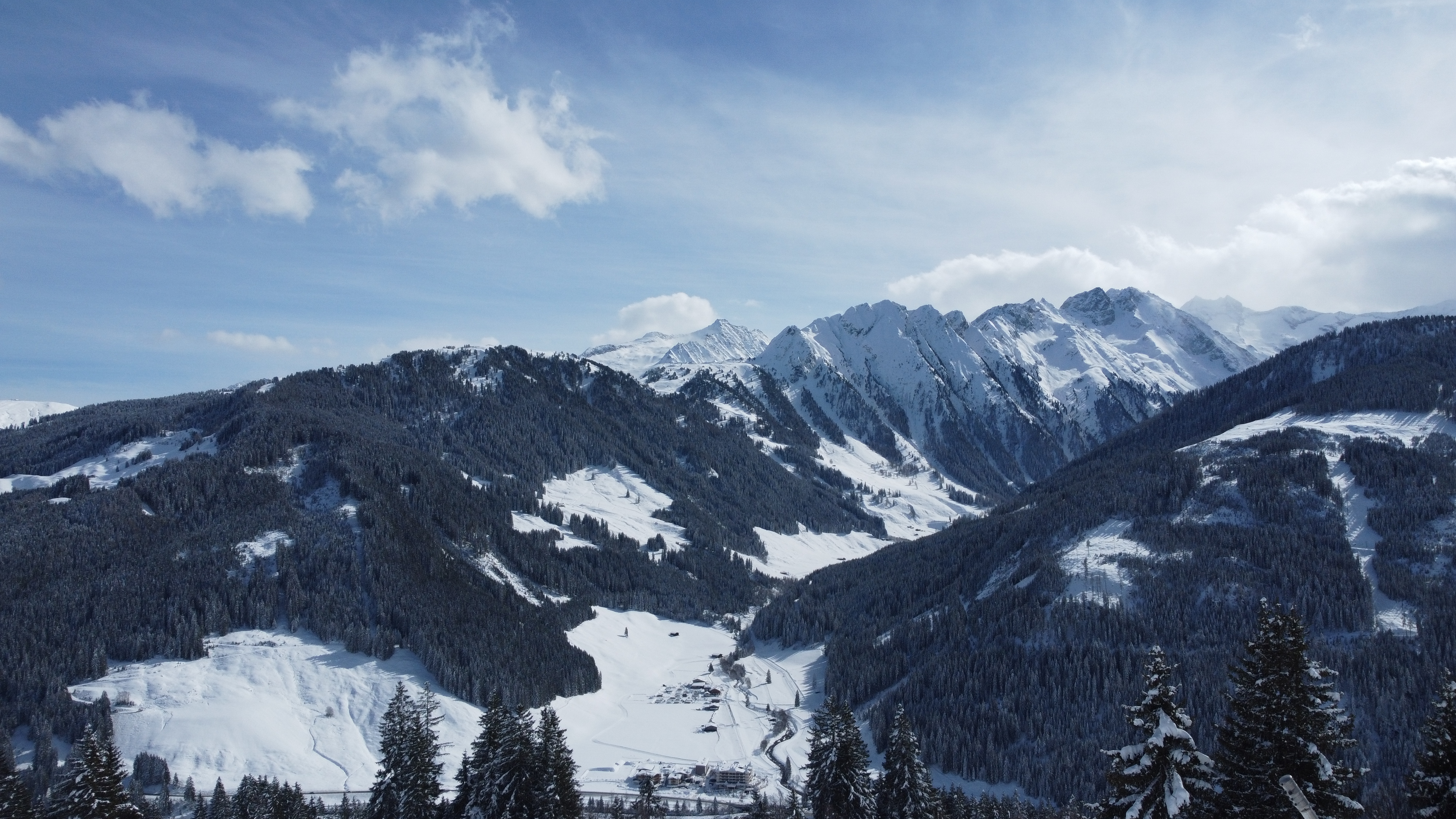
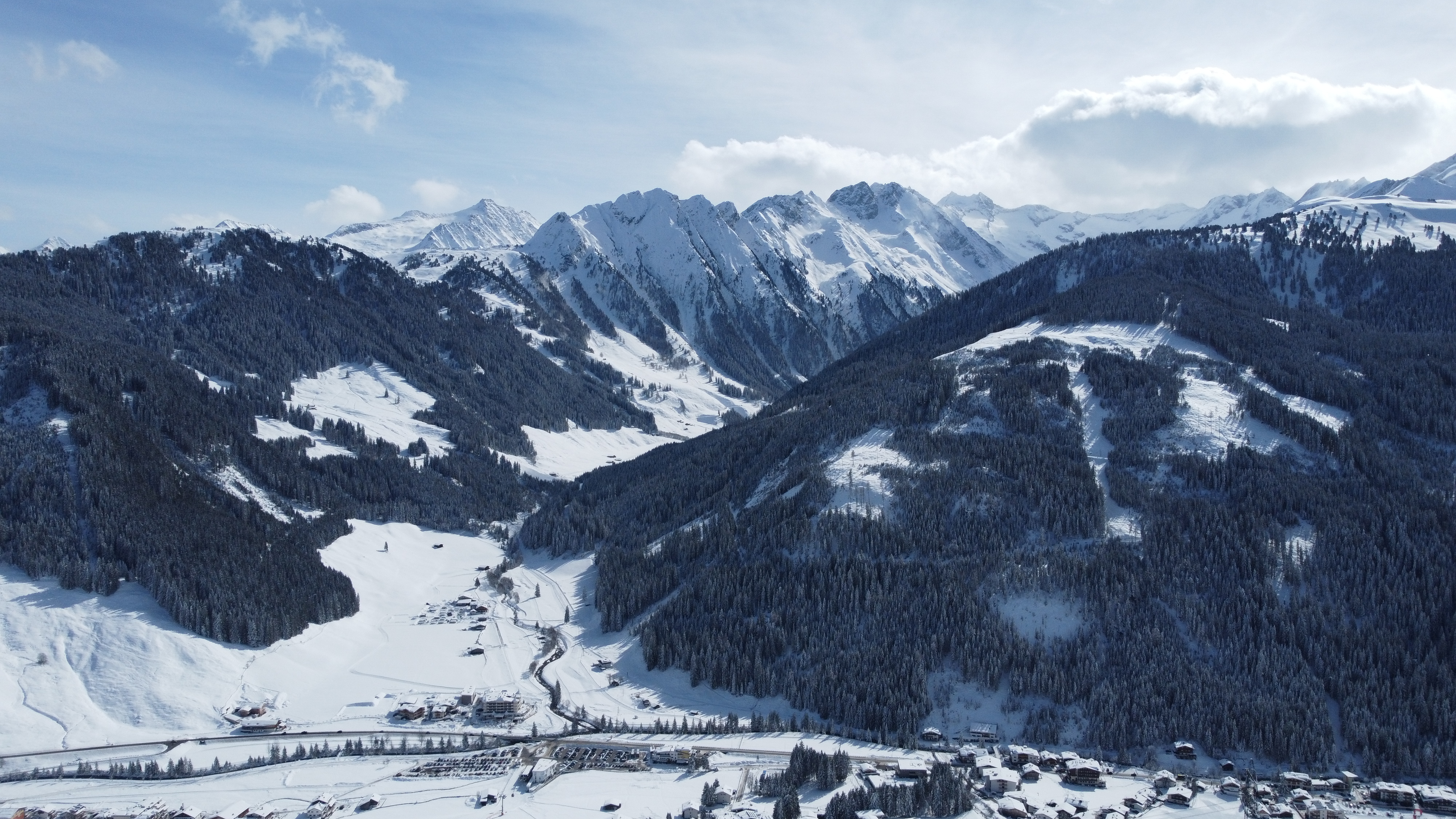
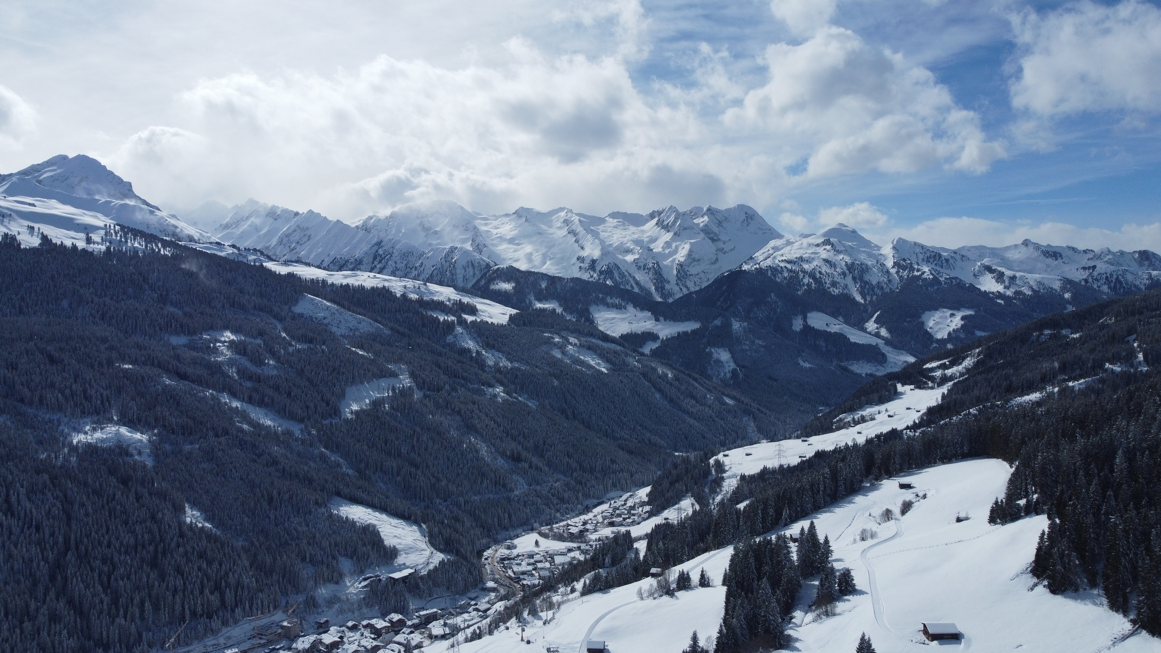
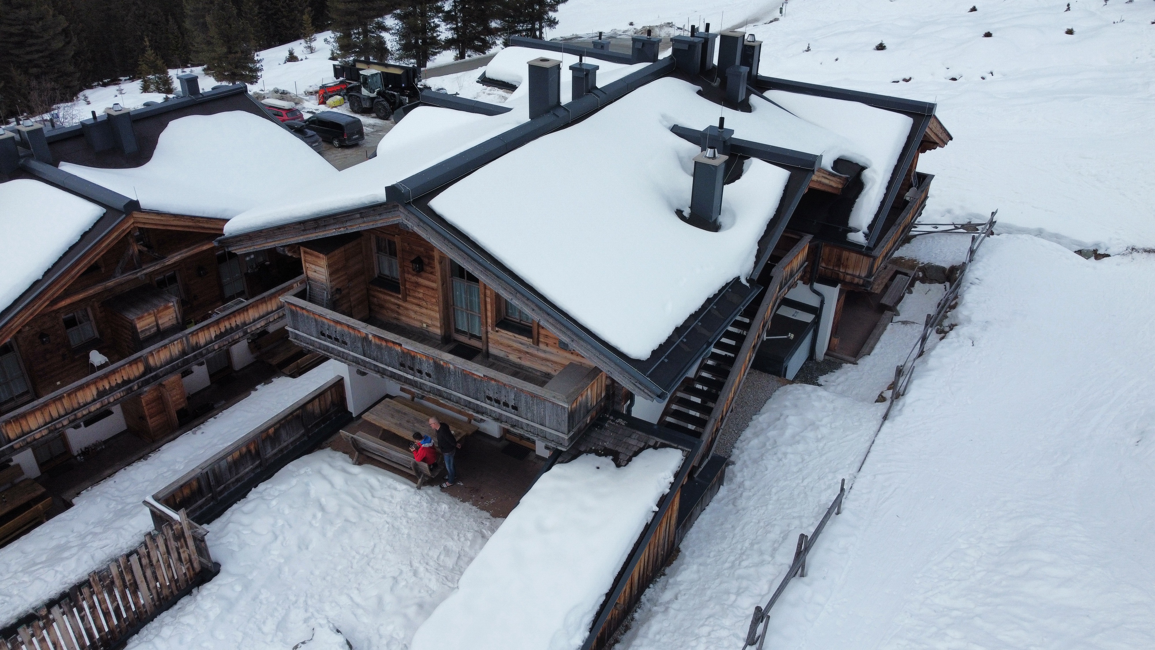
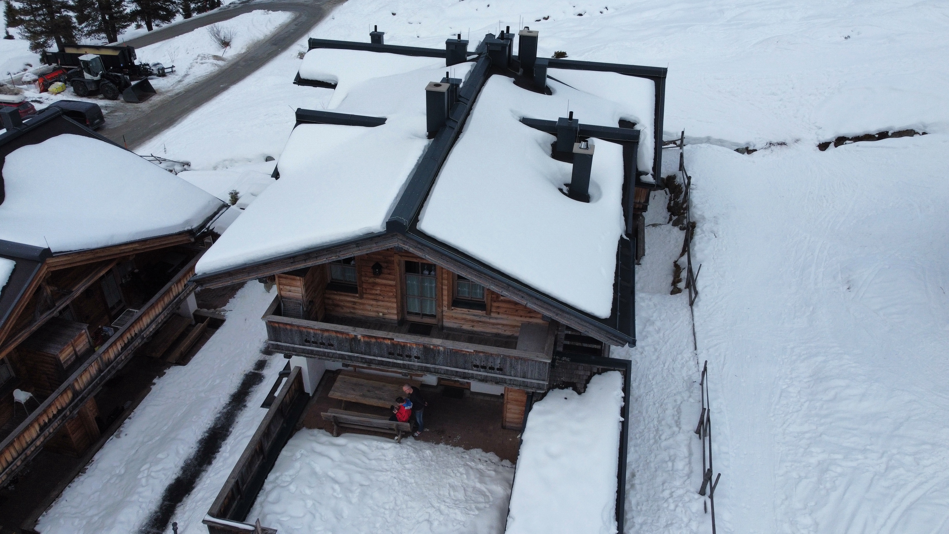
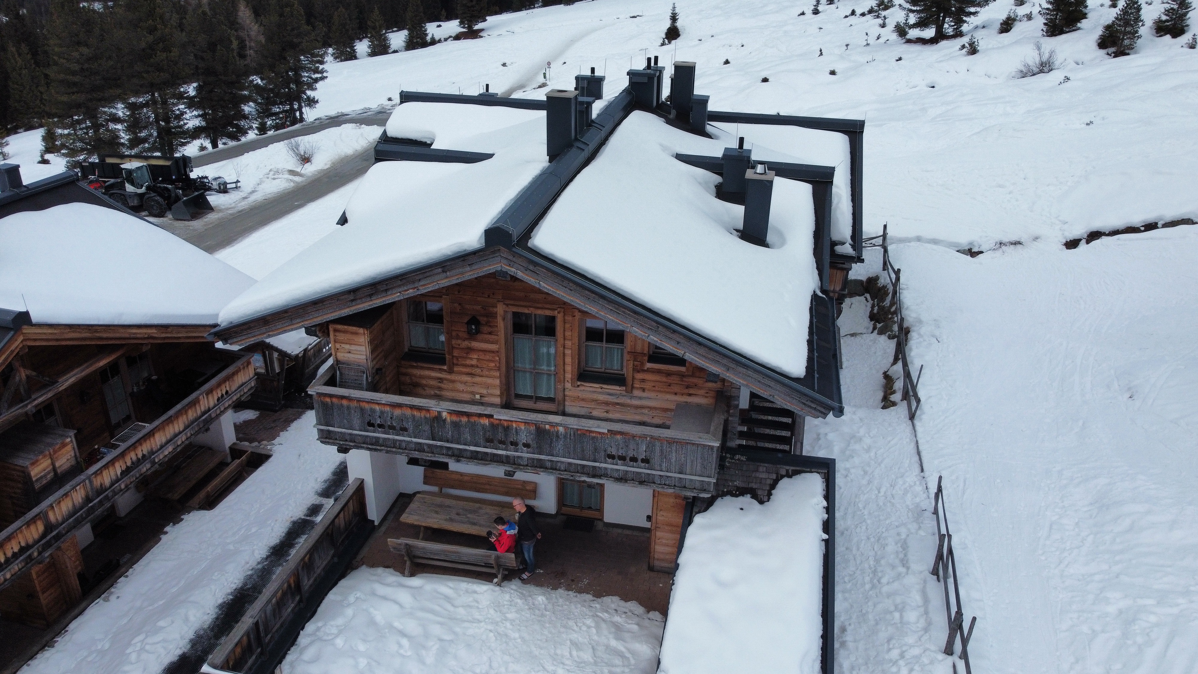
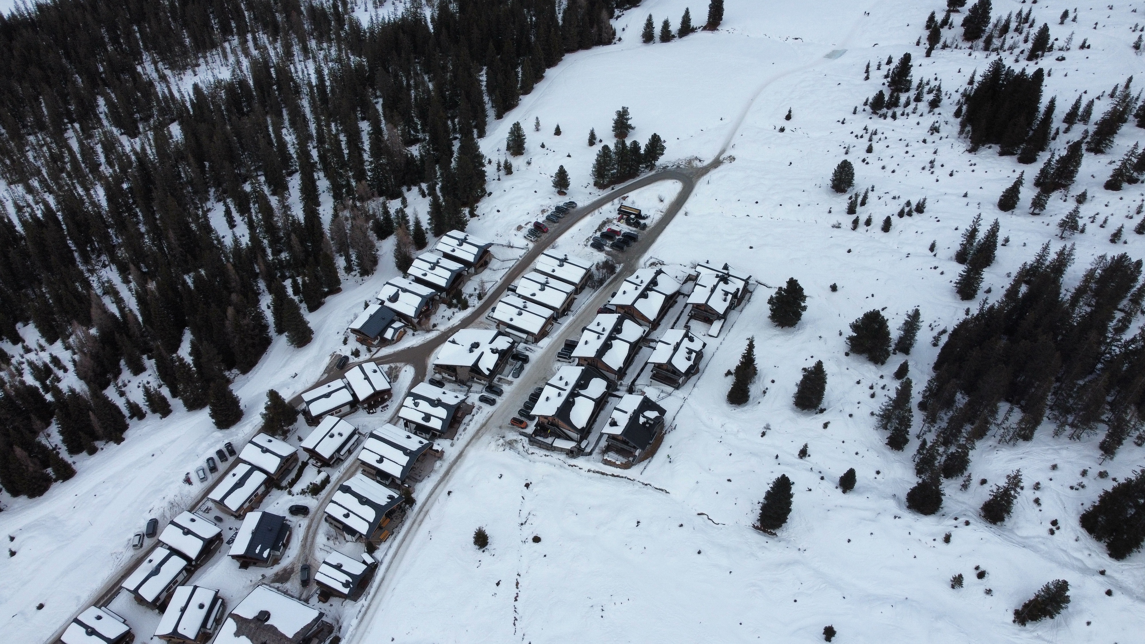
Review
Place:
Skihütten Silberleiten
5 out of 5 stars
5/5
These are ver beautiful Austrian houses with nice views and they have lots of space to fly your drone with beautiful scenic views of the surrounding nature.
Jun 2, 2026 3:03 PM
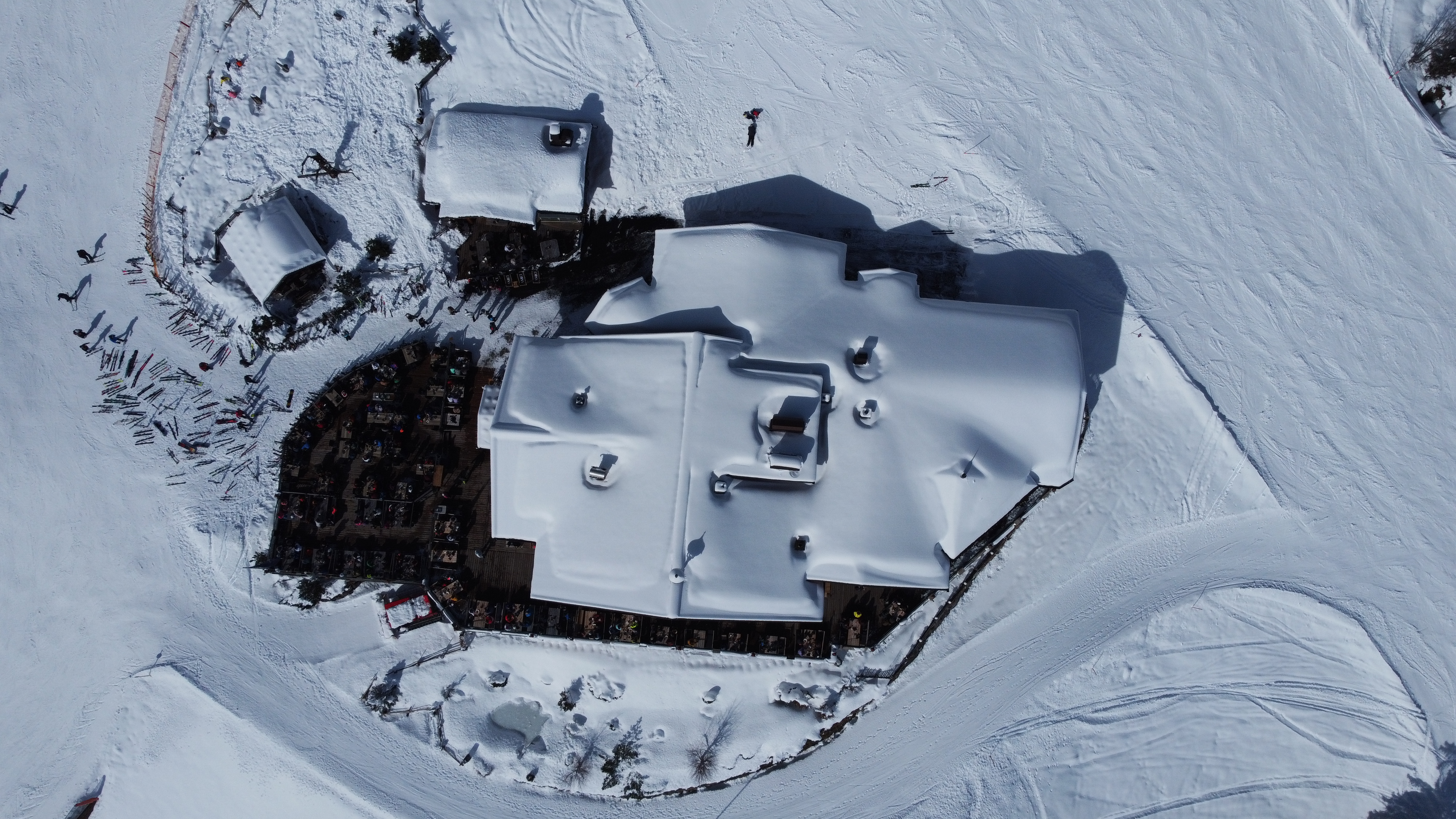
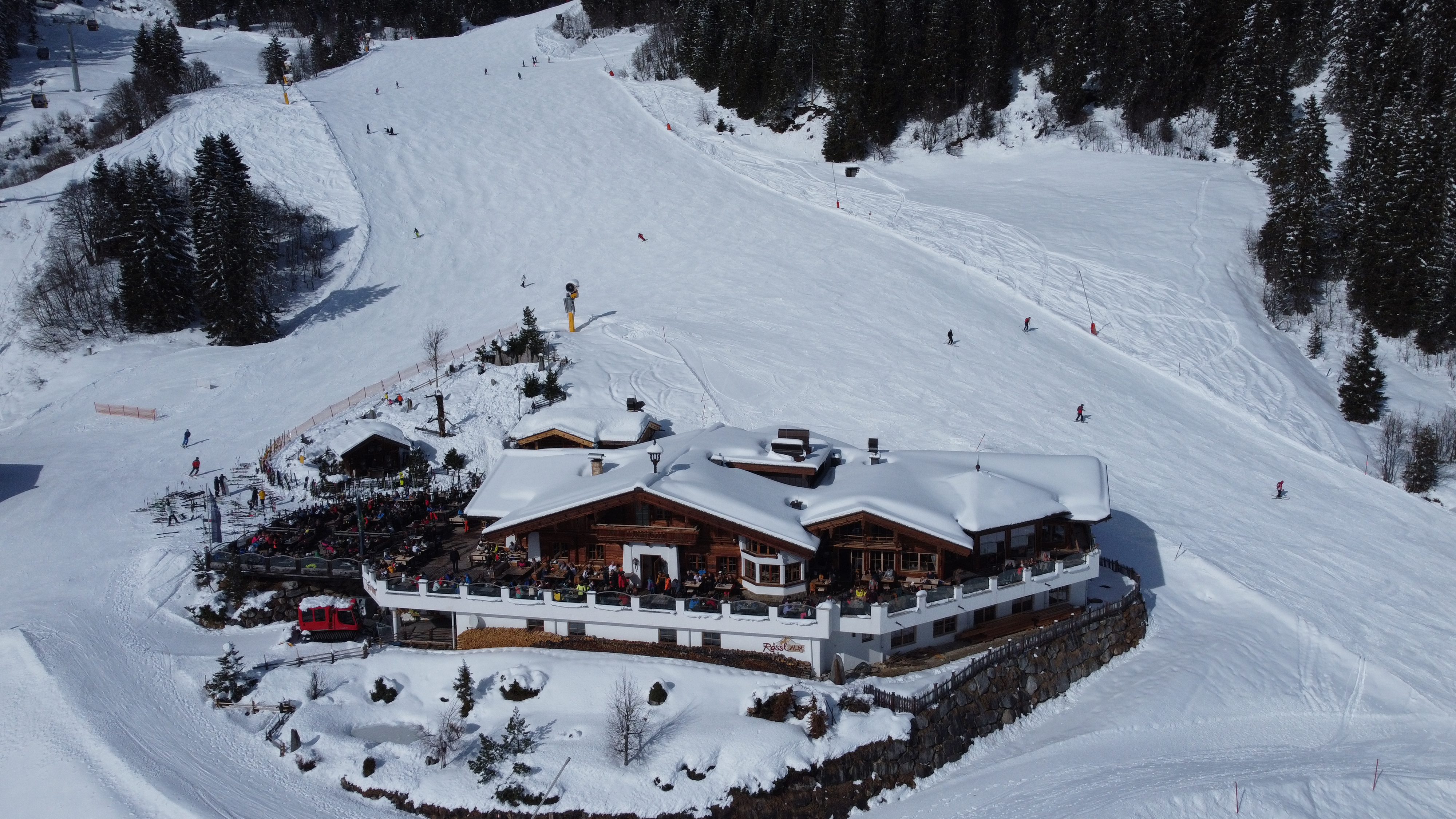
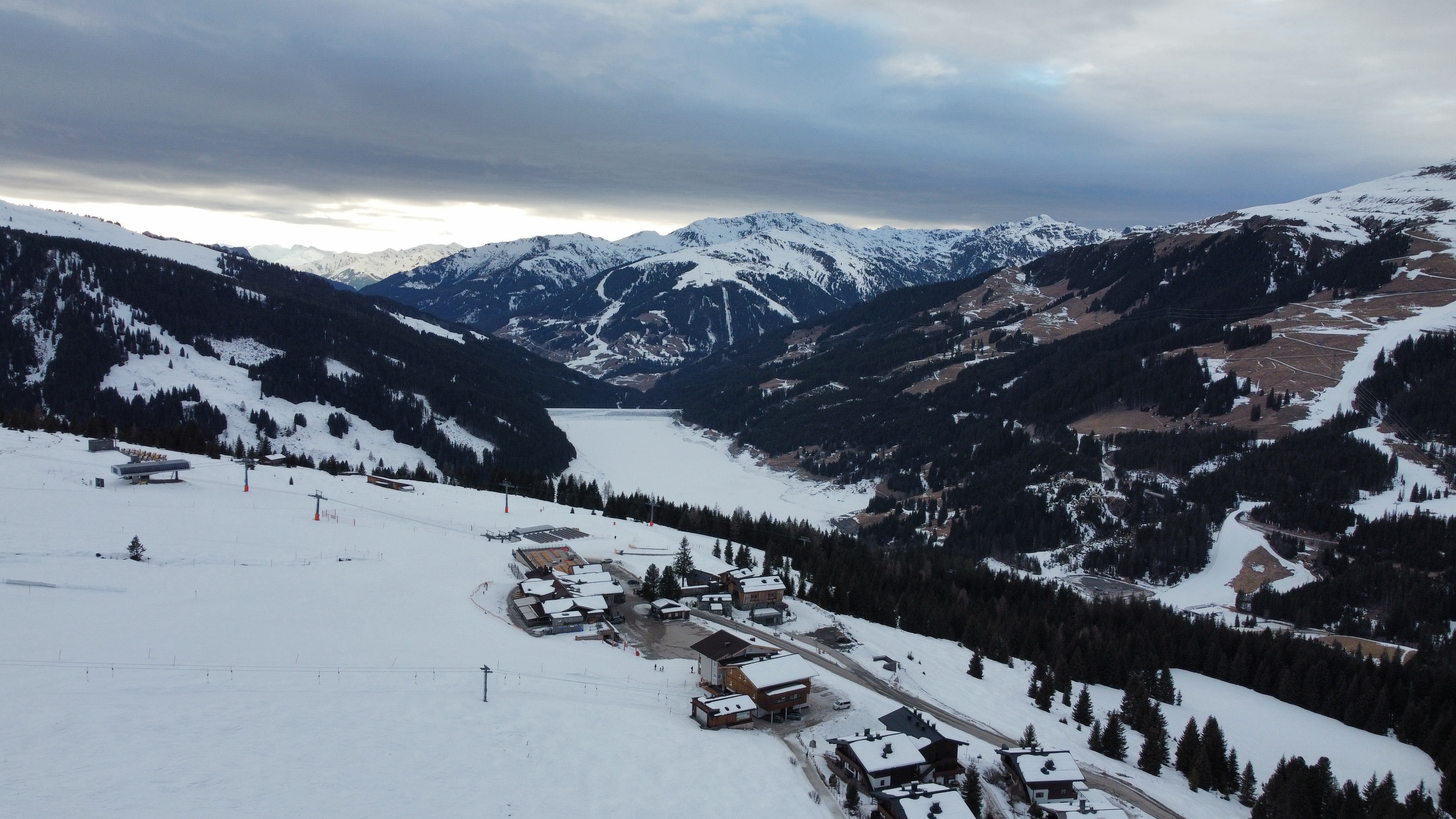
Review
Place:
Restaurant Plattenalm
5 out of 5 stars
5/5
This is a beautiful spot for flying in the winter. You have great views and can fly very long distances.
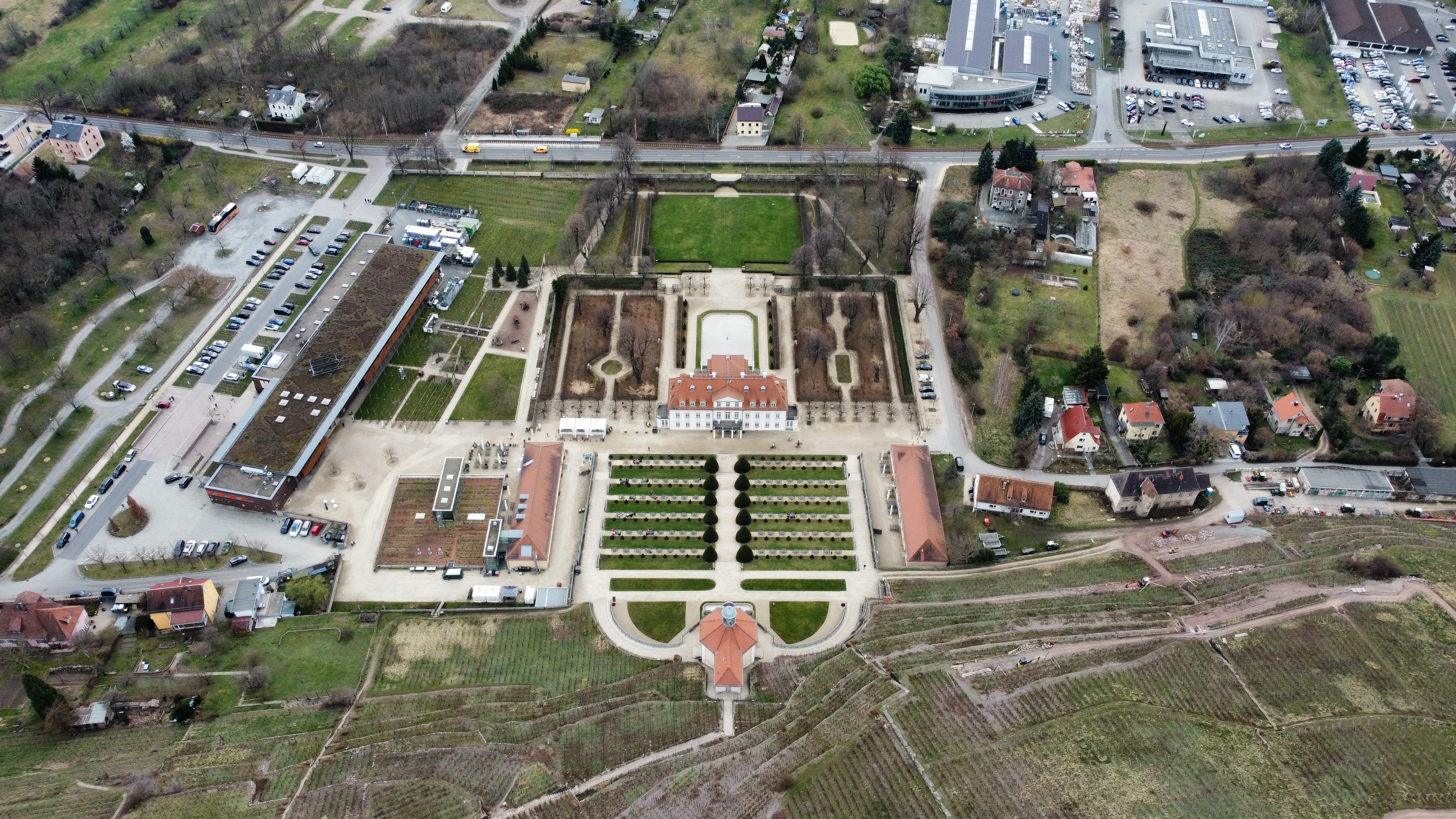
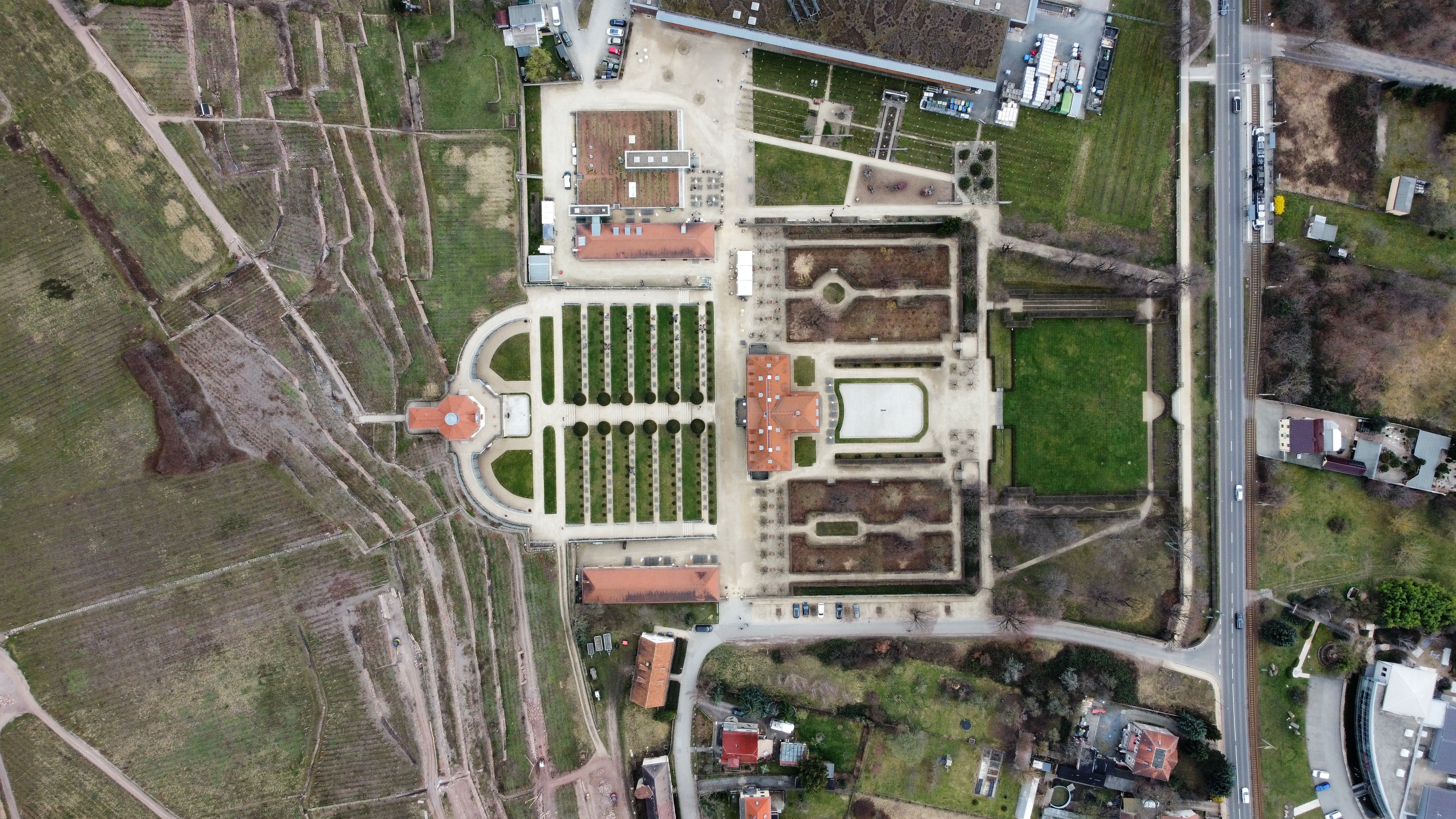
Jun 2, 2026 2:58 PM
Review
Place:
Schloss Wackerbarth
5 out of 5 stars
5/5
This is a beautiful German castle with an integrated wine dispensary and beautiful fields that have a lot of grapes. Flying here is amazing because there is lots of space.
Jun 2, 2026 2:56 PM
Rules update
• Initial rule details submitted from the map.
Changed fields
Mapped shape change
Click to load this change into the shared map viewer here.
Before shape notes
—
After shape notes
- No fly zone around airport
| Field | Before | After |
|---|---|---|
| Flight status | Unknown | NoFly |
| Summary | — | Here you are not allowed to fly because it is an airport. |
| Mapped shapes | — | ee532d95-c08f-403c-b409-7a994096dba8 |
Before
After
This is a commercial airport, and for that reason you are not allowed to fly within 1.5km of it otherwise you can be fined or arrested due to the risk of your drone colliding with low flying aircraft.
Show inline change markers
+ This is a commercial airport, and for that reason you are not allowed to fly within 1.5km of it otherwise you can be fined or arrested due to the risk of your drone colliding with low flying aircraft.
Jun 1, 2026 7:43 PM
Rules update
• Initial rule details submitted from the map.
Changed fields
Mapped shape change
Click to load this change into the shared map viewer here.
Before shape notes
—
After shape notes
- No fly zone due to air traffic
| Field | Before | After |
|---|---|---|
| Flight status | Unknown | NoFly |
| Summary | — | This is a small commercial airport wich is why you can't fly within 1.5km of it |
| Mapped shapes | — | 083c6baa-9041-4907-ad74-a39514d62569 |
Before
After
Due to this small airport having a high amount of air traffic you are not allowed to fly within 1.5km of it without special permission from the government, otherwise you may be fined or even arrested and taken to jail.
Show inline change markers
+ Due to this small airport having a high amount of air traffic you are not allowed to fly within 1.5km of it without special permission from the government, otherwise you may be fined or even arrested and taken to jail.
Jun 1, 2026 7:38 PM
Rules update
• Initial rule details submitted from the map.
Place:
Flughafen Erfurt Weimar
Changed fields
Mapped shape change
Click to load this change into the shared map viewer here.
Before shape notes
—
After shape notes
- This is the range around The airport where you cannot fly.
| Field | Before | After |
|---|---|---|
| Flight status | Unknown | NoFly |
| Summary | — | You absolutely cannot fly here because it is an airport. |
| Mapped shapes | — | 5a9b8c3a-25d6-4963-8119-6b3a4a35ea43 |
Before
After
The Airport Flughafen Erfurt Weimar is a commercial airport wich is why drones are banned there and it is an absolute no fly zone. if you do want to fly there you will need to get special permission from the government otherwise you will be arrested if you fly there
Show inline change markers
+ The Airport Flughafen Erfurt Weimar is a commercial airport wich is why drones are banned there and it is an absolute no fly zone. if you do want to fly there you will need to get special permission from the government otherwise you will be arrested if you fly there
Jun 1, 2026 7:35 PM
Rules update
• Initial rule details submitted from the map.
Place:
Flughafen Leipzig/Halle
Changed fields
Mapped shape change
Click to load this change into the shared map viewer here.
Before shape notes
—
After shape notes
- This is the approximate radius around the airport where you cannot fly
| Field | Before | After |
|---|---|---|
| Flight status | Unknown | NoFly |
| Summary | — | This is an airport where you are not allowed to fly |
| Mapped shapes | — | 27a3478a-3510-48ac-9a32-77ad78f423bc |
Before
After
Due to this being the Airport Leipzig Halle, you are not allowed to Fly here because of high airliner traffic witch could collide with your drone, wich is why you need special permission from the government if you want to fly here.
Show inline change markers
+ Due to this being the Airport Leipzig Halle, you are not allowed to Fly here because of high airliner traffic witch could collide with your drone, wich is why you need special permission from the government if you want to fly here.
Jun 1, 2026 7:30 PM
Rules update
• Initial rule details submitted from the map.
Place:
Universitätsklinikum Leipzig
Changed fields
Mapped shape change
Click to load this change into the shared map viewer here.
Before shape notes
—
After shape notes
- Approximatelz 1.5km radius where you need permission to fly.
| Field | Before | After |
|---|---|---|
| Flight status | Unknown | Permission |
| Summary | — | Here you need permission to fly, because there are a lot of low flying helicopters that could crash into your drone. |
| Mapped shapes | — | 8ae8a64d-0577-440c-94eb-6441afe9df8d |
Before
After
This is a hospital with a helipad. Due to this hospital having a helipad there is an approximately 1.5km radius where you need permission to fly due to the frequent air traffic of low flying helicopters. These helicopters could crash into your drone wich is why You need permission to fly there
Show inline change markers
+ This is a hospital with a helipad. Due to this hospital having a helipad there is an approximately 1.5km radius where you need permission to fly due to the frequent air traffic of low flying helicopters. These helicopters could crash into your drone wich is why You need permission to fly there
Jun 1, 2026 7:24 PM
Rules update
• Initial rule details submitted from the map.
Place:
Klinikum St. Georg Leipzig
Changed fields
Mapped shape change
Click to load this change into the shared map viewer here.
Before shape notes
—
After shape notes
- 1.5km radius where flying needs permission
| Field | Before | After |
|---|---|---|
| Flight status | Unknown | Permission |
| Summary | — | Here you need permission to fly, due to frequent air traffic. |
| Mapped shapes | — | 8fe4a2e9-00ba-4e8b-8cd1-baa911005dce |
Before
After
This is a hospital with a helipad. Due to this hospital having a helipad there is an approximately 1.5km radius where you need permission to fly due to the frequent air traffic of low flying helicopters. https://www.google.com/url?sa=i&source=web&rct=j&url=https://www.lds.sachsen.de/luftverkehr/?ID%3D19494%26art_param%3D513&ved=2ahUKEwj4-MzhieaUAxVH4wIHHaVtM2kQy_kOegYIAAggEAE&opi=89978449&cd&psig=AOvVaw2xHKgfaMJIIsvfQhqe6l0Z&ust=1780404504460000
Show inline change markers
+ This is a hospital with a helipad. Due to this hospital having a helipad there is an approximately 1.5km radius where you need permission to fly due to the frequent air traffic of low flying helicopters. https://www.google.com/url?sa=i&source=web&rct=j&url=https://www.lds.sachsen.de/luftverkehr/?ID%3D19494%26art_param%3D513&ved=2ahUKEwj4-MzhieaUAxVH4wIHHaVtM2kQy_kOegYIAAggEAE&opi=89978449&cd&psig=AOvVaw2xHKgfaMJIIsvfQhqe6l0Z&ust=1780404504460000
Jun 1, 2026 7:17 PM
Rules update
• Initial rule details submitted from the map.
Place:
Herzzentrum Leipzig
Changed fields
Mapped shape change
Click to load this change into the shared map viewer here.
| Field | Before | After |
|---|---|---|
| Flight status | Unknown | Permission |
| Summary | — | Hospital Helicopter Flying range, 2 Helipads, permission for flying is required. |
| Mapped shapes | — | 3ad63bc0-9197-494e-8f44-66699a635b27 |
Before
After
This a range of 1.5km within the Hospital Herzzentrum Leipzig wich has 2 Helipads wich cause frequent air traffic, Therefore flying within this zone requires Permission and is otherwise not allowed. There are no specific hours, as the hospital is open 24/7.
Show inline change markers
+ This a range of 1.5km within the Hospital Herzzentrum Leipzig wich has 2 Helipads wich cause frequent air traffic, Therefore flying within this zone requires Permission and is otherwise not allowed. There are no specific hours, as the hospital is open 24/7.
Jun 1, 2026 7:12 PM
Rules update
• Initial rule details submitted from the map.
Place:
Helios Park-Klinikum Leipzig
Changed fields
Mapped shape change
Click to load this change into the shared map viewer here.
Before shape notes
—
After shape notes
- Approximately 150m Radius where you should inform the hospital before you fly.
| Field | Before | After |
|---|---|---|
| Flight status | Unknown | Caution |
| Summary | — | This is a German Hospital with air traffic nearby, therefore it is recommended you stay 150m away or inform the hospital |
| Mapped shapes | — | d438f46b-456d-4c36-83f4-7e3b5d72430c |
Before
After
You nee to stay 150m away if you fly here because helicopters will often fly above this hospital and they may fly into you so you should inform the hospital before you fly above it.
Show inline change markers
+ You nee to stay 150m away if you fly here because helicopters will often fly above this hospital and they may fly into you so you should inform the hospital before you fly above it.
Jun 1, 2026 6:58 PM
Rules update
• Initial rule details submitted from the map.
Changed fields
Mapped shape change
Click to load this change into the shared map viewer here.
Before shape notes
—
After shape notes
- 150m range where you should not fly/ inform the hospital if you do
| Field | Before | After |
|---|---|---|
| Flight status | Unknown | Caution |
| Summary | — | This is a hospital near the airport wich means that there is a lot of air traffic above it. |
| Mapped shapes | — | b7c36e3c-38f3-4aac-ad87-58cb5006bbf0 |
Before
After
This is a hospital in the city Dresden and it is located next to the airport wich is why helicopters often fly over it and you should fly 150m away from it or inform the hospital that you are flying above it.
Show inline change markers
+ This is a hospital in the city Dresden and it is located next to the airport wich is why helicopters often fly over it and you should fly 150m away from it or inform the hospital that you are flying above it.
Jun 1, 2026 6:54 PM
Rules update
• Initial rule details submitted from the map.
Changed fields
Mapped shape change
Click to load this change into the shared map viewer here.
Before shape notes
—
After shape notes
- 150 meter radius where you need to inform the hospital before flying.
| Field | Before | After |
|---|---|---|
| Flight status | Unknown | Caution |
| Summary | — | This is the city hospital in Dresden wich often gets flown over by rescue helicopters. |
| Mapped shapes | — | d7af82a9-8f18-44fc-81a2-5924d9077f87 |
Before
After
If you want to fly here you need to stay at least 150m away from the hospital or inform the hospital that you are flying over it, because rescue helicopters often fly over this hospital.
Show inline change markers
+ If you want to fly here you need to stay at least 150m away from the hospital or inform the hospital that you are flying over it, because rescue helicopters often fly over this hospital.
Jun 1, 2026 6:47 PM
Rules update
• Initial rule details submitted from the map.
Changed fields
Mapped shape change
Click to load this change into the shared map viewer here.
Before shape notes
—
After shape notes
- Hospital with frequent air traffic above it.
| Field | Before | After |
|---|---|---|
| Flight status | Unknown | Caution |
| Summary | — | Helicopters often pass over this hospital. |
| Mapped shapes | — | aa5e2205-51ba-40f9-a5f9-3cb4a10ea578 |
Before
After
This hospital often has helicopters passing over it due to a surrounding hospital having a helipad. That is why it is recommended to fly at least 150m away from the hospital and if you do fly above it to inform the hospital of your flight.
Show inline change markers
+ This hospital often has helicopters passing over it due to a surrounding hospital having a helipad. That is why it is recommended to fly at least 150m away from the hospital and if you do fly above it to inform the hospital of your flight.
Jun 1, 2026 6:41 PM
Rules update
• Initial rule details submitted from the map.
Changed fields
Mapped shape change
Click to load this change into the shared map viewer here.
Before shape notes
—
After shape notes
- approximately 1.5km radius where you need permission to fly
| Field | Before | After |
|---|---|---|
| Flight status | Unknown | Permission |
| Summary | — | This is a hospital with a helipad and frequent air travel, you need permission to fly inside of this zone. |
| Mapped shapes | — | 13b83225-5be7-44b9-856b-b090dc7424fd |
Before
After
In this 1.5km zone you are only allowed to fly, if you have permission from thyme government. This is due to low flying rescue helicopters landing and starting here frequently.
Show inline change markers
+ In this 1.5km zone you are only allowed to fly, if you have permission from thyme government. This is due to low flying rescue helicopters landing and starting here frequently.
Jun 1, 2026 6:18 PM
Rules update
• Initial rule details submitted from the map.
Changed fields
Mapped shape change
Click to load this change into the shared map viewer here.
Before shape notes
—
After shape notes
- Need permission from government to fly within 100m of police station.
| Field | Before | After |
|---|---|---|
| Flight status | Unknown | Permission |
| Summary | — | This is a German police station, it is advised you stay 100m away, otherwise you need permission to fly there. |
| Mapped shapes | — | e36bc11b-2a91-4ee7-a00d-655b0dc0aa14 |
Before
After
This is a German police station and due to that flying within 100m of it requires permission from the government so this area should be avoided, as local law enforcement could fine/arrest you.
Show inline change markers
+ This is a German police station and due to that flying within 100m of it requires permission from the government so this area should be avoided, as local law enforcement could fine/arrest you.
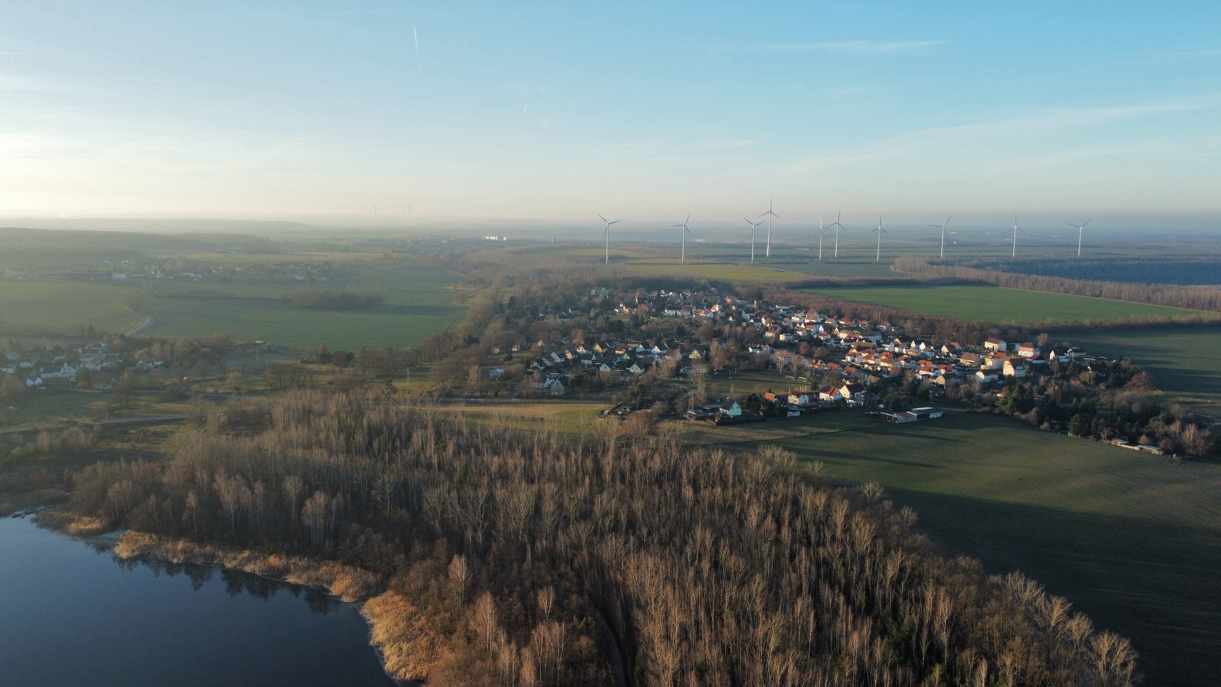
Jun 1, 2026 1:28 PM
Review
Place:
Haselbacher See
5 out of 5 stars
5/5
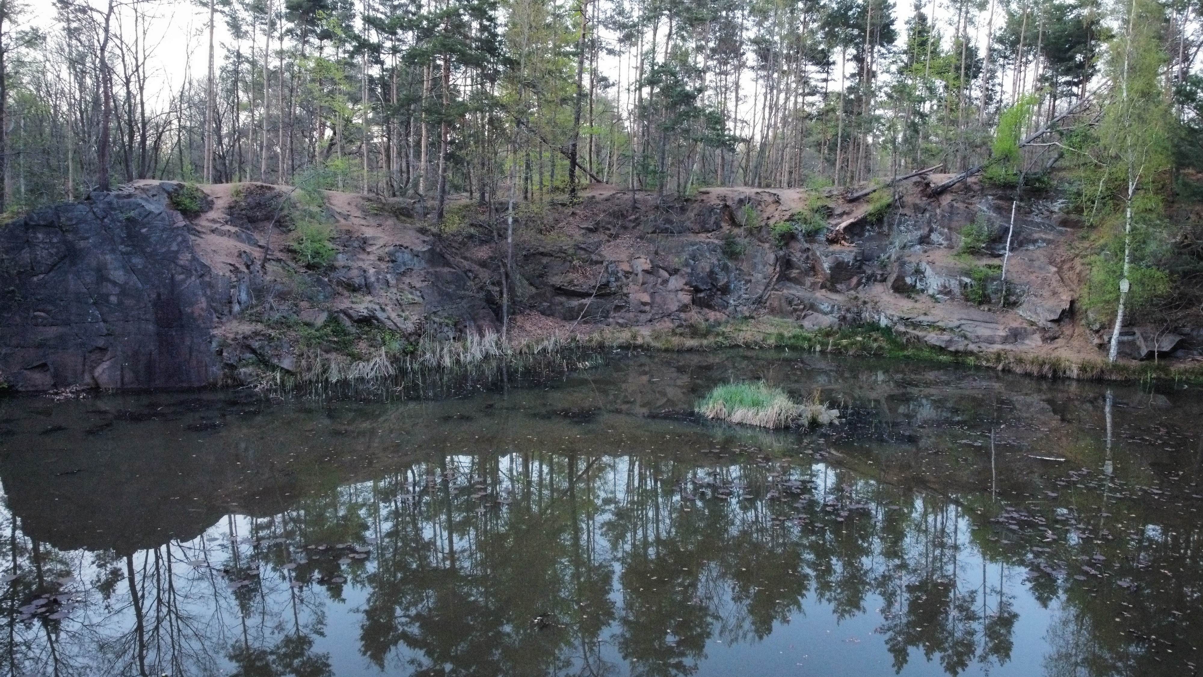
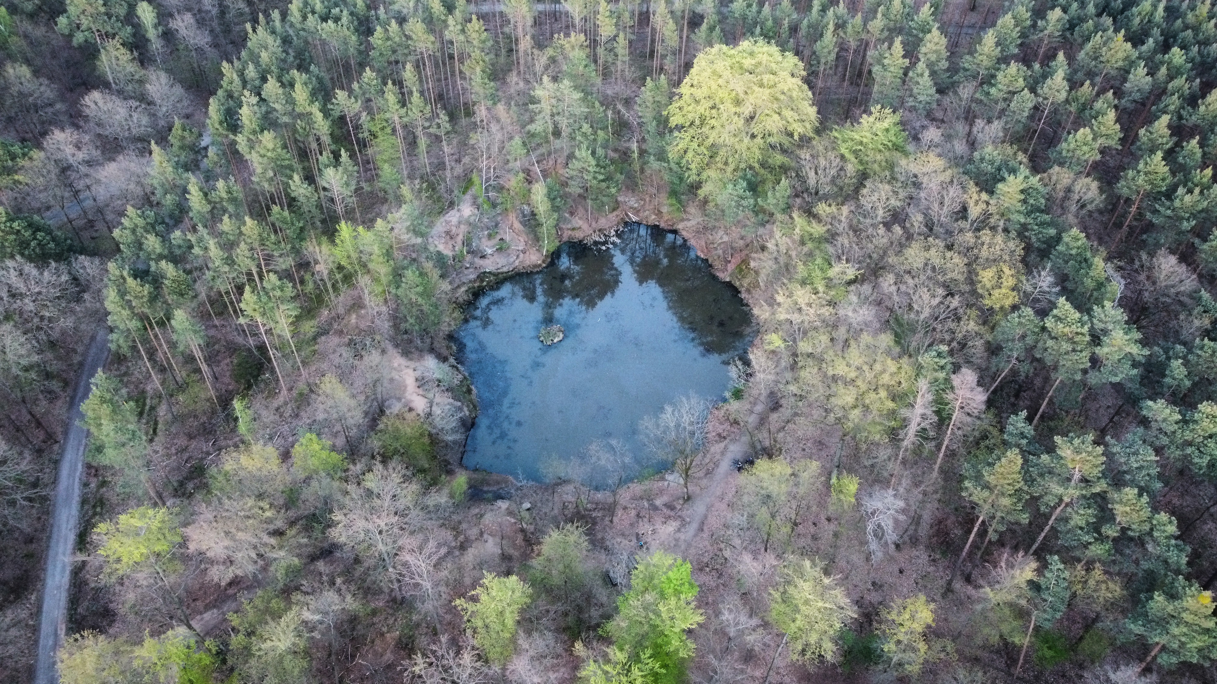
This is a nice Lake in Regis Breitingen. Here there are lots of fun activities that you can do, for example you can fly your drone above the lake and you might see an excavator wich was used to mine coal back in the day, but fell in and never got retrieved. The spot is very beginner friendly and offers stunning views flying here is always recommended.
Jun 1, 2026 1:24 PM
Rules update
• Initial rule details submitted from the map.
Place:
Elblandklinikum Meißen
Changed fields
Mapped shape change
Click to load this change into the shared map viewer here.
Before shape notes
—
After shape notes
- 1.5km radius of helipad.
| Field | Before | After |
|---|---|---|
| Flight status | Unknown | Caution |
| Summary | — | This is a hospital with a helipad and frequent air traffic. Flying here is not advised due to helicopters frequently delivering patients at low altitudes. |
| Mapped shapes | — | 6cba547d-bb31-45d4-942e-1d94d0b5e072 |
Before
After
If you fly within this 1.5km radius you may crash into low flying rescue helicopters, wich cannot evade you, therefore it is better if you stay low and avoid this zone.
Show inline change markers
+ If you fly within this 1.5km radius you may crash into low flying rescue helicopters, wich cannot evade you, therefore it is better if you stay low and avoid this zone.
Jun 1, 2026 1:18 PM
Review
Place:
Hartenstein-Thierfeld Ul
5 out of 5 stars
5/5
This is a small Flying field with not a lot of air traffic but with a nice view and even nicer locals wich don't get annoyed by the noise of any drone. Nearby there even is a model plane flying field wich you can fly to and check out. Its a nice open space with lots to explore.
Jun 1, 2026 1:14 PM
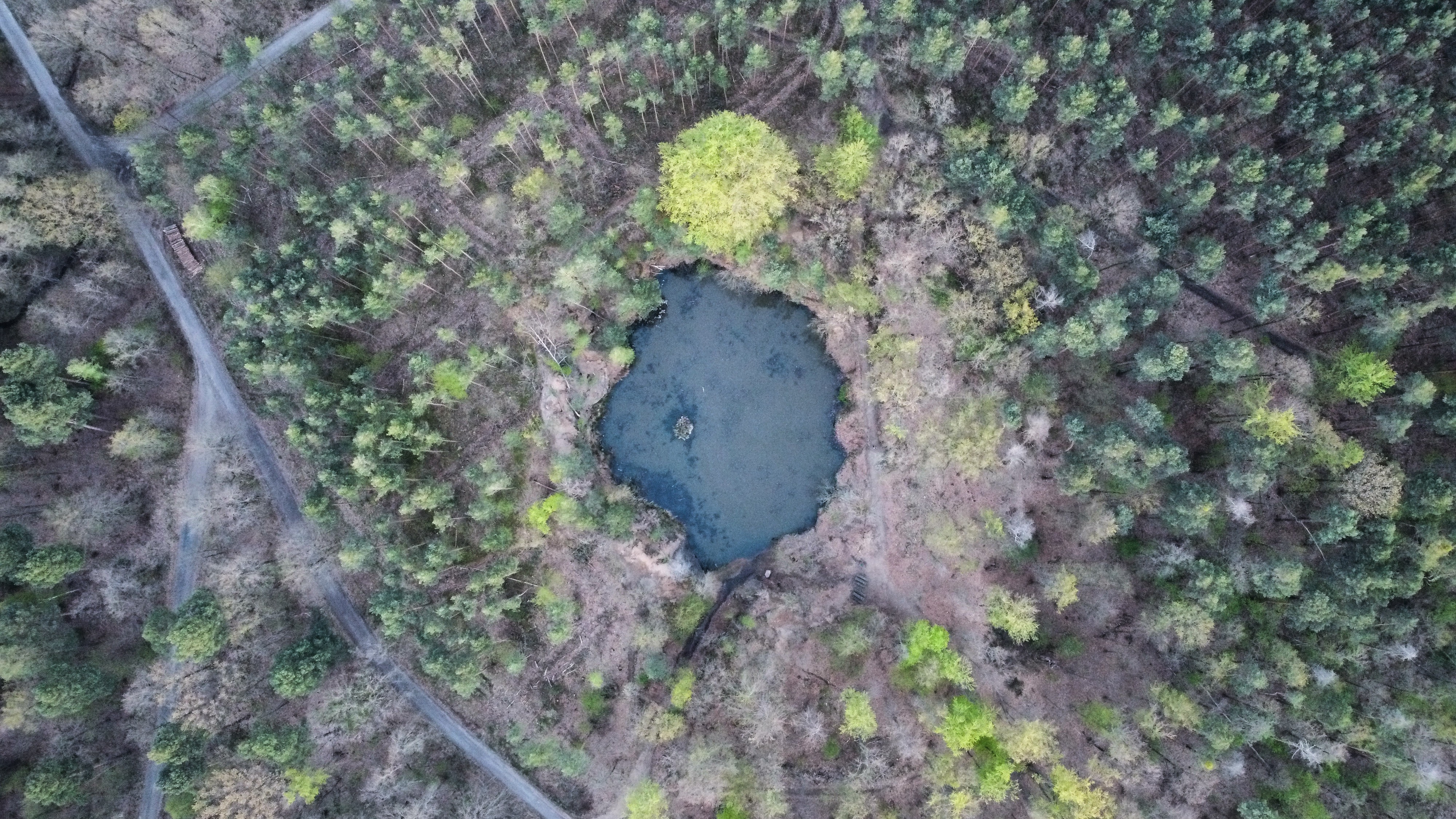
Review
Place:
Seerosenteich
5 out of 5 stars
5/5
This is a hidden gem amongst small ponds in Germany. The Seerosenteich offers nice and calm hiking trails as well as a beautiful atmosphere with all the animals of the surrounding forest making calming noises, and it is great for viewing the surrounding areas via drone without annoying anyone.