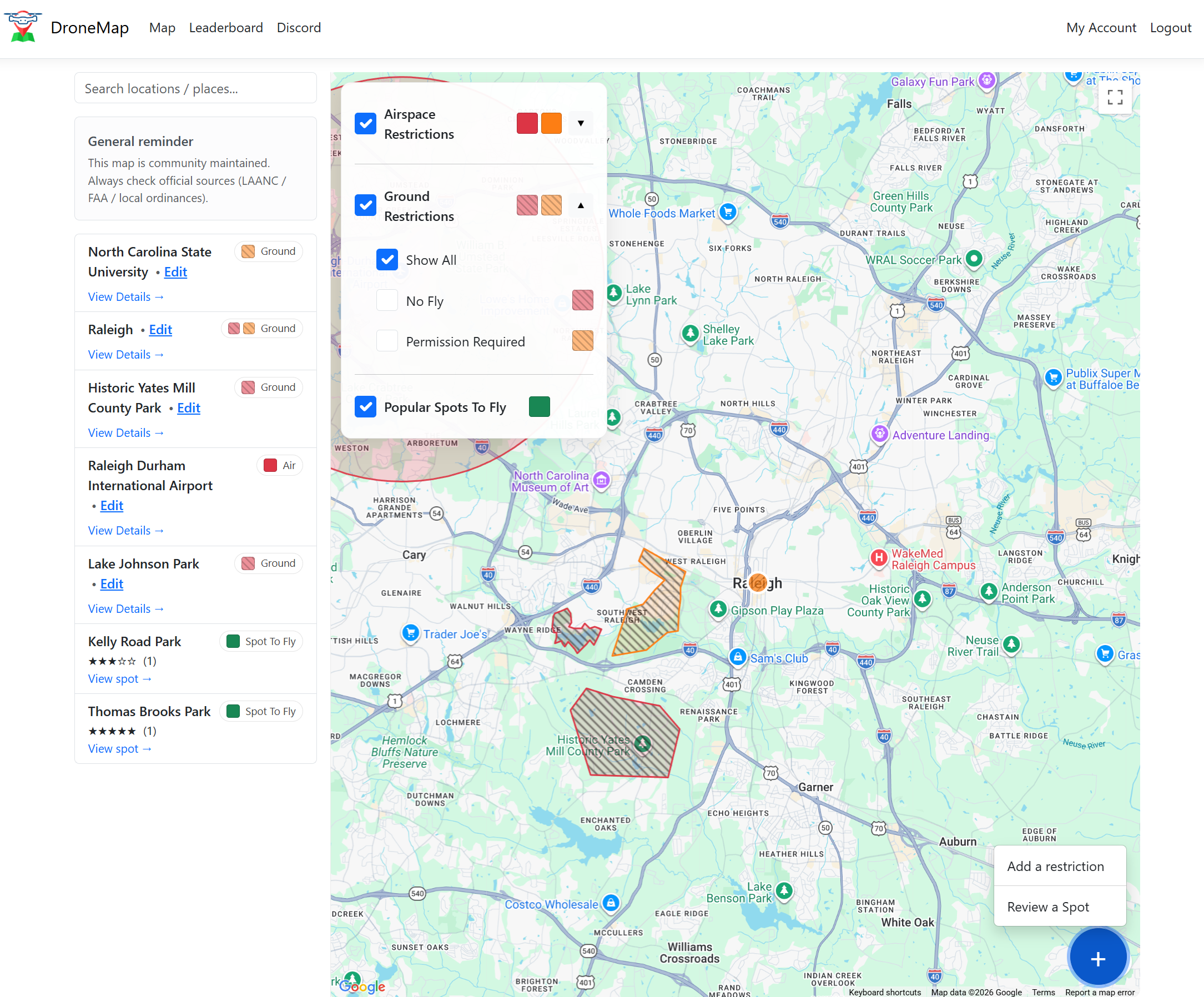
Know where you can fly — in the air and on the ground.
DroneMap is a community-driven map that combines airspace context, local ground access rules, and real-world pilot activity to enable pilots to fly confidently. Contribute what you learn, earn reputation, and help the map get more accurate over time.
DroneMap aggregates public sources and community reports. DroneMap reports real-world rules and observations. Final responsibility always remains with the pilot.
One question. One answer.
- Can I fly here legally?
- Can I take off and land?
- Do pilots actually fly here?
Contribute in seconds
Help the next pilot avoid a mistake. Every report improves accuracy for everyone.
- Evidence (signage, links) boosts confidence.
- Edits are proposed and community-reviewed.
- Unverified entries remain clearly labeled.
Trust & neutrality
DroneMap is built to report reality, not to provide guarantees or tactics.
- Confidence tiers instead of absolute claims.
- Aggregation and safeguards for sensitive data.
- Designed to stay useful as rules change.
Built for pilots, by pilots.
DroneMap stays free and community-driven for pilots.